< STS042-96-69 >
| NASA Photo ID | STS042-96-69 |
| Focal Length | 100mm |
| Date taken | 1992.01.26 |
| Time taken | 21:39:13 GMT |

Cloud masks available for this image:
Spacecraft nadir point: 55.0° N, 157.9° W
Photo center point: 59.5° N, 161.5° W
Photo center point by machine learning:
Photo center point: 59.5° N, 161.5° W
Photo center point by machine learning:
Nadir to Photo Center: Northwest
Spacecraft Altitude: 167 nautical miles (309km)
Country or Geographic Name: | USA-ALASKA |
Features: | PAN-AHKLUN MNTS., ICE |
| Features Found Using Machine Learning: | |
Cloud Cover Percentage: | 5 (1-10)% |
Sun Elevation Angle: | 15° |
Sun Azimuth: | 164° |
Camera: | Hasselblad |
Focal Length: | 100mm |
Camera Tilt: | High Oblique |
Format: | VELVI: Fuji, natural color positive, Velvia 50, CS 135-36, ASA 32, standard base |
Film Exposure: | Normal |
| Additional Information | |
| Width | Height | Annotated | Cropped | Purpose | Links |
|---|---|---|---|---|---|
| 5700 pixels | 6000 pixels | No | No | Download Image Download Color Calibration Image for this Image |
|
| 500 pixels | 526 pixels | No | No | Download Image Download Color Calibration Image for this Image |
|
| 640 pixels | 480 pixels | No | No | Download Image |
Download Packaged File
Download a Google Earth KML for this Image
View photo footprint information
No GeoTIFF is available for this photo.Image Caption:
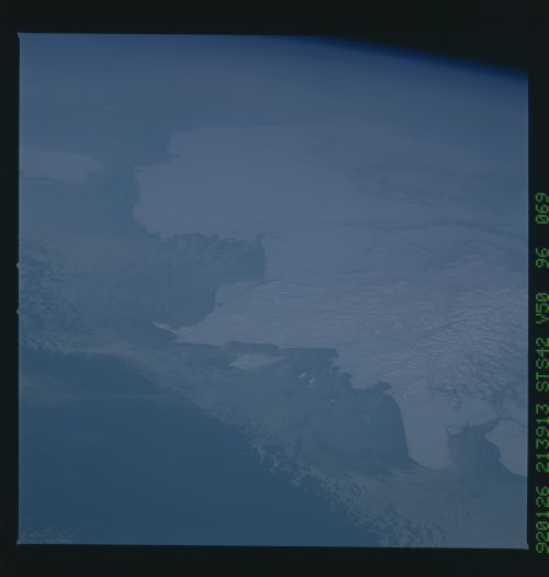
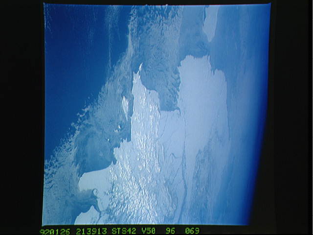
STS042-96-069 NW Alaskan Coast, Bering Sea (59.0! N, 162.0! W)
This oblique view of the coast of Alaska and adjacent
Bering Sea was taken on 26 January at 21:39JGMT using a Hassel-
blad camera equipped with natural color transparency film and a
100 mm lens. The wide field of view shows an impressive panora-
ma, encompassing the Alaskan coast from Bristol Bay in the south
to Nunivak Island in the north. The Earth limb is seen in the
top right portion of the photo. The land areas are totally
snow-covered. A broad band of sea ice extends 10-50 miles out
from the coastline, forming a complex pattern of linear and eddy
features as the ice is moved around under the influence of wind
and water currents.
