< ISS022-E-66972 >
| NASA Photo ID | ISS022-E-66972 |
| Focal Length | 12mm |
| Date taken | 2010.02.17 |
| Time taken | 08:01:15 GMT |


Spacecraft nadir point: 14.3° N, 26.9° E
Photo center point: 14.7° N, 26.8° E
Photo center point by machine learning:
Photo center point: 14.7° N, 26.8° E
Photo center point by machine learning:
Nadir to Photo Center: North
Spacecraft Altitude: 188 nautical miles (348km)
Country or Geographic Name: | SUDAN |
Features: | CUPOLA VIEW, MEIDOB VOLCANIC FIELD |
| Features Found Using Machine Learning: | |
Cloud Cover Percentage: | 0 (no clouds present) |
Sun Elevation Angle: | 45° |
Sun Azimuth: | 124° |
Camera: | Nikon D2Xs Electronic Still Camera |
Focal Length: | 12mm |
Camera Tilt: | 7 degrees |
Format: | 4288E: 4288 x 2848 pixel CMOS sensor, RGBG imager color filter |
Film Exposure: | |
| Additional Information | |
| Width | Height | Annotated | Cropped | Purpose | Links |
|---|---|---|---|---|---|
| 720 pixels | 480 pixels | No | No | NASA's Earth Observatory web site | Download Image |
| 4288 pixels | 2929 pixels | No | No | Download Image | |
| 640 pixels | 437 pixels | No | No | Download Image |
Download Packaged File
Download a Google Earth KML for this Image
View photo footprint information
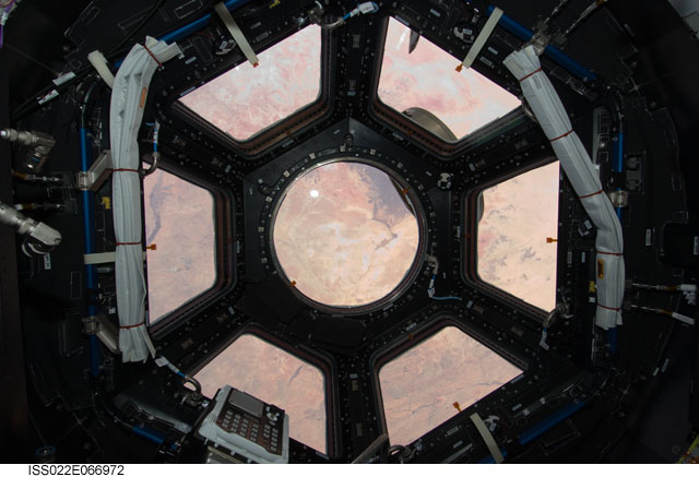
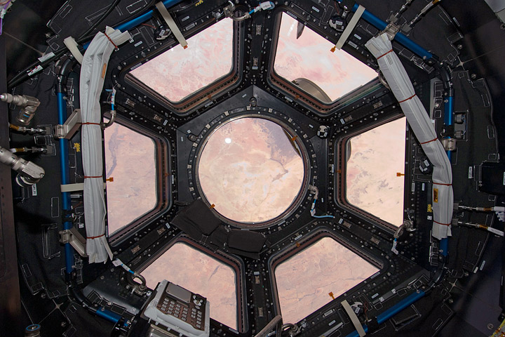
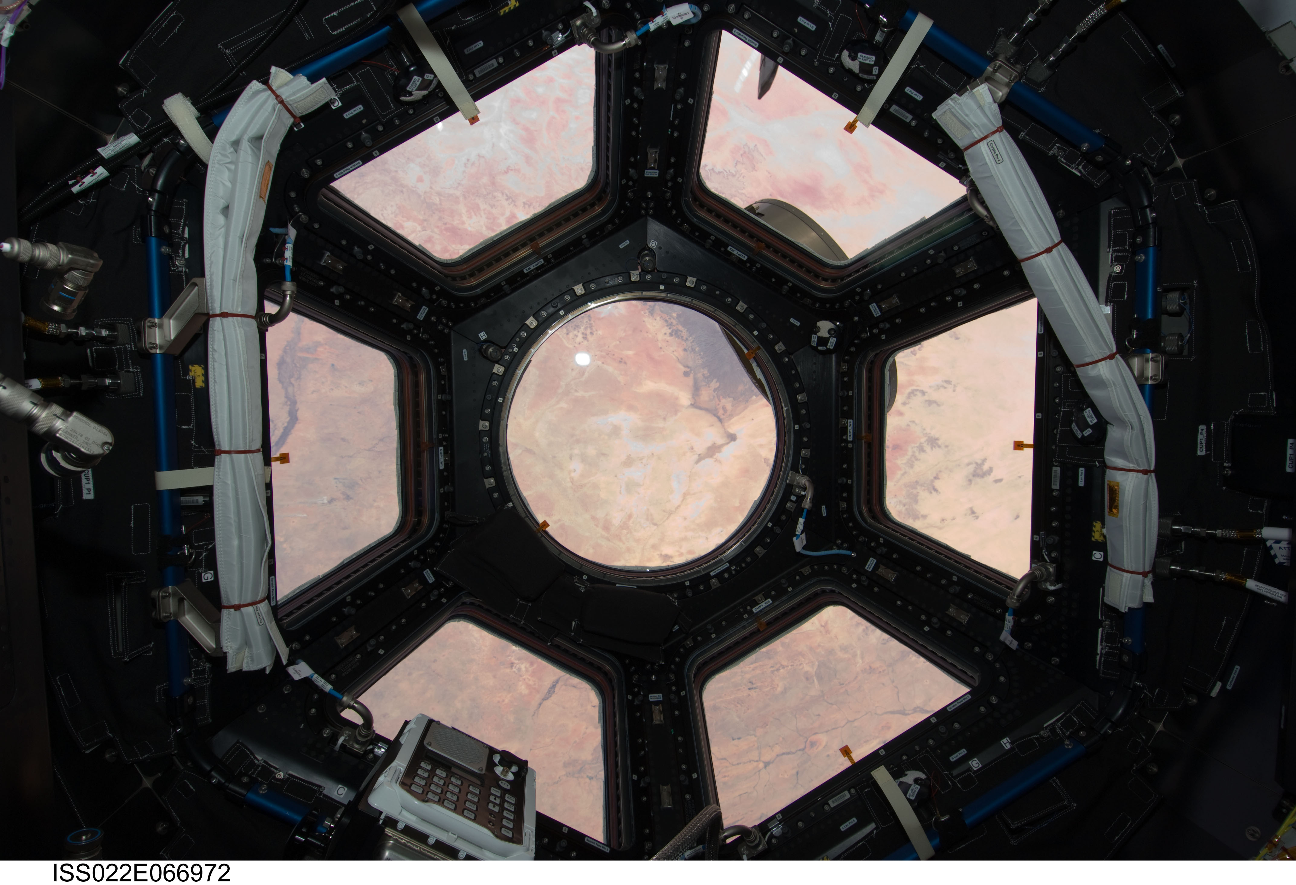
No GeoTIFF is available for this photo.Image Caption: ISS022-E-066972 (17 Feb. 2010) --- This image is the first taken through a first of its kind ?bay window? on the International Space Station, the seven-windowed Cupola. The image shows the Sahara Desert spread out through the array of windows. The Cupola will house controls for the station robotics and will be a location where crew members can operate the robotic arms and monitor other exterior activities. The location of the image is in Sudan near Al Fashir. Center of the round window is looking at 14.68 degrees north latitude and 26.74 east longitude, recorded with a 12-24mm zoom lens.
