< STS039-96-65 >
| NASA Photo ID | STS039-96-65 |
| Focal Length | 250mm |
| Date taken | 1991.05.02 |
| Time taken | 20:32:14 GMT |
Resolutions offered for this image:
3904 x 3880 pixels 639 x 636 pixels 5700 x 6000 pixels 500 x 526 pixels 640 x 480 pixels
3904 x 3880 pixels 639 x 636 pixels 5700 x 6000 pixels 500 x 526 pixels 640 x 480 pixels

Cloud masks available for this image:
Spacecraft nadir point: 33.2° N, 104.7° W
Photo center point: 32.8° N, 106.0° W
Photo center point by machine learning:
Photo center point: 32.8° N, 106.0° W
Photo center point by machine learning:
Nadir to Photo Center: West
Spacecraft Altitude: 138 nautical miles (256km)
Country or Geographic Name: | USA-NEW MEXICO |
Features: | WHITE SANDS AREA |
| Features Found Using Machine Learning: | |
Cloud Cover Percentage: | 0 (no clouds present) |
Sun Elevation Angle: | 59° |
Sun Azimuth: | 199° |
Camera: | Hasselblad |
Focal Length: | 250mm |
Camera Tilt: | 31 degrees |
Format: | 5017: Kodak, natural color positive, Ektachrome, X Professional, ASA 64, standard base |
Film Exposure: | Normal |
| Additional Information | |
| Width | Height | Annotated | Cropped | Purpose | Links |
|---|---|---|---|---|---|
| 3904 pixels | 3880 pixels | No | No | Earth From Space collection | Download Image |
| 639 pixels | 636 pixels | No | No | Earth From Space collection | Download Image |
| 5700 pixels | 6000 pixels | No | No | Download Image Download Color Calibration Image for this Image |
|
| 500 pixels | 526 pixels | No | No | Download Image Download Color Calibration Image for this Image |
|
| 640 pixels | 480 pixels | No | No | Download Image |
Download Packaged File
Download a Google Earth KML for this Image
View photo footprint information
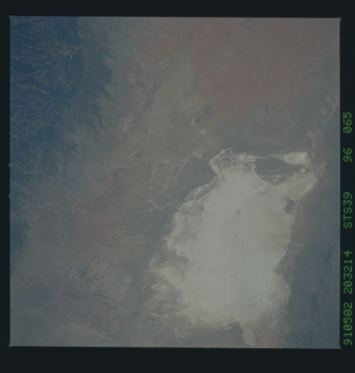
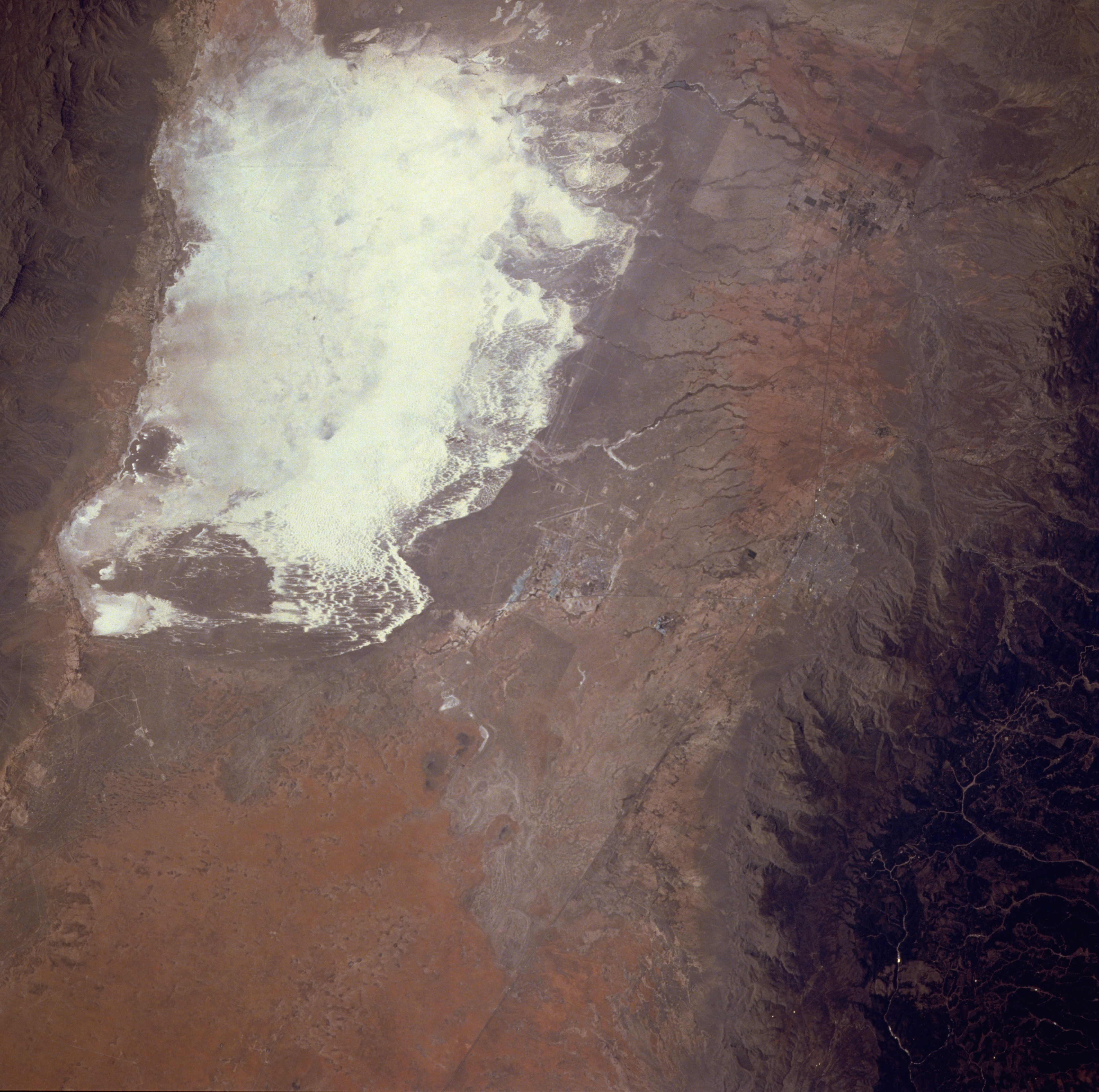
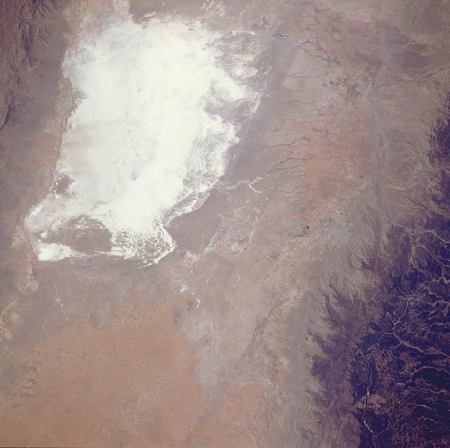
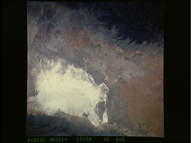
No GeoTIFF is available for this photo.Image Caption: STS039-096-065 White Sands National Monument, New Mexico, U.S.A. May 1991
The highly reflective white sand of south-central New Mexico is easily recognized from spacecraft. White Sands National Monument, established by the U.S. National Park Service, is recognized as the world's largest gypsum sand field with approximately 300 square miles (777 square kilometers). The southwest corner of White Sands National Monument, the lowest spot in the Tularosa Valley, changes from a dry lakebed into Lake Lucero when summer rain falls. This photograph shows no evidence of standing water in Lake Lucero. The sparse, scrub vegetation of the surrounding desert landscape contrasts with the dark, forested Sacramento Mountains, which form part of the eastern edge of the Tularosa Valley. Holloman Air Force Base (center of the photograph) and Alamogordo, northeast of Holloman, are barely discernible.
The highly reflective white sand of south-central New Mexico is easily recognized from spacecraft. White Sands National Monument, established by the U.S. National Park Service, is recognized as the world's largest gypsum sand field with approximately 300 square miles (777 square kilometers). The southwest corner of White Sands National Monument, the lowest spot in the Tularosa Valley, changes from a dry lakebed into Lake Lucero when summer rain falls. This photograph shows no evidence of standing water in Lake Lucero. The sparse, scrub vegetation of the surrounding desert landscape contrasts with the dark, forested Sacramento Mountains, which form part of the eastern edge of the Tularosa Valley. Holloman Air Force Base (center of the photograph) and Alamogordo, northeast of Holloman, are barely discernible.
