< STS034-73-65 >

| NASA Photo ID | STS034-73-65 |
| Focal Length | 250mm |
| Date taken | 1989.10.19 |
| Time taken | 21:52:40 GMT |
Resolutions offered for this image:
3880 x 3904 pixels 636 x 639 pixels 5700 x 5900 pixels 500 x 518 pixels 640 x 480 pixels 3359 x 3364 pixels
3880 x 3904 pixels 636 x 639 pixels 5700 x 5900 pixels 500 x 518 pixels 640 x 480 pixels 3359 x 3364 pixels

Cloud masks available for this image:
Spacecraft nadir point: 32.8° N, 106.1° W
Photo center point: 32.5° N, 106.5° W
Photo center point by machine learning:
Photo center point: 32.5° N, 106.5° W
Photo center point by machine learning:
Nadir to Photo Center: Southwest
Spacecraft Altitude: 172 nautical miles (319km)
Country or Geographic Name: | USA-NEW MEXICO |
Features: | LAS CRUCES, RIO GRANDE |
| Features Found Using Machine Learning: | |
Cloud Cover Percentage: | 0 (no clouds present) |
Sun Elevation Angle: | 28° |
Sun Azimuth: | 233° |
Camera: | Hasselblad |
Focal Length: | 250mm |
Camera Tilt: | 10 degrees |
Format: | 5017: Kodak, natural color positive, Ektachrome, X Professional, ASA 64, standard base |
Film Exposure: | Normal |
| Additional Information | |
| Width | Height | Annotated | Cropped | Purpose | Links |
|---|---|---|---|---|---|
| 3880 pixels | 3904 pixels | No | No | Earth From Space collection | Download Image |
| 636 pixels | 639 pixels | No | No | Earth From Space collection | Download Image |
| 5700 pixels | 5900 pixels | No | No | Download Image Download Color Calibration Image for this Image |
|
| 500 pixels | 518 pixels | No | No | Download Image Download Color Calibration Image for this Image |
|
| 640 pixels | 480 pixels | No | No | Download Image | |
| 3359 pixels | 3364 pixels | Download Image |
Download Packaged File
Download a Google Earth KML for this Image
View photo footprint information
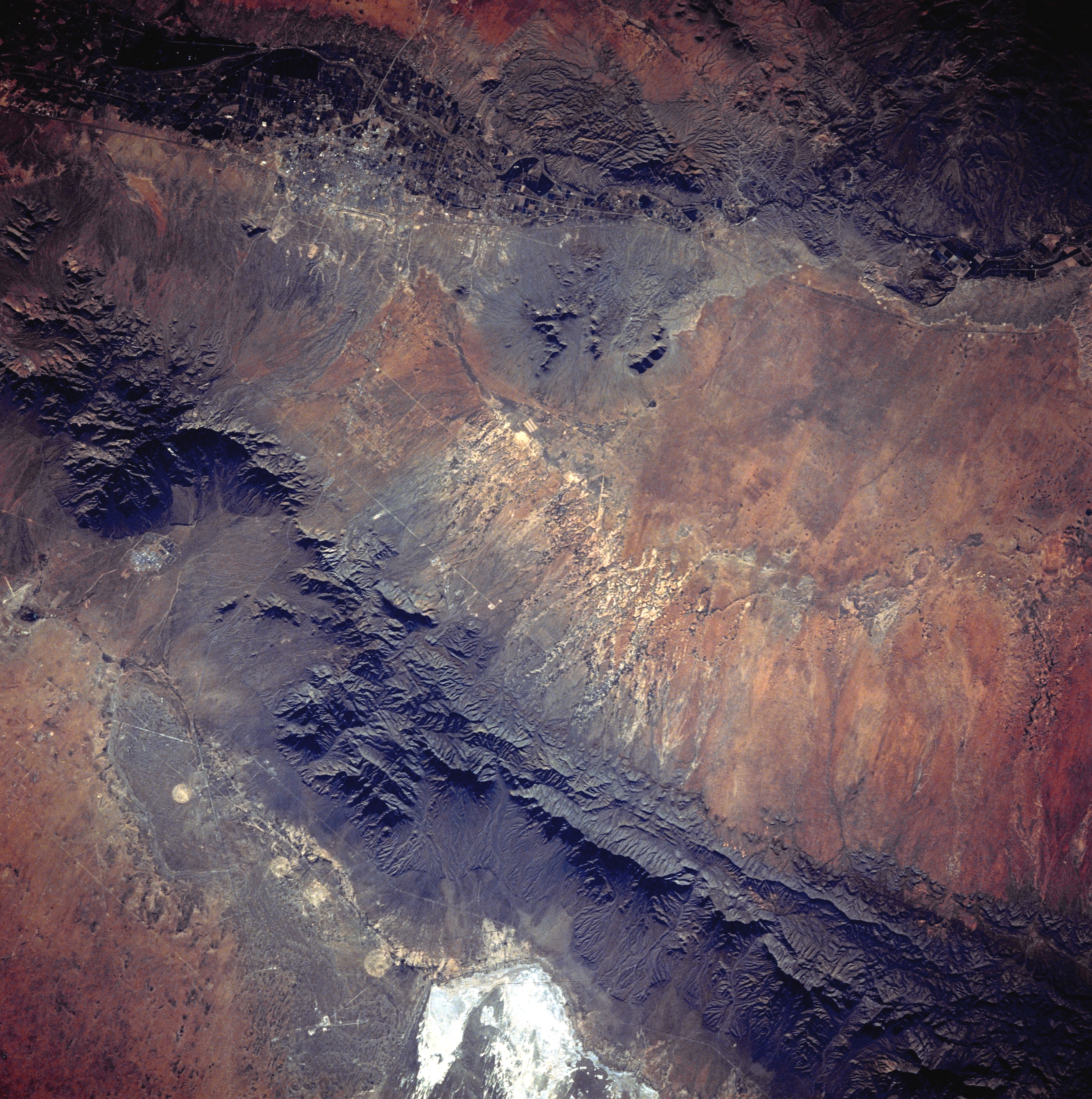
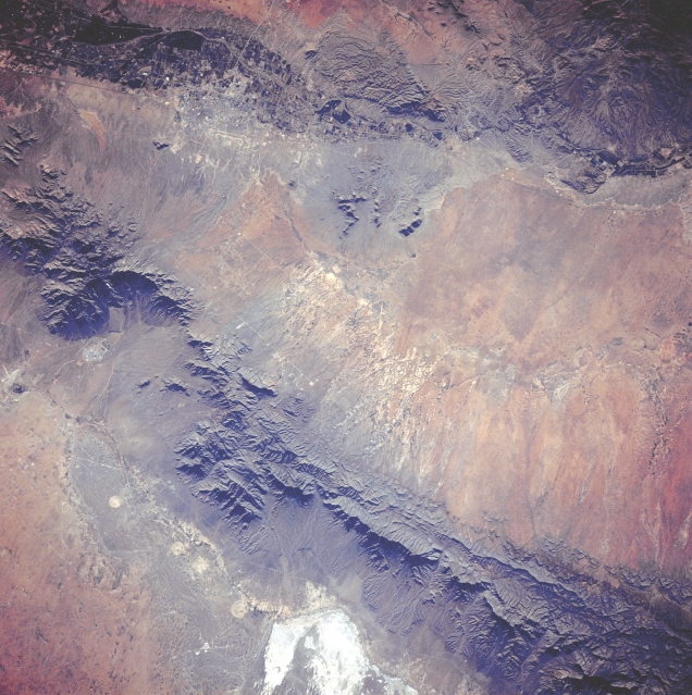
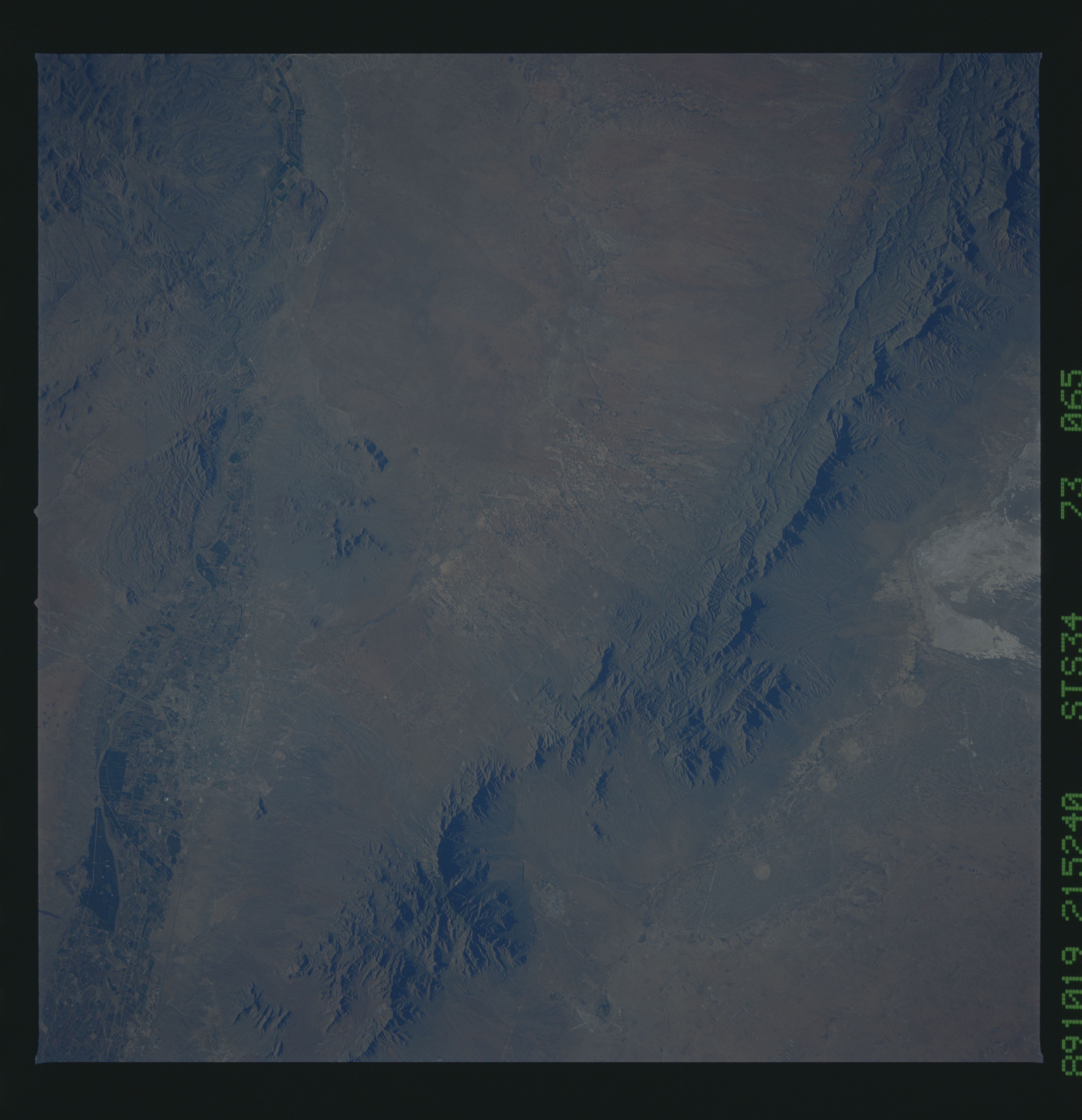
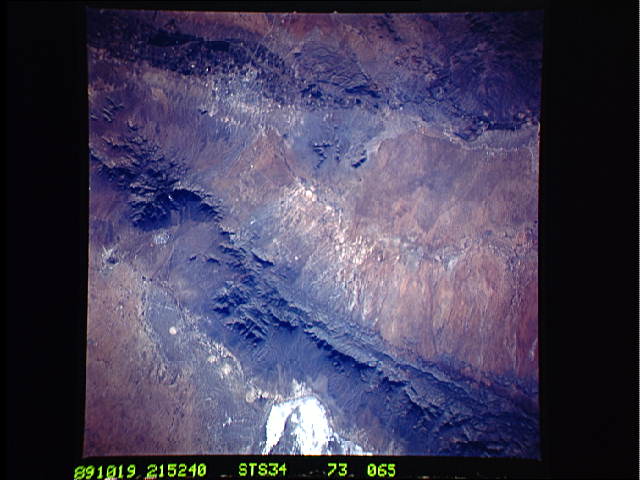
No GeoTIFF is available for this photo.Image Caption: STS034-073-065 San Andres Mountains, New Mexico, U.S.A. October 1989
The north-south-trending San Andres Mountains of south-central New Mexico, with several peaks exceeding 8000 feet (2438 meters), extend diagonally across the desert landscape northeast of Las Cruces (barely discernible in the upper left of the photograph). Visible are the Tularosa Valley, the desert area east of the San Andres Mountains; the southwest corner of White Sands National Monument; a small section of the Rio Grande along the western side of Las Cruces; and dark cultivated fields in the floodplain of the Rio Grande.
The north-south-trending San Andres Mountains of south-central New Mexico, with several peaks exceeding 8000 feet (2438 meters), extend diagonally across the desert landscape northeast of Las Cruces (barely discernible in the upper left of the photograph). Visible are the Tularosa Valley, the desert area east of the San Andres Mountains; the southwest corner of White Sands National Monument; a small section of the Rio Grande along the western side of Las Cruces; and dark cultivated fields in the floodplain of the Rio Grande.
