< NM23-744-635 >
| NASA Photo ID | NM23-744-635 |
| Focal Length | 250mm |
| Date taken | 1997.04.22 |
| Time taken | 18:05:09 GMT |
Resolutions offered for this image:
4024 x 4024 pixels 640 x 640 pixels 5700 x 6000 pixels 500 x 526 pixels 504 x 505 pixels 479 x 478 pixels
4024 x 4024 pixels 640 x 640 pixels 5700 x 6000 pixels 500 x 526 pixels 504 x 505 pixels 479 x 478 pixels

Cloud masks available for this image:
Spacecraft nadir point: 44.2° N, 67.9° W
Photo center point: 41.5° N, 70.5° W
Photo center point by machine learning:
Photo center point: 41.5° N, 70.5° W
Photo center point by machine learning:
Nadir to Photo Center: Southwest
Spacecraft Altitude: 210 nautical miles (389km)
Country or Geographic Name: | USA-MASSACHUSETTS |
Features: | MARTHAS VINEYARD, C. COD |
| Features Found Using Machine Learning: | |
Cloud Cover Percentage: | 5 (1-10)% |
Sun Elevation Angle: | 52° |
Sun Azimuth: | 220° |
Camera: | Hasselblad |
Focal Length: | 250mm |
Camera Tilt: | 47 degrees |
Format: | 5046: Kodak, natural color positive, Lumiere 100/5046, ASA 100, standard base |
Film Exposure: | Normal |
| Additional Information | |
| Width | Height | Annotated | Cropped | Purpose | Links |
|---|---|---|---|---|---|
| 4024 pixels | 4024 pixels | No | No | Earth From Space collection | Download Image |
| 640 pixels | 640 pixels | No | No | Earth From Space collection | Download Image |
| 5700 pixels | 6000 pixels | No | No | Download Image | |
| 500 pixels | 526 pixels | No | No | Download Image | |
| 504 pixels | 505 pixels | No | No | Download Image | |
| 479 pixels | 478 pixels | Download Image |
Download Packaged File
Download a Google Earth KML for this Image
View photo footprint information
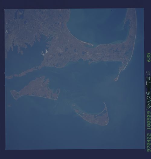
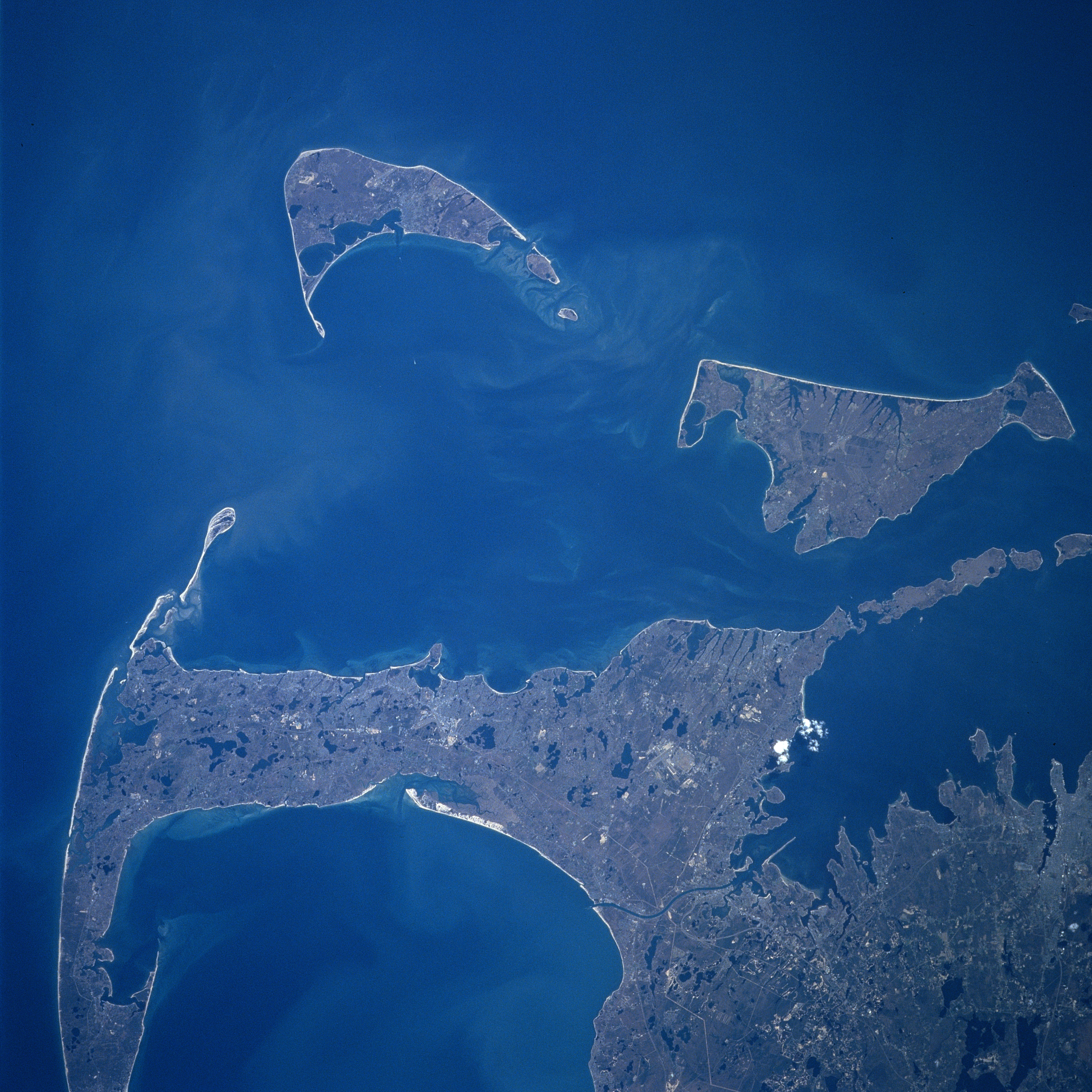
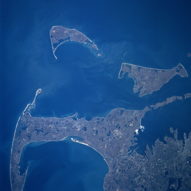
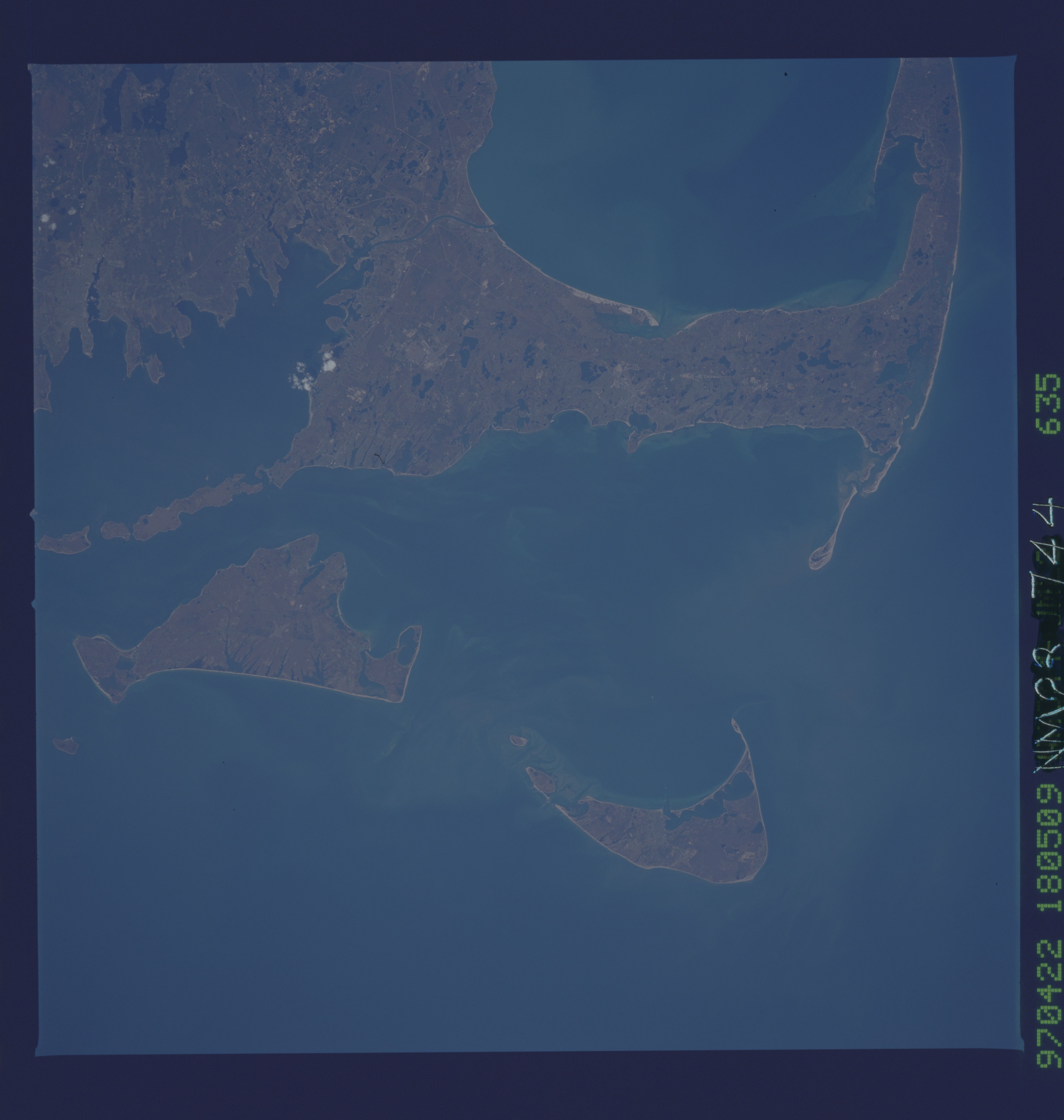
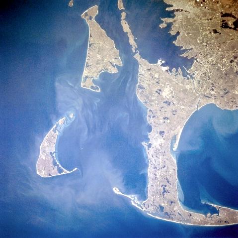
No GeoTIFF is available for this photo.Image Caption: NM23-744-635 Cape Cod, Nantucket and Marthas Vineyard Islands, Massachusetts Spring 1997
Looking generally to the south, Cape Cod and the islands of Nantucket and Marthas Vineyard are visible in this synoptic view. Nantucket Island is located 30 miles (48 km) off the coast of southeast Massachusetts. The island is 14 miles (23 km) long and from 3 to 6 miles (5 to 10 km) wide. Nantucket Island has many sandy beaches and low rolling hills composed of sand and gravel. Marthas Vineyard is the larger of the two islands and is triangular shaped island situated 7 miles (11 km) off the southern coast of Massachusetts. Marthas Vineyard is 23 miles (37 km) wide (east to west) and 9 miles (14 km) long (north to south), and covers 100 sq. miles (259 sq. km). Both islands are favorite tourist and resort areas. North of Martha's Vineyard (right center), the Elizabeth Islands and Buzzards Bay are visible. Cape Cod Bay is in the lower left portion of the image.
Looking generally to the south, Cape Cod and the islands of Nantucket and Marthas Vineyard are visible in this synoptic view. Nantucket Island is located 30 miles (48 km) off the coast of southeast Massachusetts. The island is 14 miles (23 km) long and from 3 to 6 miles (5 to 10 km) wide. Nantucket Island has many sandy beaches and low rolling hills composed of sand and gravel. Marthas Vineyard is the larger of the two islands and is triangular shaped island situated 7 miles (11 km) off the southern coast of Massachusetts. Marthas Vineyard is 23 miles (37 km) wide (east to west) and 9 miles (14 km) long (north to south), and covers 100 sq. miles (259 sq. km). Both islands are favorite tourist and resort areas. North of Martha's Vineyard (right center), the Elizabeth Islands and Buzzards Bay are visible. Cape Cod Bay is in the lower left portion of the image.
