< STS034-74-63 >
| NASA Photo ID | STS034-74-63 |
| Focal Length | 250mm |
| Date taken | 1989.10.22 |
| Time taken | 19:18:36 GMT |
Cloud masks available for this image:
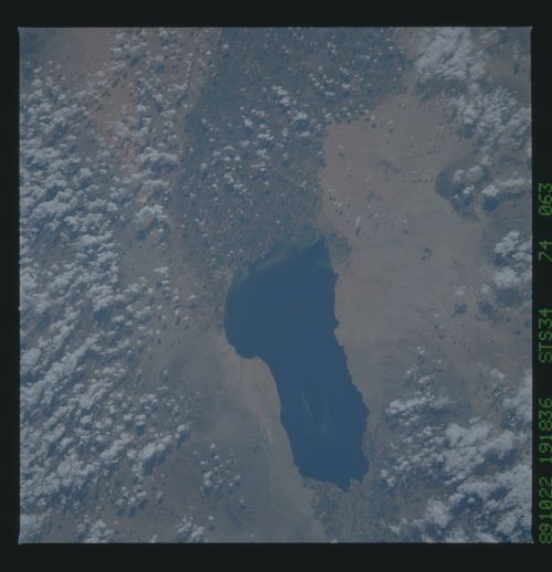
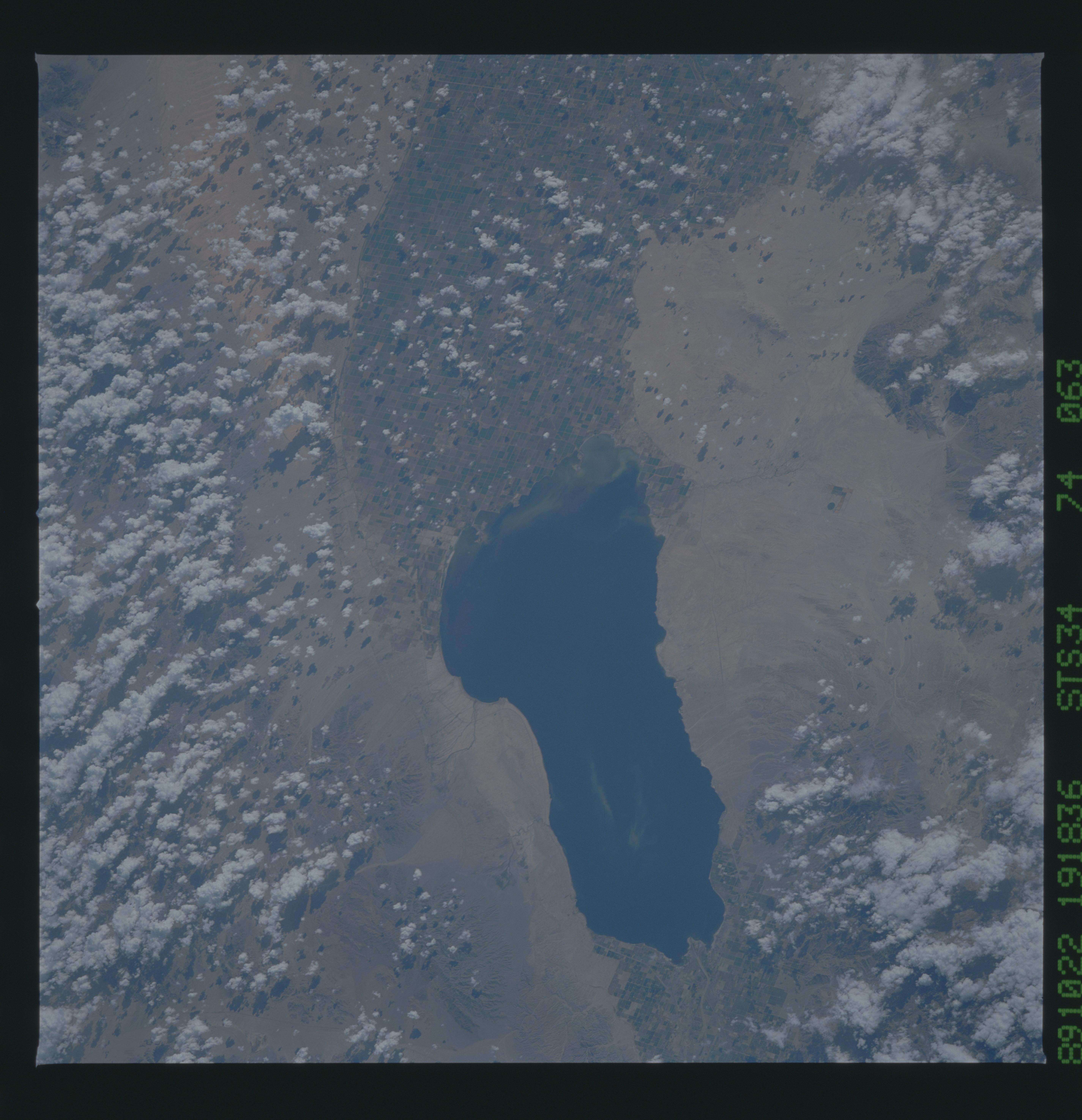
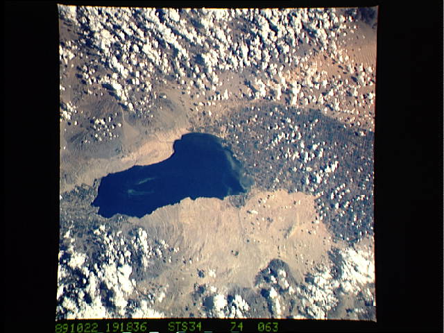
Spacecraft nadir point: 34.2° N, 118.3° W
Photo center point: 33.0° N, 115.5° W
Photo center point by machine learning:
Photo center point: 33.0° N, 115.5° W
Photo center point by machine learning:
Nadir to Photo Center: East
Spacecraft Altitude: 179 nautical miles (332km)
Country or Geographic Name: | USA-CALIFORNIA |
Features: | SALTON SEA, IMPERIAL VAL. |
| Features Found Using Machine Learning: | |
Cloud Cover Percentage: | 50 (26-50)% |
Sun Elevation Angle: | 44° |
Sun Azimuth: | 173° |
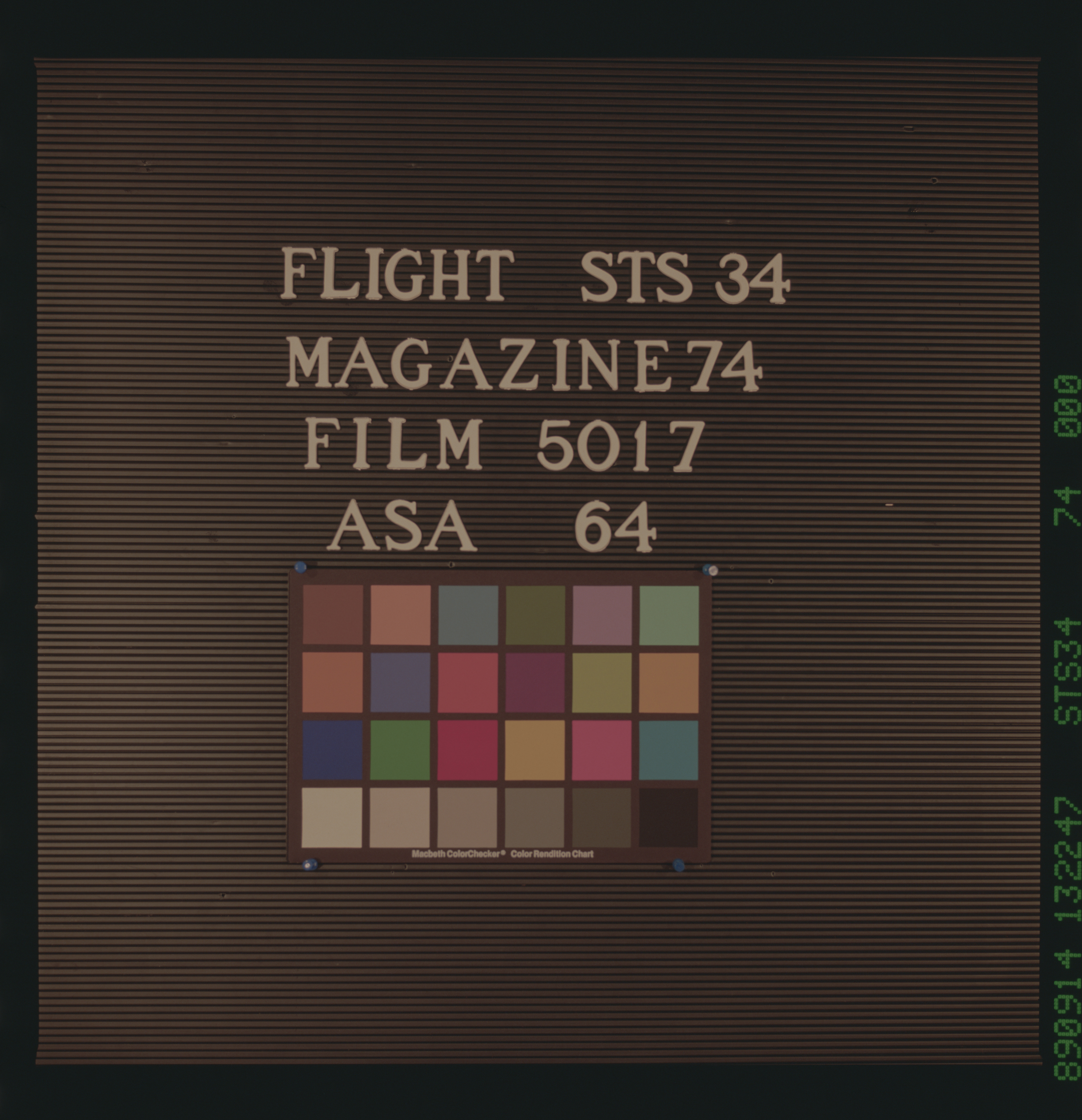
Camera: | Hasselblad |
Focal Length: | 250mm |
Camera Tilt: | 46 degrees |
Format: | 5017: Kodak, natural color positive, Ektachrome, X Professional, ASA 64, standard base |
Film Exposure: | Normal |
| Additional Information | |
| Width | Height | Annotated | Cropped | Purpose | Links |
|---|---|---|---|---|---|
| 5700 pixels | 5900 pixels | No | No | Download Image Download Color Calibration Image for this Image |
|
| 500 pixels | 518 pixels | No | No | Download Image Download Color Calibration Image for this Image |
|
| 640 pixels | 480 pixels | No | No | Download Image |
Download Packaged File
Download a Google Earth KML for this Image
View photo footprint information
No GeoTIFF is available for this photo.Image Caption:
The North American-Pacific Plate Boundary
Large faults criss-cross this scene. The San Andreas fault (1)
runs just east of San Francisco Bay, and runs offshore south of
the city of San Francisco (2). It cuts through Marin county near
Point Reyes (3). The Haywood fault runs along the eastern side
of the bay (4). The epicenter of the large October 17, 1989
earthquake which created much damage in San Francisco and Santa
Cruz (5) was located at the juction of the San Andreas and anoth-
er fault at (6). The folded Coast Ranges north and south of the
bay include marine rocks which were buckled up and sandwiched
against the coast several million years ago. (S34-72-63, 64)
