< ISS025-E-6280 >
| NASA Photo ID | ISS025-E-6280 |
| Focal Length | 16mm |
| Date taken | 2010.10.07 |
| Time taken | 21:07:21 GMT |
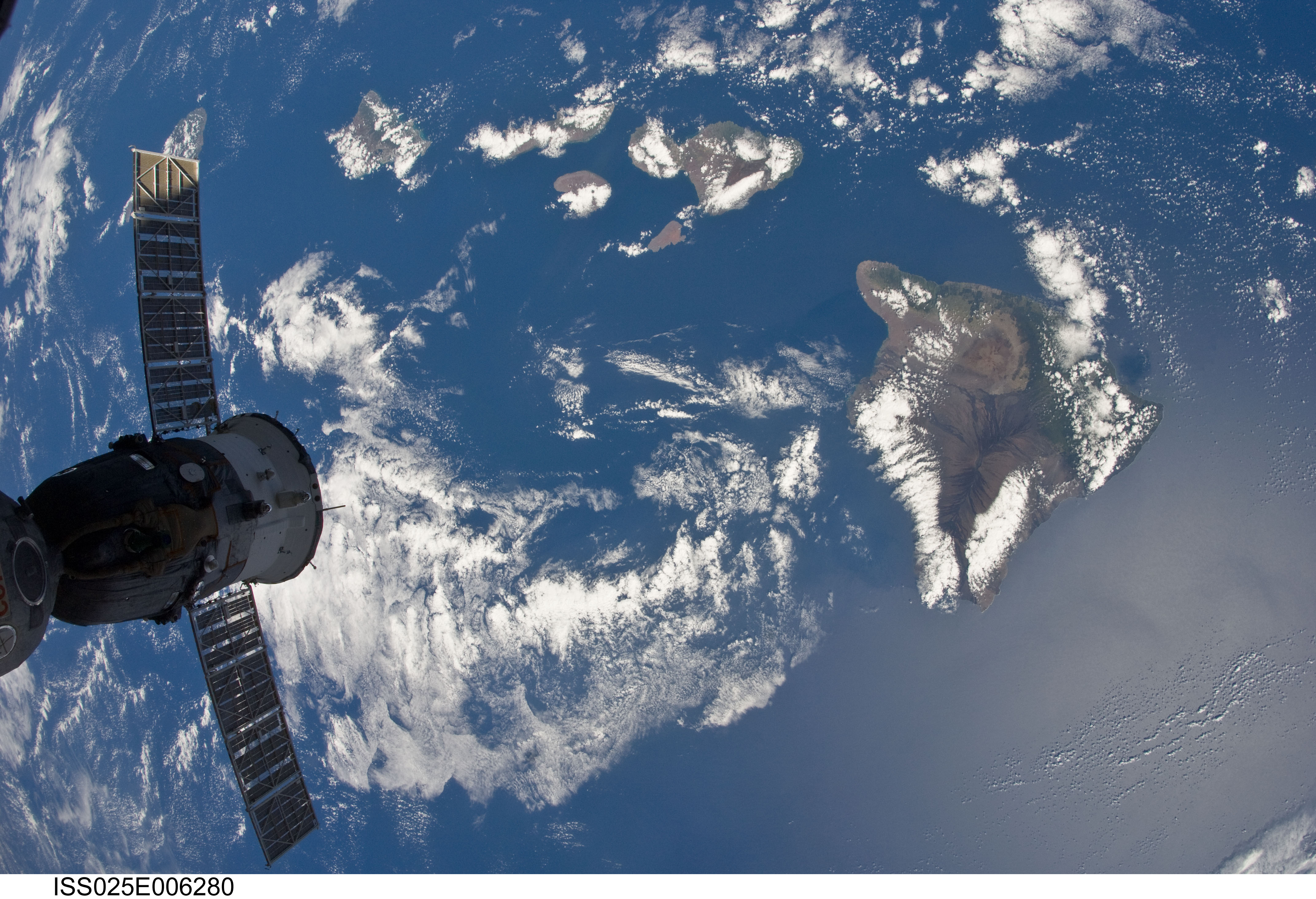

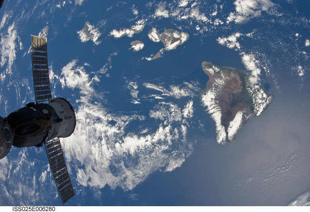
Spacecraft nadir point: 20.7° N, 156.5° W
Photo center point: 20.0° N, 157.0° W
Photo center point by machine learning:
Photo center point: 20.0° N, 157.0° W
Photo center point by machine learning:
Nadir to Photo Center: Southwest
Spacecraft Altitude: 190 nautical miles (352km)
Country or Geographic Name: | USA-HAWAII |
Features: | ISS, HAWAIIAN ISLANDS |
| Features Found Using Machine Learning: | |
Cloud Cover Percentage: | 50 (26-50)% |
Sun Elevation Angle: | 59° |
Sun Azimuth: | 146° |
Camera: | Nikon D2Xs Electronic Still Camera |
Focal Length: | 16mm |
Camera Tilt: | 15 degrees |
Format: | 4288E: 4288 x 2848 pixel CMOS sensor, RGBG imager color filter |
Film Exposure: | |
| Additional Information | |
| Width | Height | Annotated | Cropped | Purpose | Links |
|---|---|---|---|---|---|
| 4288 pixels | 2929 pixels | No | No | Download Image | |
| 640 pixels | 437 pixels | No | No | Download Image |
Download Packaged File
Download a Google Earth KML for this Image
View photo footprint information
No GeoTIFF is available for this photo.Image Caption: ISS025-E-006280 (7 Oct. 2010) --- While on an orbit that took the International Space Station over the Pacific Ocean, one of the Expedition 25 crew members captured this image of part of the Hawaiian Island chain. While most of the islands are either out of frame or covered by clouds, Hawaii, the largest of them, is visible at right. A Russian Soyuz, docked to the orbital outpost, is in left foreground.
