< STS090-767-62 >
| NASA Photo ID | STS090-767-62 |
| Focal Length | 40mm |
| Date taken | 1998.04.28 |
| Time taken | 10:23:17 GMT |
Resolutions offered for this image:
5700 x 5900 pixels 483 x 500 pixels 640 x 652 pixels 415 x 442 pixels 817 x 545 pixels 817 x 545 pixels
5700 x 5900 pixels 483 x 500 pixels 640 x 652 pixels 415 x 442 pixels 817 x 545 pixels 817 x 545 pixels

Cloud masks available for this image:
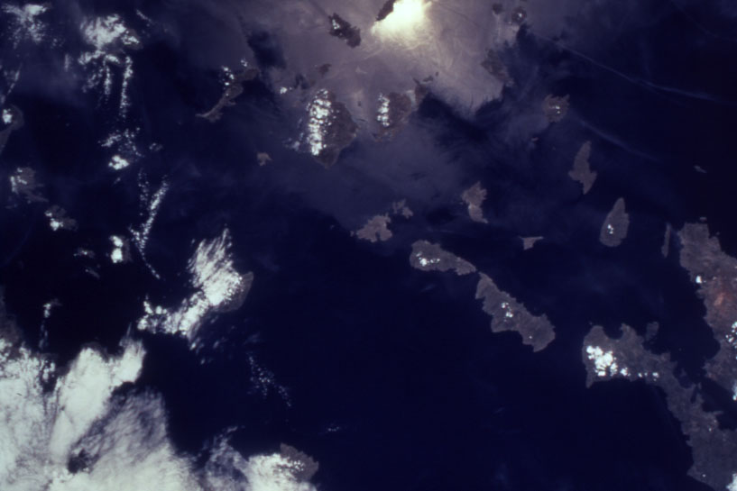
Spacecraft nadir point: 37.5° N, 25.2° E
Photo center point: 37.5° N, 25.5° E
Photo center point by machine learning:
Photo center point: 37.5° N, 25.5° E
Photo center point by machine learning:
Nadir to Photo Center: East
Spacecraft Altitude: 131 nautical miles (243km)
Country or Geographic Name: | GREECE |
Features: | CYCLADES ISLANDS, SNGLNT. |
| Features Found Using Machine Learning: | |
Cloud Cover Percentage: | 25 (11-25)% |
Sun Elevation Angle: | 67° |
Sun Azimuth: | 184° |
Camera: | Hasselblad |
Focal Length: | 40mm |
Camera Tilt: | 8 degrees |
Format: | 5069: Kodak Elite 100S, E6 Reversal, Replaces Lumiere, Warmer in tone vs. Lumiere |
Film Exposure: | Under Exposed |
| Additional Information | |
| Width | Height | Annotated | Cropped | Purpose | Links |
|---|---|---|---|---|---|
| 5700 pixels | 5900 pixels | No | No | Download Image Download Color Calibration Image for this Image |
|
| 483 pixels | 500 pixels | No | No | Download Image Download Color Calibration Image for this Image |
|
| 640 pixels | 652 pixels | No | No | Photographic Highlights | Download Image |
| 415 pixels | 442 pixels | No | No | Download Image | |
| 817 pixels | 545 pixels | Download Image | |||
| 817 pixels | 545 pixels | No | No | Download Image |
Download Packaged File
Download a Google Earth KML for this Image
View photo footprint information
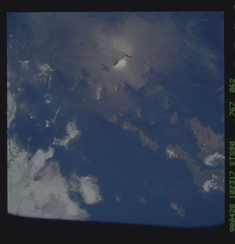
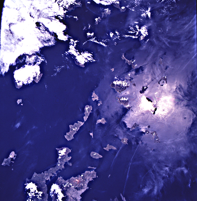
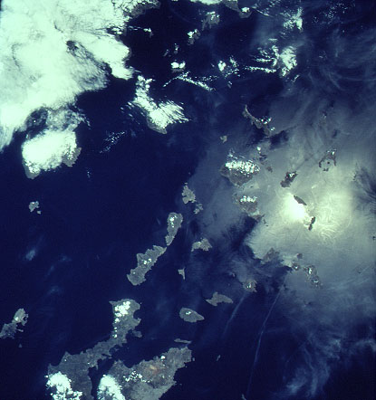
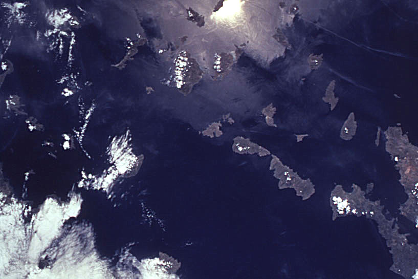
No GeoTIFF is available for this photo.Image Caption: From the southern tip of the Attic Peninsula, the islands of the Cyclades decorate the Aegean. Santorini is a
volcanic island, half of which was blown out to the west when the volcano erupted in 1625 B.C. Acrotiri, a
significant Minoan city that rivaled those on Crete from the 18th century B.C., was entirely buried in ash
and pumice from the eruption. Sunglint helps define Nea Kameni, a young lava dome in the midst of the
half-drowned caldera, which still spouts steam, gas and ash.
