< ISS017-E-6184 >
| NASA Photo ID | ISS017-E-6184 |
| Focal Length | 800mm |
| Date taken | 2008.05.03 |
| Time taken | 19:18:29 GMT |
Resolutions offered for this image:
1000 x 689 pixels 540 x 372 pixels 540 x 405 pixels 3072 x 2096 pixels 639 x 436 pixels
1000 x 689 pixels 540 x 372 pixels 540 x 405 pixels 3072 x 2096 pixels 639 x 436 pixels


Spacecraft nadir point: 36.6° N, 122.4° W
Photo center point: 37.4° N, 122.0° W
Photo center point by machine learning:
Photo center point: 37.4° N, 122.0° W
Photo center point by machine learning:
Nadir to Photo Center: Northeast
Spacecraft Altitude: 180 nautical miles (333km)
Country or Geographic Name: | USA-CALIFORNIA |
Features: | MOUNTAIN VIEW, NASA AMES |
| Features Found Using Machine Learning: | |
Cloud Cover Percentage: | 10 (1-10)% |
Sun Elevation Angle: | 67° |
Sun Azimuth: | 149° |
Camera: | Nikon D2Xs Electronic Still Camera |
Focal Length: | 800mm |
Camera Tilt: | 17 degrees |
Format: | 4288E: 4288 x 2848 pixel CMOS sensor, RGBG imager color filter |
Film Exposure: | |
| Additional Information | |
| Width | Height | Annotated | Cropped | Purpose | Links |
|---|---|---|---|---|---|
| 1000 pixels | 689 pixels | No | Yes | Earth From Space collection | Download Image |
| 540 pixels | 372 pixels | Yes | Yes | Earth From Space collection | Download Image |
| 540 pixels | 405 pixels | Yes | Yes | NASA's Earth Observatory web site | Download Image |
| 3072 pixels | 2096 pixels | No | No | Download Image | |
| 639 pixels | 436 pixels | No | No | Download Image |
Download Packaged File
Download a Google Earth KML for this Image
View photo footprint information
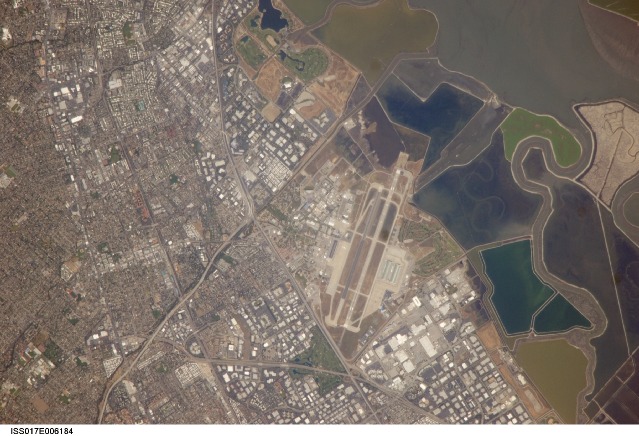
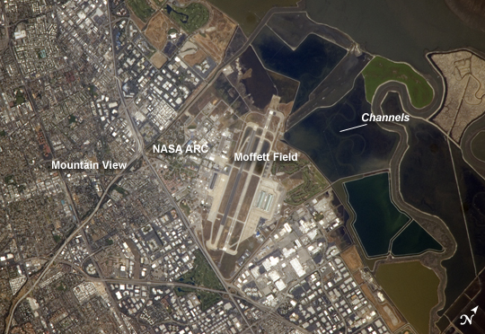
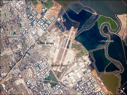
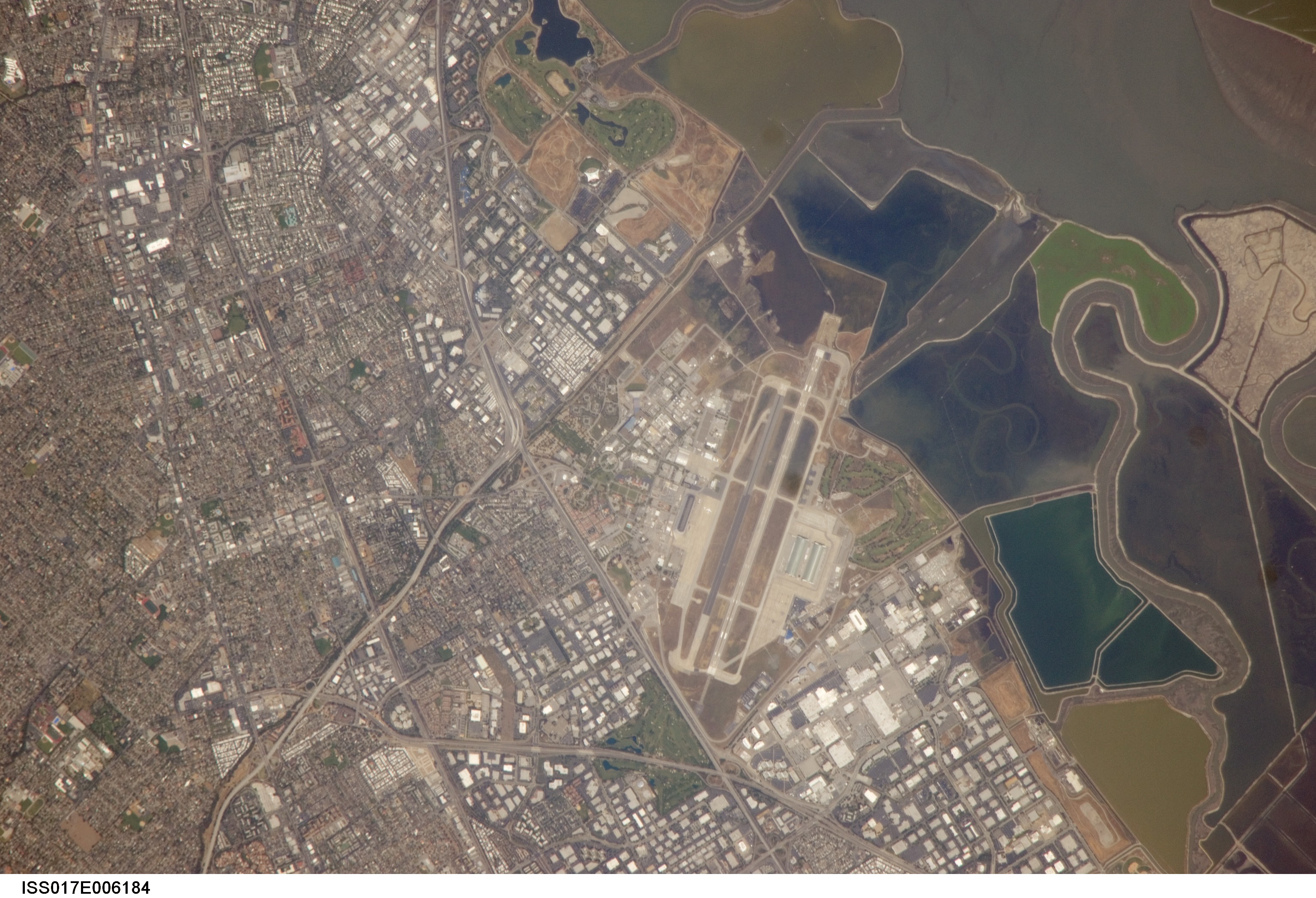
No GeoTIFF is available for this photo.Image Caption: NASA Ames Research Center, Moffett Field, CA
This astronaut photograph illustrates the diverse built environment surrounding the NASA Ames Research Center located at the southernmost end of San Francisco Bay. Founded in 1939 as an aircraft research laboratory, Ames became a NASA facility in 1958. Its original aircraft research focus was enhanced by the adjacent Moffett Field--an active Naval Air Station until 1994, and the original home of the Navy dirigible U.S.S. Macon. The large hanger for docking the U.S.S. Macon is still present at Moffett Field, and is visible in this astronaut photograph (image center). Today, NASA Ames includes the former Naval Air Station, and it continues its focus on aeronautics in addition to nanotechnology, information technology, fundamental space biology, biotechnology, thermal protection systems, and human factors research.
Land use and land cover in the southern San Francisco Bay area is a diverse mix of industrial, institutional, and residential patterns. Industrial lots, characterized by lack of green vegetation and large buildings with highly reflective white rooftops, border NASA Ames to the west, east, and south. The city of Mountain View directly to the south appears as a dense gray-brown network of streets and residential properties with interspersed green parks. The northern boundary of NASA ARC consists of former salt ponds that are being restored to tidal wetlands (image right). Drainage channels that predate the salt pond levees are visible at image right.
