< STS087-707-60 >
| NASA Photo ID | STS087-707-60 |
| Focal Length | 250mm |
| Date taken | 1997.11.22 |
| Time taken | 04:40:14 GMT |
Resolutions offered for this image:
4054 x 4084 pixels 635 x 639 pixels 5700 x 5900 pixels 483 x 500 pixels 507 x 512 pixels
4054 x 4084 pixels 635 x 639 pixels 5700 x 5900 pixels 483 x 500 pixels 507 x 512 pixels

Cloud masks available for this image:
Spacecraft nadir point: 21.5° N, 82.9° E
Photo center point: 21.0° N, 84.0° E
Photo center point by machine learning:
Photo center point: 21.0° N, 84.0° E
Photo center point by machine learning:
Nadir to Photo Center: East
Spacecraft Altitude: 150 nautical miles (278km)
Country or Geographic Name: | INDIA |
Features: | MAHANDI RIVER |
| Features Found Using Machine Learning: | |
Cloud Cover Percentage: | 0 (no clouds present) |
Sun Elevation Angle: | 43° |
Sun Azimuth: | 149° |
Camera: | Hasselblad |
Focal Length: | 250mm |
Camera Tilt: | 26 degrees |
Format: | 5069: Kodak Elite 100S, E6 Reversal, Replaces Lumiere, Warmer in tone vs. Lumiere |
Film Exposure: | Normal |
| Additional Information | |
| Width | Height | Annotated | Cropped | Purpose | Links |
|---|---|---|---|---|---|
| 4054 pixels | 4084 pixels | No | No | Earth From Space collection | Download Image |
| 635 pixels | 639 pixels | No | No | Earth From Space collection | Download Image |
| 5700 pixels | 5900 pixels | No | No | Download Image Download Color Calibration Image for this Image |
|
| 483 pixels | 500 pixels | No | No | Download Image Download Color Calibration Image for this Image |
|
| 507 pixels | 512 pixels | No | No | Download Image |
Download Packaged File
Download a Google Earth KML for this Image
View photo footprint information
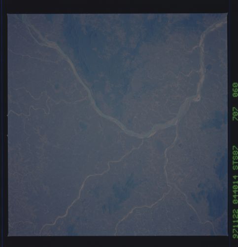
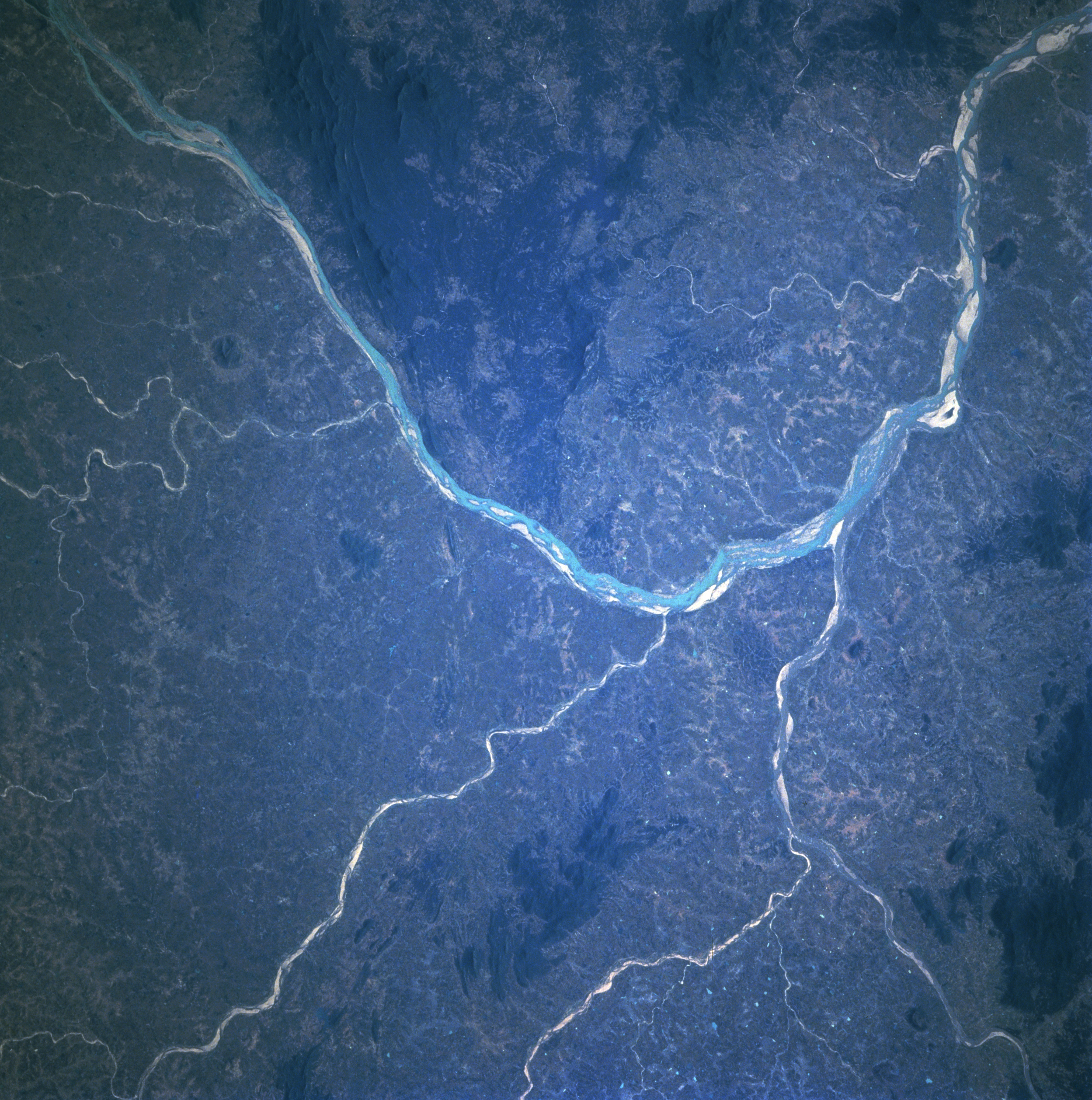
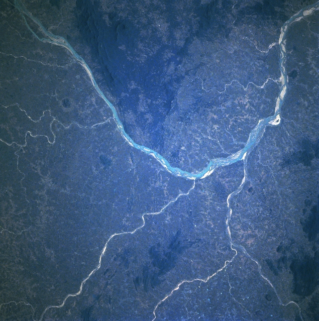
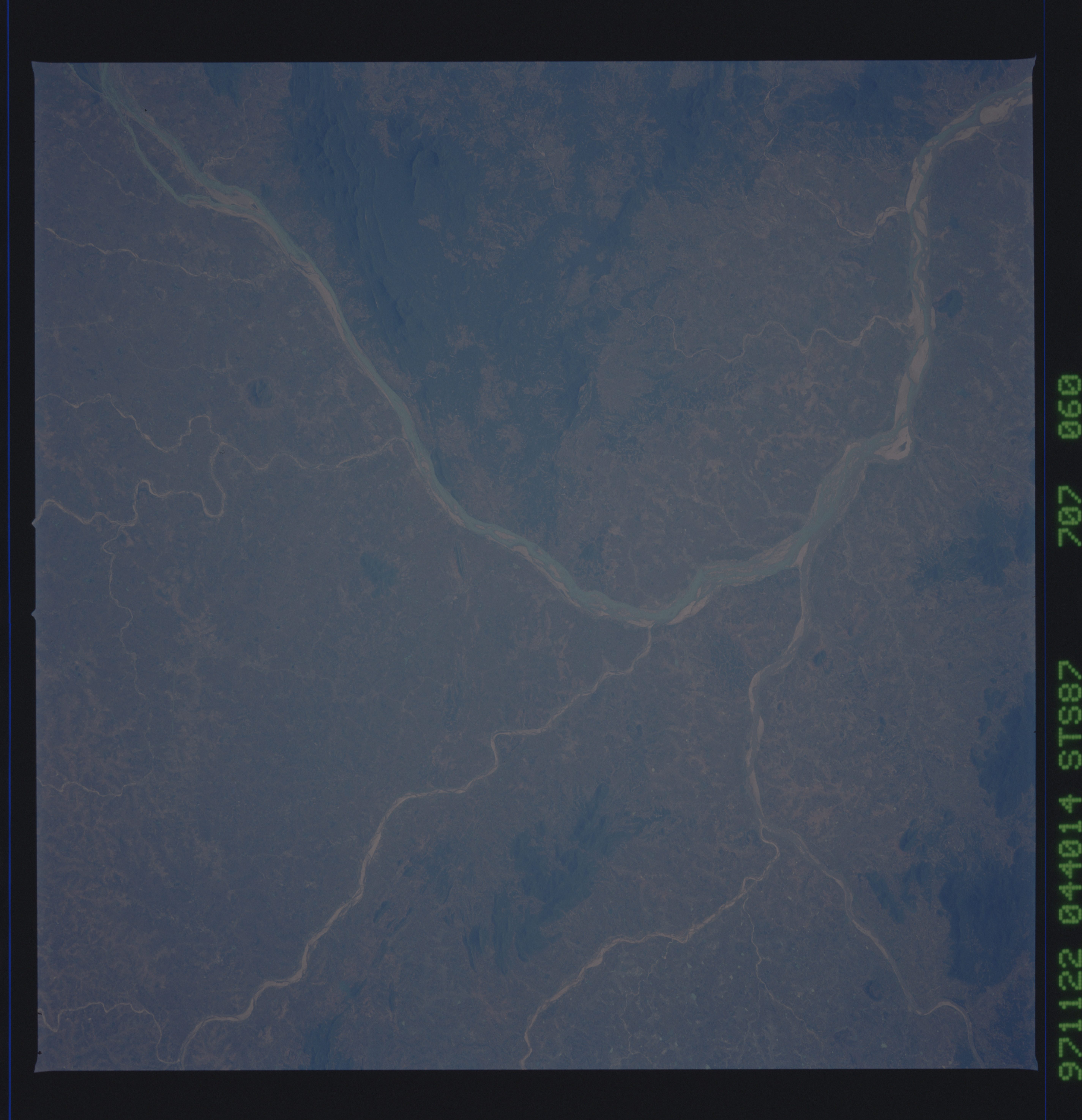
No GeoTIFF is available for this photo.Image Caption: STS087-707-060 Mahanadi River, India November 1997
The Mahanadi River (light-colored linear feature), largest river in Orissi State, makes a dramatic south to east course change immediately to the south of Hirakud Dam and Reservoir (just off of lower right corner of the image). The highly reflective material within the floodplain of the Mahanadi River as well as the tributary streams, are extensive sandbars that become more visible, especially during periods of low water (November through May/June). The darker area on the image shows the distribution of hilly, wooded terrain. The darkest areas in this region of east central India have elevations that exceed 2000 feet (610 meters) above sea level.
The Mahanadi River (light-colored linear feature), largest river in Orissi State, makes a dramatic south to east course change immediately to the south of Hirakud Dam and Reservoir (just off of lower right corner of the image). The highly reflective material within the floodplain of the Mahanadi River as well as the tributary streams, are extensive sandbars that become more visible, especially during periods of low water (November through May/June). The darker area on the image shows the distribution of hilly, wooded terrain. The darkest areas in this region of east central India have elevations that exceed 2000 feet (610 meters) above sea level.
