< STS079-821-60 >

| NASA Photo ID | STS079-821-60 |
| Focal Length | 100mm |
| Date taken | 1996.09.24 |
| Time taken | 03:10:52 GMT |
Cloud masks available for this image:
Spacecraft nadir point: 46.3° N, 59.1° E
Photo center point: 46.0° N, 60.0° E
Photo center point by machine learning:
Photo center point: 46.0° N, 60.0° E
Photo center point by machine learning:
Nadir to Photo Center: East
Spacecraft Altitude: 202 nautical miles (374km)
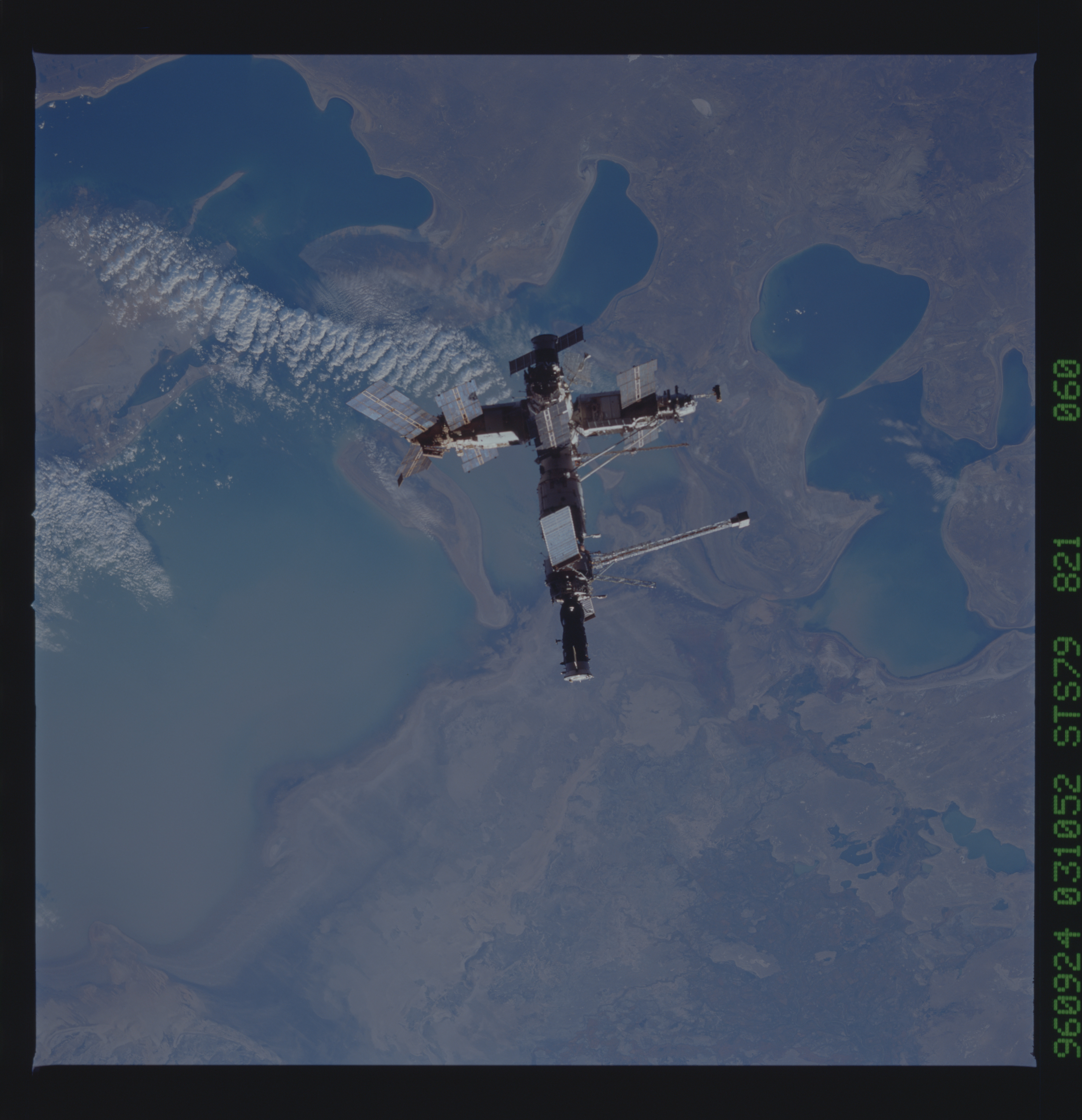
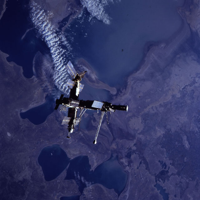
Country or Geographic Name: | KAZAKHSTAN |
Features: | MIR OVER ARAL SEA |
| Features Found Using Machine Learning: | |
Cloud Cover Percentage: | 5 (1-10)% |
Sun Elevation Angle: | 13° |
Sun Azimuth: | 104° |
Camera: | Hasselblad |
Focal Length: | 100mm |
Camera Tilt: | 16 degrees |
Format: | 5046: Kodak, natural color positive, Lumiere 100/5046, ASA 100, standard base |
Film Exposure: | Normal |
| Additional Information | |
| Width | Height | Annotated | Cropped | Purpose | Links |
|---|---|---|---|---|---|
| 5700 pixels | 5900 pixels | No | No | Download Image Download Color Calibration Image for this Image |
|
| 483 pixels | 500 pixels | No | No | Download Image Download Color Calibration Image for this Image |
|
| 640 pixels | 640 pixels | No | No | Photographic Highlights | Download Image |
Download Packaged File
Download a Google Earth KML for this Image
View photo footprint information
No GeoTIFF is available for this photo.Image Caption: Mir over the Aral Sea; Syr Darya Delta. Growing islands in the Aral Sea indicate a continuing decline of lake level.
