< STS033-91-60 >
| NASA Photo ID | STS033-91-60 |
| Focal Length | 250mm |
| Date taken | 1989.11.26 |
| Time taken | 04:56:52 GMT |
Cloud masks available for this image:
Spacecraft nadir point: 11.9° N, 120.3° E
Photo center point: 12.5° N, 121.0° E
Photo center point by machine learning:
Photo center point: 12.5° N, 121.0° E
Photo center point by machine learning:
Nadir to Photo Center: Northeast
Spacecraft Altitude: 164 nautical miles (304km)Body: Earth
Country or Geographic Name: | PHILIPPINES |
Features: | MINDORO ISLAND |
| Features Found Using Machine Learning: | |
Cloud Cover Percentage: | 20 (11-25)% |
Sun Elevation Angle: | 53° |
Sun Azimuth: | 208° |
Camera: | Hasselblad |
Focal Length: | 250mm |
Camera Tilt: | 19 degrees |
Format: | 2443: Kodak Aerochrome 2443, color IR, thin base, EA-5 process thru June 1999, E-6 process afterward |
Film Exposure: | Normal |
| Additional Information | |
| Width | Height | Annotated | Cropped | Purpose | Links |
|---|---|---|---|---|---|
| 5700 pixels | 5900 pixels | No | No | Download Image | |
| 500 pixels | 518 pixels | No | No | Download Image | |
| 640 pixels | 480 pixels | No | No | Download Image |
Download Packaged File
Download a Google Earth KML for this Image
View photo footprint information
No GeoTIFF is available for this photo.Image Caption:
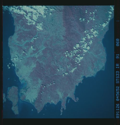
Southern end of Mindoro Island, Philippines (north is to the
top). Vegetation patterns, including agriculture and hill-slope
deforestation are evident in this CIR view. Large deltas rim the
coast. Streams currently are carrying very heavy loads of sedi-
ment that has been deposited in braided patterns within channels.
More subtle geological features may be inferred from topography
and vegetation patterns; for example, the north-south vegetation
boundary in the upper center of the frame marks the approximate
position of a suture zone between two diferent geological ter-
ranes. S33-91-060.
Southern end of Mindoro Island, Philippines (north is to the
top). Vegetation patterns, including agriculture and hill-slope
deforestation are evident in this CIR view. Large deltas rim the
coast. Streams currently are carrying very heavy loads of sedi-
ment that has been deposited in braided patterns within channels.
More subtle geological features may be inferred from topography
and vegetation patterns; for example, the north-south vegetation
boundary in the upper center of the frame marks the approximate
position of a suture zone between two diferent geological ter-
ranes. S33-91-060.

