< STS069-730-59 >

| NASA Photo ID | STS069-730-59 |
| Focal Length | 100mm |
| Date taken | 1995.09.09 |
| Time taken | 16:09:03 GMT |
Resolutions offered for this image:
5700 x 5900 pixels 500 x 518 pixels 640 x 480 pixels 512 x 512 pixels
5700 x 5900 pixels 500 x 518 pixels 640 x 480 pixels 512 x 512 pixels

Cloud masks available for this image:
Spacecraft nadir point: 28.3° N, 120.7° W
Photo center point: 28.0° N, 117.5° W
Photo center point by machine learning:
Photo center point: 28.0° N, 117.5° W
Photo center point by machine learning:
Nadir to Photo Center: East
Spacecraft Altitude: 199 nautical miles (369km)
Country or Geographic Name: | MEXICO |
Features: | GUADALUPE I, EDDIES, SHUT |
| Features Found Using Machine Learning: | |
Cloud Cover Percentage: | 65 (51-75)% |
Sun Elevation Angle: | 31° |
Sun Azimuth: | 101° |
Camera: | Hasselblad |
Focal Length: | 100mm |
Camera Tilt: | 44 degrees |
Format: | 5046: Kodak, natural color positive, Lumiere 100/5046, ASA 100, standard base |
Film Exposure: | Normal |
| Additional Information | |
| Width | Height | Annotated | Cropped | Purpose | Links |
|---|---|---|---|---|---|
| 5700 pixels | 5900 pixels | No | No | Download Image Download Color Calibration Image for this Image |
|
| 500 pixels | 518 pixels | No | No | Download Image Download Color Calibration Image for this Image |
|
| 640 pixels | 480 pixels | No | No | Download Image | |
| 512 pixels | 512 pixels | Yes | No | Download Image |
Download Packaged File
Download a Google Earth KML for this Image
View photo footprint information
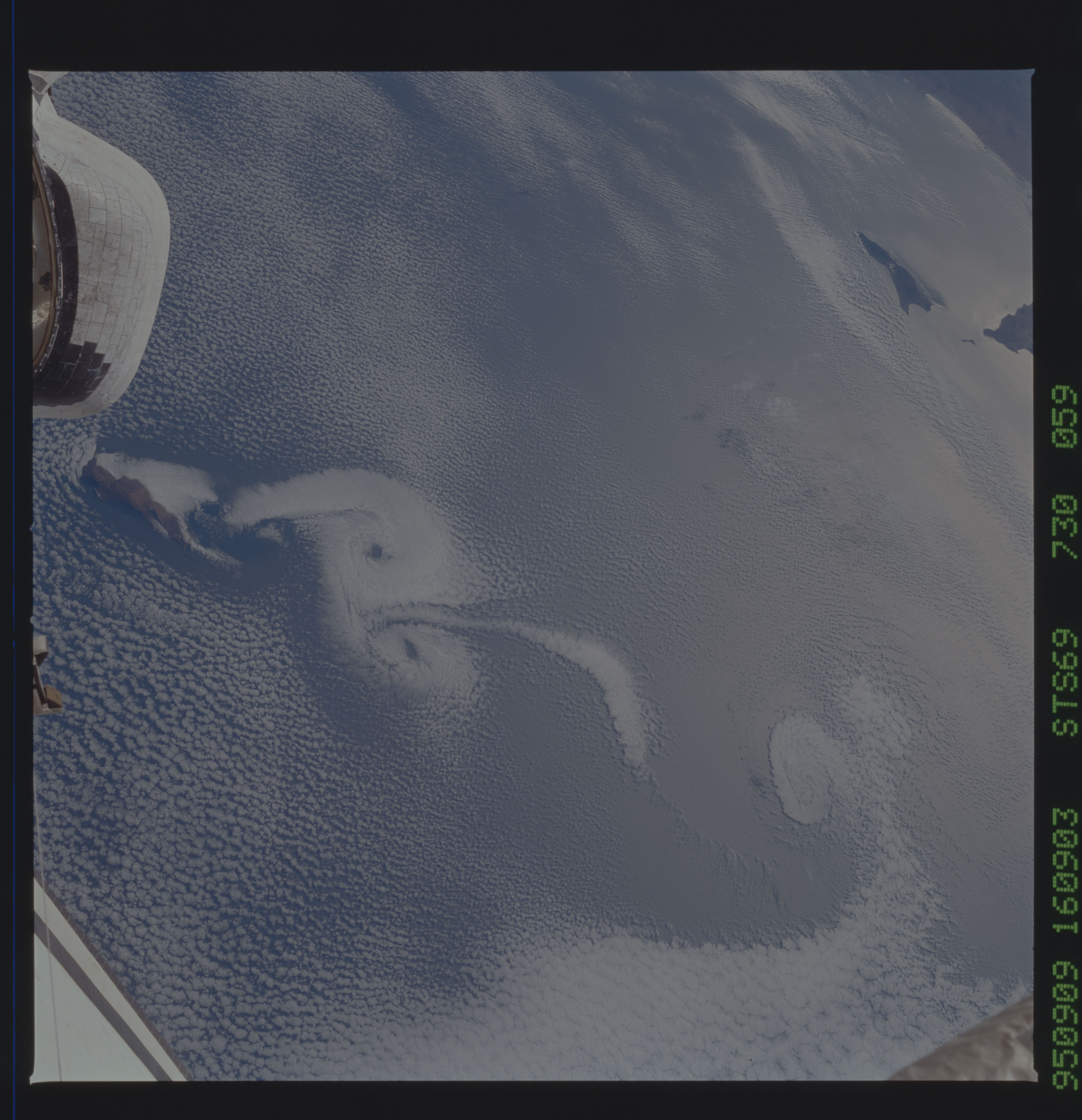
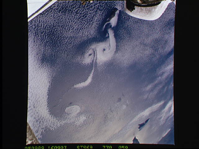
No GeoTIFF is available for this photo.Image Caption: The small islands off the west of California are the breeding grounds
for some the most picture perfect weather images. In these two
photographs, stable atmospheric status clouds are being moved into
circular patterns by the light southeasterly winds that have been
disrupted by the islands. As wind moves around solid objects small
vortices, call Von Karmen vortices, form and the clouds are moved
around by the winds creating this visual display of wind flow.
