< STS028-83-57 >
| NASA Photo ID | STS028-83-57 |
| Focal Length | 100mm |
| Date taken | 1989.08.11 |
| Time taken | 20:56:09 GMT |
Resolutions offered for this image:
3904 x 3904 pixels 639 x 639 pixels 5700 x 5900 pixels 500 x 518 pixels 640 x 480 pixels
3904 x 3904 pixels 639 x 639 pixels 5700 x 5900 pixels 500 x 518 pixels 640 x 480 pixels
Cloud masks available for this image:
Spacecraft nadir point: 55.9° N, 135.5° W
Photo center point: 57.0° N, 135.0° W
Photo center point by machine learning:
Photo center point: 57.0° N, 135.0° W
Photo center point by machine learning:
Nadir to Photo Center: North
Spacecraft Altitude: 162 nautical miles (300km)
Country or Geographic Name: | USA-ALASKA |
Features: | BARANOF ISLAND |
| Features Found Using Machine Learning: | |
Cloud Cover Percentage: | 20 (11-25)% |
Sun Elevation Angle: | 49° |
Sun Azimuth: | 176° |
Camera: | Hasselblad |
Focal Length: | 100mm |
Camera Tilt: | 24 degrees |
Format: | 5017: Kodak, natural color positive, Ektachrome, X Professional, ASA 64, standard base |
Film Exposure: | Normal |
| Additional Information | |
| Width | Height | Annotated | Cropped | Purpose | Links |
|---|---|---|---|---|---|
| 3904 pixels | 3904 pixels | No | No | Earth From Space collection | Download Image |
| 639 pixels | 639 pixels | No | No | Earth From Space collection | Download Image |
| 5700 pixels | 5900 pixels | No | No | Download Image | |
| 500 pixels | 518 pixels | No | No | Download Image | |
| 640 pixels | 480 pixels | No | No | Download Image |
Download Packaged File
Download a Google Earth KML for this Image
View photo footprint information
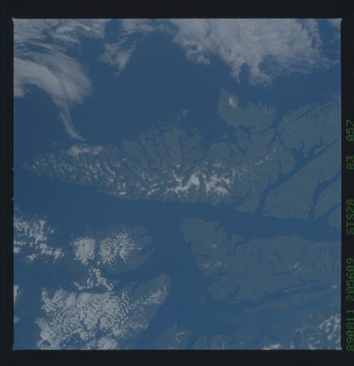
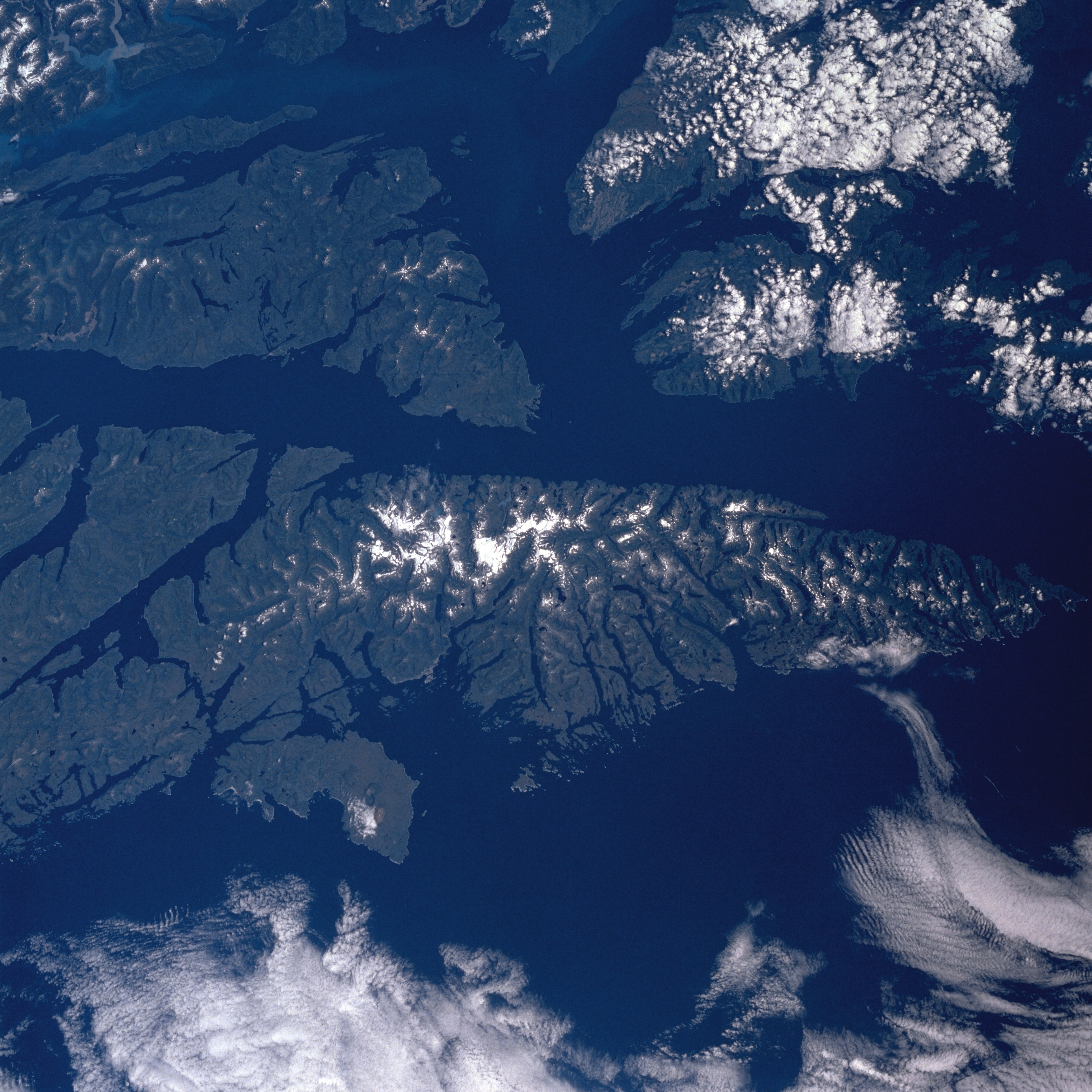
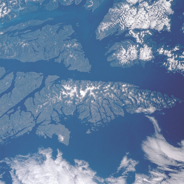
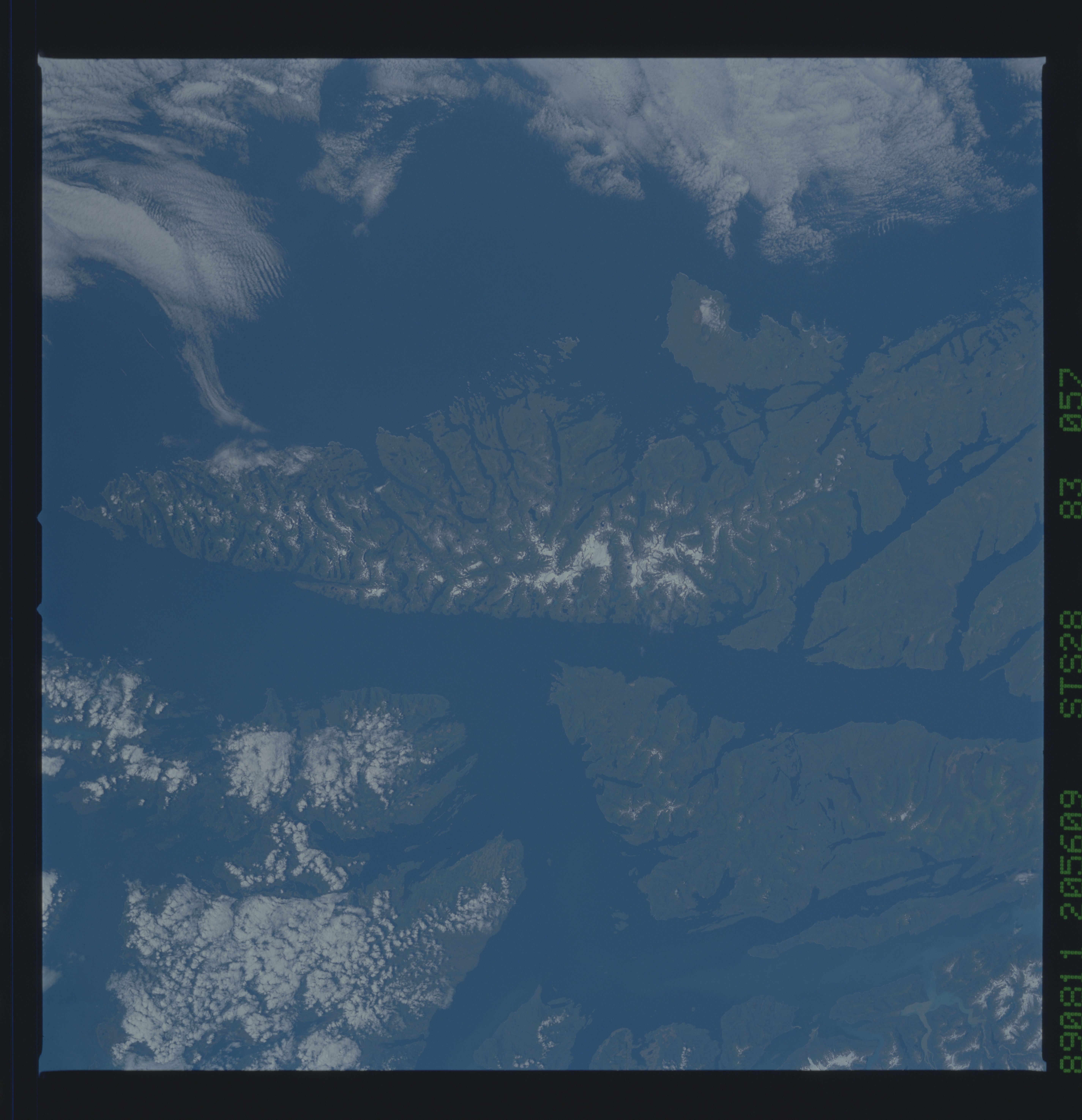
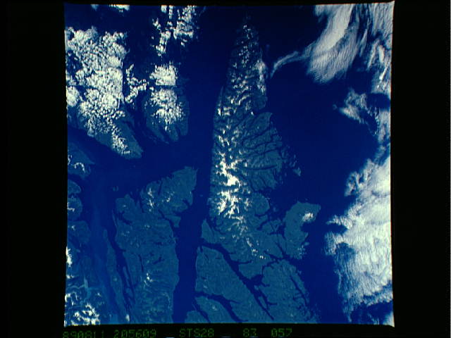
No GeoTIFF is available for this photo.Image Caption: STS028-083-057 Baranof Island and Chatham Strait, Alaska, U.S.A. August 1989
Parts of several heavily forested islands that constitute the Alaskan panhandle are visible in this photograph. Snowcapped peaks and ridge lines appear in some of the higher elevations of southward-pointing Baranof Island. Kuiu Island and Kupreanof Island are covered by clouds. Frederick Sound extends eastward from north-south-oriented Chatham Strait, which borders the eastern shore of Baranof Island. Both the sound and the strait are part of the Inside Passage, a sheltered waterway that operates from Seattle, Washington, to Skagway, Alaska. A section of Stephens Passage, an alternate route of the Inside Passage, is visible along the eastern coast of Admiralty Island.
Parts of several heavily forested islands that constitute the Alaskan panhandle are visible in this photograph. Snowcapped peaks and ridge lines appear in some of the higher elevations of southward-pointing Baranof Island. Kuiu Island and Kupreanof Island are covered by clouds. Frederick Sound extends eastward from north-south-oriented Chatham Strait, which borders the eastern shore of Baranof Island. Both the sound and the strait are part of the Inside Passage, a sheltered waterway that operates from Seattle, Washington, to Skagway, Alaska. A section of Stephens Passage, an alternate route of the Inside Passage, is visible along the eastern coast of Admiralty Island.
