< ISS002-E-5665 >

| NASA Photo ID | ISS002-E-5665 |
| Focal Length | 800mm |
| Date taken | 2001.04.16 |
| Time taken | 22:31:30 GMT |
Resolutions offered for this image:
2092 x 3060 pixels
2092 x 3060 pixels
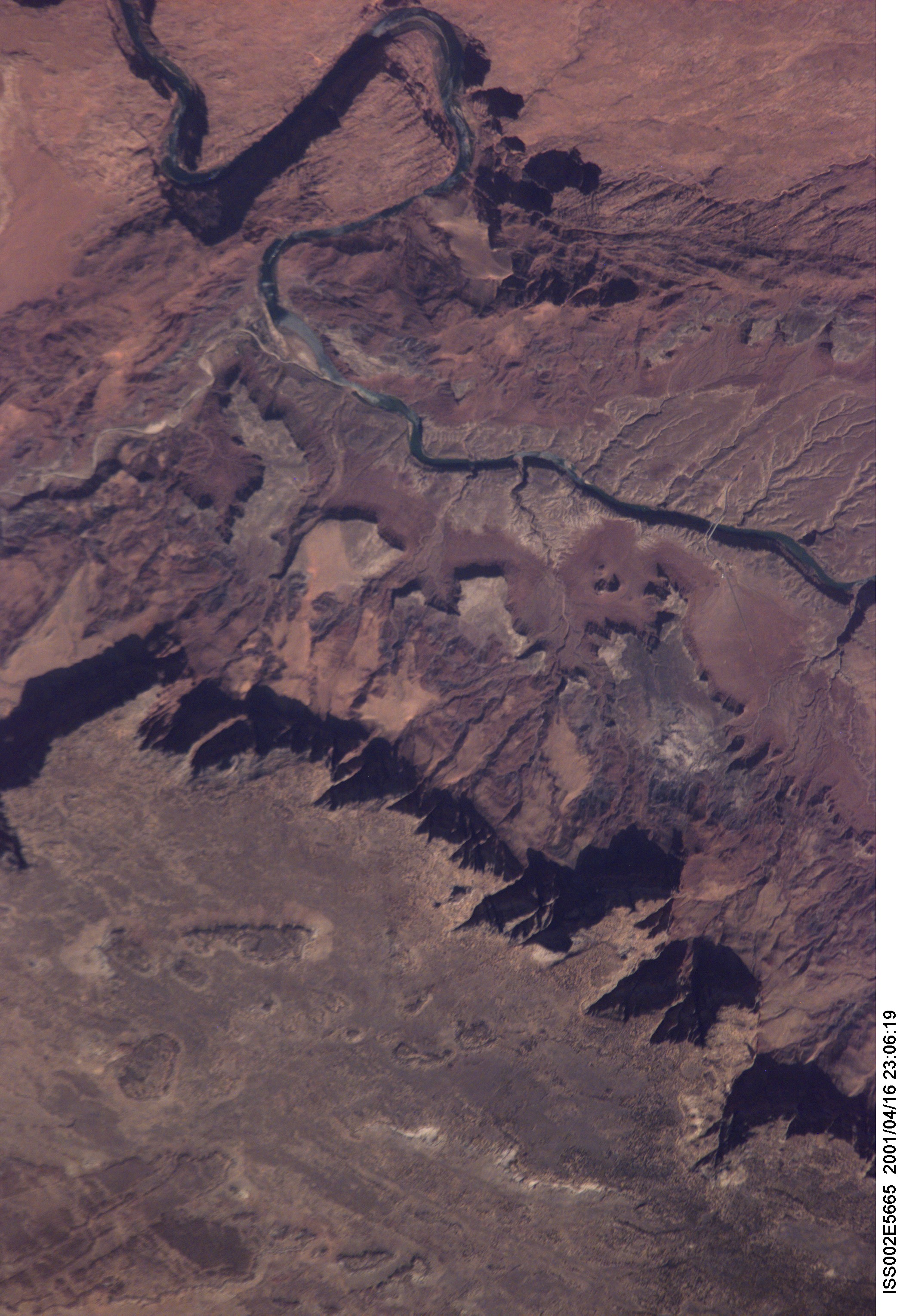


Spacecraft nadir point: 36.5° N, 110.0° W
Photo center point: 37.0° N, 111.5° W
Photo center point by machine learning: 36.85° N, 111.65° W
Photo center point: 37.0° N, 111.5° W
Photo center point by machine learning: 36.85° N, 111.65° W
Nadir to Photo Center: West
Spacecraft Altitude: 208 nautical miles (385km)

Country or Geographic Name: | USA-ARIZONA |
Features: | COLORADO RIVER |
| Features Found Using Machine Learning: | |
Cloud Cover Percentage: | 10 (1-10)% |
Sun Elevation Angle: | 40° |
Sun Azimuth: | 252° |
Camera: | Kodak DCS460 Electronic Still Camera |
Focal Length: | 800mm |
Camera Tilt: | 25 degrees |
Format: | 3060E: 3060 x 2036 pixel CCD, RGBG array |
Film Exposure: | |
| Additional Information | |
| Width | Height | Annotated | Cropped | Purpose | Links |
|---|---|---|---|---|---|
| 2092 pixels | 3060 pixels | No | No | Download Image |
Download Packaged File
Download a Google Earth KML for this Image
View photo footprint information
No GeoTIFF is available for this photo.Image Caption: none
