< STS091-719-56 >
| NASA Photo ID | STS091-719-56 |
| Focal Length | 250mm |
| Date taken | 1998.06.12 |
| Time taken | 10:13:49 GMT |
Cloud masks available for this image:
Spacecraft nadir point: 36.2° N, 51.9° E
Photo center point: 37.5° N, 50.0° E
Photo center point by machine learning:
Photo center point: 37.5° N, 50.0° E
Photo center point by machine learning:
Nadir to Photo Center: Northwest
Spacecraft Altitude: 186 nautical miles (344km)
Country or Geographic Name: | IRAN |
Features: | SEND R. DELTA, COAST, SED. |
| Features Found Using Machine Learning: | |
Cloud Cover Percentage: | 10 (1-10)% |
Sun Elevation Angle: | 65° |
Sun Azimuth: | 247° |
Camera: | Hasselblad |
Focal Length: | 250mm |
Camera Tilt: | 37 degrees |
Format: | 5069: Kodak Elite 100S, E6 Reversal, Replaces Lumiere, Warmer in tone vs. Lumiere |
Film Exposure: | Normal |
| Additional Information | |
| Width | Height | Annotated | Cropped | Purpose | Links |
|---|---|---|---|---|---|
| 5700 pixels | 5900 pixels | No | No | Download Image Download Color Calibration Image for this Image |
|
| 483 pixels | 500 pixels | No | No | Download Image Download Color Calibration Image for this Image |
Download Packaged File
Download a Google Earth KML for this Image
View photo footprint information
No GeoTIFF is available for this photo.Image Caption:
STS091-719-56
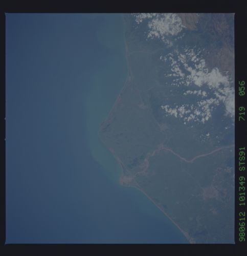
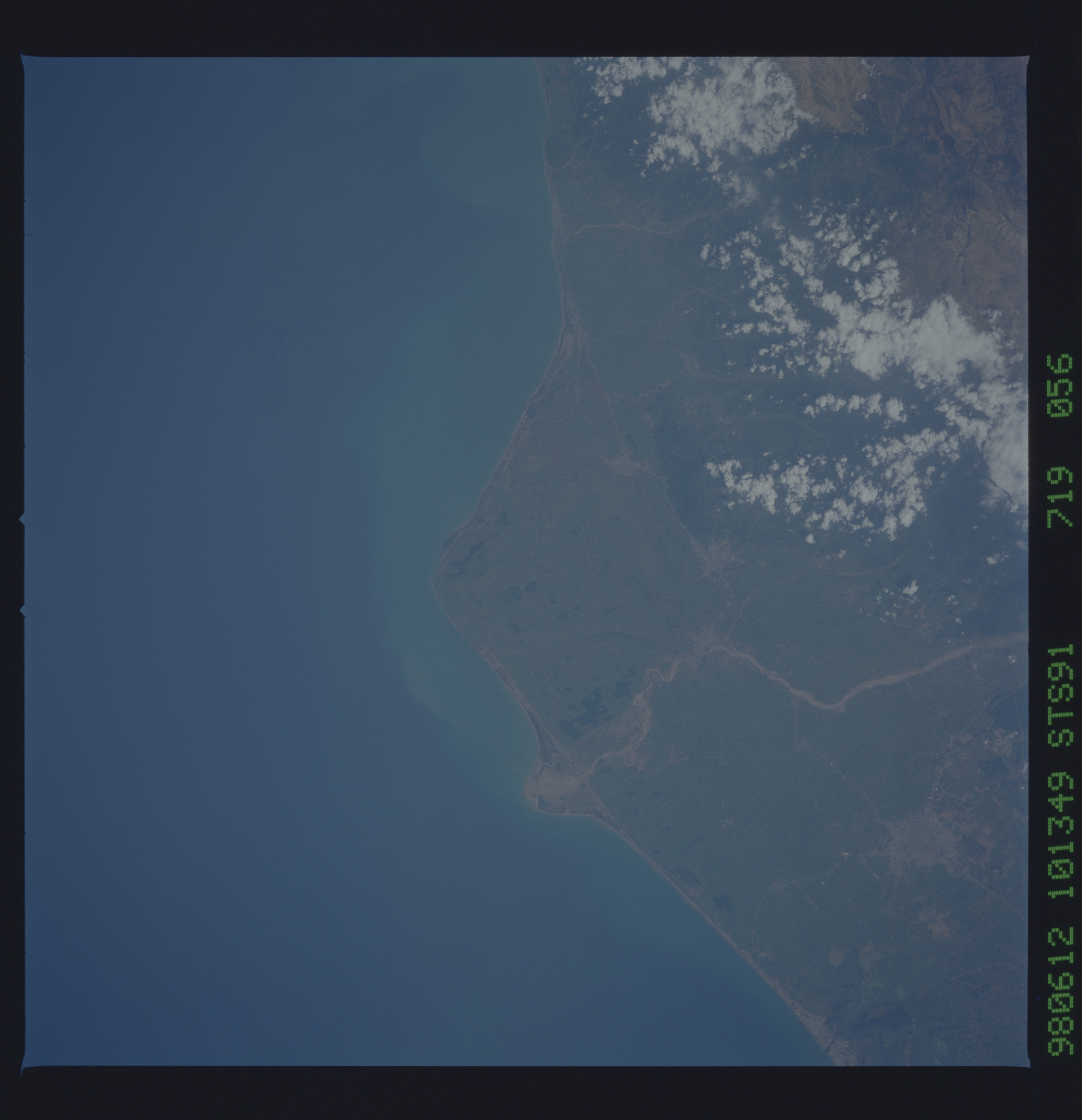
Cape Safidrud, Iran. This is an exceptionally detailed view of the delta of the Safid River, along the Iranian shore of the Caspian Sea; the city of Rasht is just to the southwest. The head of the river delta is at the sharp, linear fault zone that defines the coastline to either side of the delta. The Elburz Mountains, immediately south of the Caspian shore, rise to elevations greater than 5,500 m.
STS091-719-56
Cape Safidrud, Iran. This is an exceptionally detailed view of the delta of the Safid River, along the Iranian shore of the Caspian Sea; the city of Rasht is just to the southwest. The head of the river delta is at the sharp, linear fault zone that defines the coastline to either side of the delta. The Elburz Mountains, immediately south of the Caspian shore, rise to elevations greater than 5,500 m.
