< STS090-767-56 >

| NASA Photo ID | STS090-767-56 |
| Focal Length | 40mm |
| Date taken | 1998.04.28 |
| Time taken | 10:22:56 GMT |
Cloud masks available for this image:
Spacecraft nadir point: 37.8° N, 23.5° E
Photo center point: 38.0° N, 23.5° E
Photo center point by machine learning:
Photo center point: 38.0° N, 23.5° E
Photo center point by machine learning:
Nadir to Photo Center: North
Spacecraft Altitude: 131 nautical miles (243km)
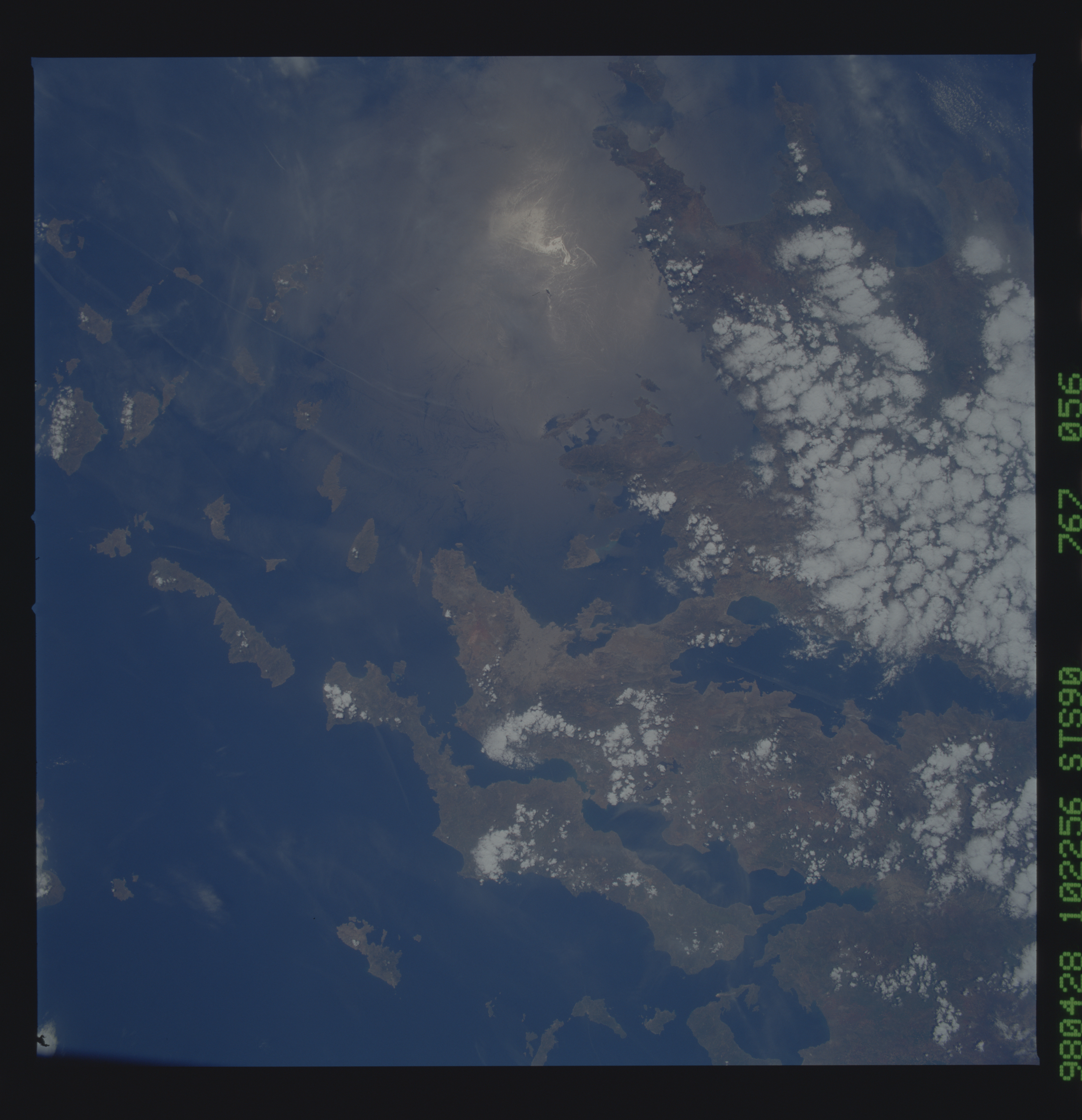
Country or Geographic Name: | GREECE |
Features: | ATHENS, CYCLADES ISLANDS |
| Features Found Using Machine Learning: | |
Cloud Cover Percentage: | 25 (11-25)% |
Sun Elevation Angle: | 67° |
Sun Azimuth: | 180° |
Camera: | Hasselblad |
Focal Length: | 40mm |
Camera Tilt: | 5 degrees |
Format: | 5069: Kodak Elite 100S, E6 Reversal, Replaces Lumiere, Warmer in tone vs. Lumiere |
Film Exposure: | Normal |
| Additional Information | |
| Width | Height | Annotated | Cropped | Purpose | Links |
|---|---|---|---|---|---|
| 5700 pixels | 5900 pixels | No | No | Download Image Download Color Calibration Image for this Image |
|
| 483 pixels | 500 pixels | No | No | Download Image Download Color Calibration Image for this Image |
|
| 640 pixels | 640 pixels | No | No | Photographic Highlights | Download Image |
Download Packaged File
Download a Google Earth KML for this Image
View photo footprint information
No GeoTIFF is available for this photo.Image Caption: The Peloponnesos of Greece is another region feeling the effects of the northward convergence of the
African tectonic plate. Twenty-seven hours after this photograph was taken, an earthquake of magnitude
5.9 shook the port town of Kalamata; the town and the faults of the area can be seen in the lower right of
this frame.
African tectonic plate. Twenty-seven hours after this photograph was taken, an earthquake of magnitude
5.9 shook the port town of Kalamata; the town and the faults of the area can be seen in the lower right of
this frame.
