< ISS017-E-5403 >

| NASA Photo ID | ISS017-E-5403 |
| Focal Length | 800mm |
| Date taken | 2008.04.27 |
| Time taken | 21:58:15 GMT |
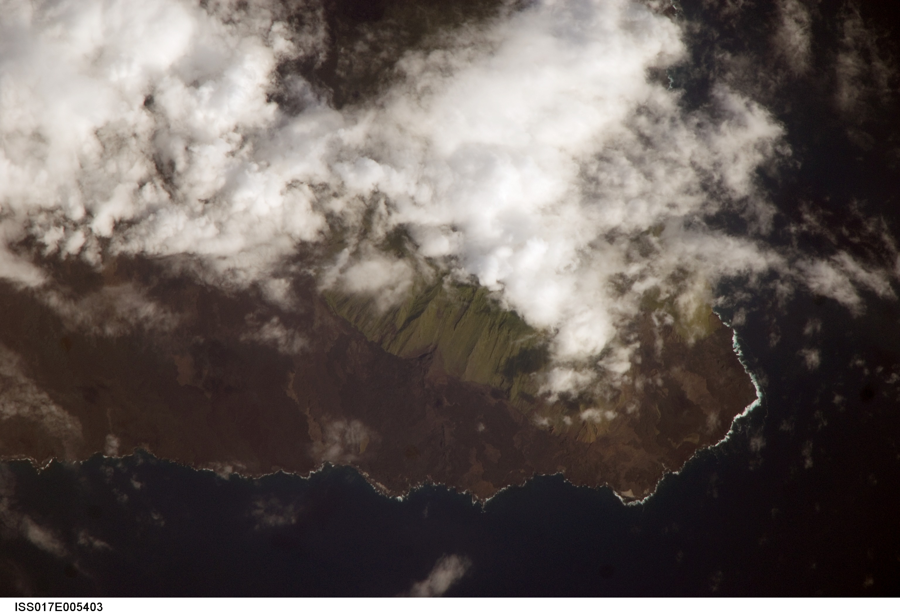
Spacecraft nadir point: 1.4° N, 91.4° W
Photo center point: 0.0° N, 91.5° W
Photo center point by machine learning:
Photo center point: 0.0° N, 91.5° W
Photo center point by machine learning:
Nadir to Photo Center: South
Spacecraft Altitude: 183 nautical miles (339km)
Country or Geographic Name: | GALAPAGOS ISLANDS |
Features: | CAPE BERKELY, ISABELLA ISLAND |
| Features Found Using Machine Learning: | |
Cloud Cover Percentage: | 50 (26-50)% |
Sun Elevation Angle: | 31° |
Sun Azimuth: | 286° |
Camera: | Nikon D2Xs Electronic Still Camera |
Focal Length: | 800mm |
Camera Tilt: | 25 degrees |
Format: | 4288E: 4288 x 2848 pixel CMOS sensor, RGBG imager color filter |
Film Exposure: | |
| Additional Information | |
| Width | Height | Annotated | Cropped | Purpose | Links |
|---|---|---|---|---|---|
| 3072 pixels | 2096 pixels | No | No | Download Image | |
| 639 pixels | 436 pixels | No | No | Download Image |
Download Packaged File
Download a Google Earth KML for this Image
View photo footprint information
No GeoTIFF is available for this photo.Image Caption: none
