< STS086-708-54 >
| NASA Photo ID | STS086-708-54 |
| Focal Length | 100mm |
| Date taken | 1997.10.04 |
| Time taken | 12:35:05 GMT |

Cloud masks available for this image:
Spacecraft nadir point: 51.7° S, 29.7° W
Photo center point:
Photo center point by machine learning:
Photo center point:
Photo center point by machine learning:
Nadir to Photo Center:
Spacecraft Altitude: 201 nautical miles (372km)
Camera: | Hasselblad |
Focal Length: | 100mm |
Camera Tilt: | Low Oblique |
Format: | 5069: Kodak Elite 100S, E6 Reversal, Replaces Lumiere, Warmer in tone vs. Lumiere |
Film Exposure: | Normal |
| Additional Information | |
| Width | Height | Annotated | Cropped | Purpose | Links |
|---|---|---|---|---|---|
| 5700 pixels | 5900 pixels | No | No | Download Image Download Color Calibration Image for this Image |
|
| 483 pixels | 500 pixels | No | No | Download Image Download Color Calibration Image for this Image |
|
| 598 pixels | 629 pixels | No | No | Download Image |
Download Packaged File
Download a Google Earth KML for this Image
View photo footprint information
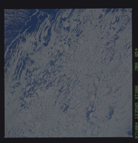
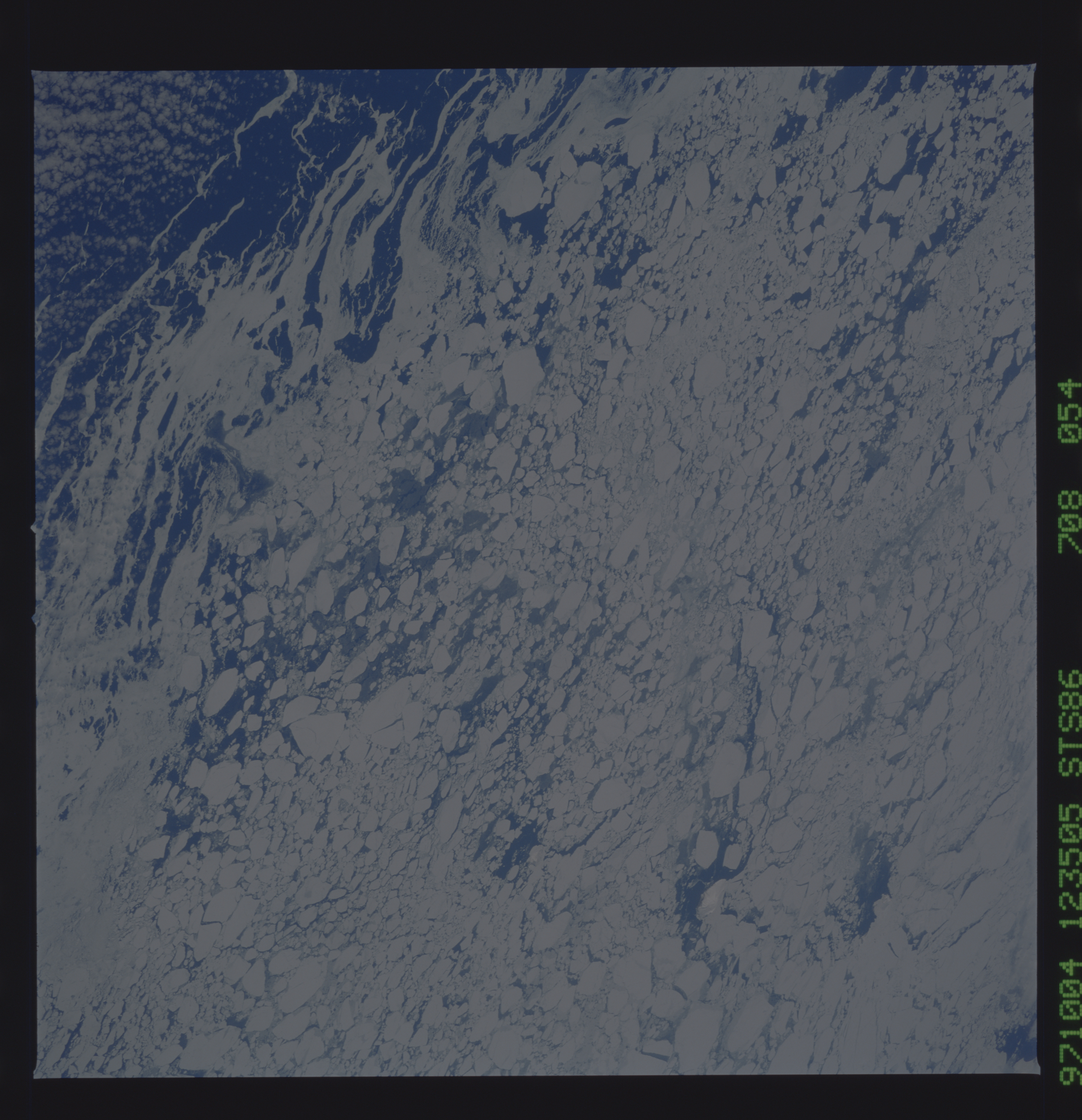
No GeoTIFF is available for this photo.Image Caption: South Sandwich Islands in the marginal ice zone of the ice pack extending from Antarctica. If you look closely you will see three islands. The center more prominent one is Visokoi Island (56.7S 27.2W) with a peak at 3300 feet. North, or toward the edge of the ice pack, is Zavodovski Island (peak elevation 1805 ft) and southward is Candlemas Island (peak elevation 1800 ft). In this region the ice edge reaches northward to about 54 deg south in September, when the water temperatures usually reach their coldest temperatures.
