< STS085-729-53 >
| NASA Photo ID | STS085-729-53 |
| Focal Length | 100mm |
| Date taken | 1997.08.11 |
| Time taken | 15:23:20 GMT |
Resolutions offered for this image:
4037 x 4037 pixels 639 x 639 pixels 5700 x 5900 pixels 483 x 500 pixels
4037 x 4037 pixels 639 x 639 pixels 5700 x 5900 pixels 483 x 500 pixels
Cloud masks available for this image:
Spacecraft nadir point: 57.1° N, 45.8° W
Photo center point: 60.0° N, 44.0° W
Photo center point by machine learning:
Photo center point: 60.0° N, 44.0° W
Photo center point by machine learning:
Nadir to Photo Center: Northeast
Spacecraft Altitude: 157 nautical miles (291km)
Country or Geographic Name: | GREENLAND |
Features: | PRINS CHRISTIANS SOUND |
| Features Found Using Machine Learning: | |
Cloud Cover Percentage: | 30 (26-50)% |
Sun Elevation Angle: | 48° |
Sun Azimuth: | 185° |
Camera: | Hasselblad |
Focal Length: | 100mm |
Camera Tilt: | 53 degrees |
Format: | 5069: Kodak Elite 100S, E6 Reversal, Replaces Lumiere, Warmer in tone vs. Lumiere |
Film Exposure: | Normal |
| Additional Information | |
| Width | Height | Annotated | Cropped | Purpose | Links |
|---|---|---|---|---|---|
| 4037 pixels | 4037 pixels | No | No | Earth From Space collection | Download Image |
| 639 pixels | 639 pixels | No | No | Earth From Space collection | Download Image |
| 5700 pixels | 5900 pixels | No | No | Download Image Download Color Calibration Image for this Image |
|
| 483 pixels | 500 pixels | No | No | Download Image Download Color Calibration Image for this Image |
Download Packaged File
Download a Google Earth KML for this Image
View photo footprint information
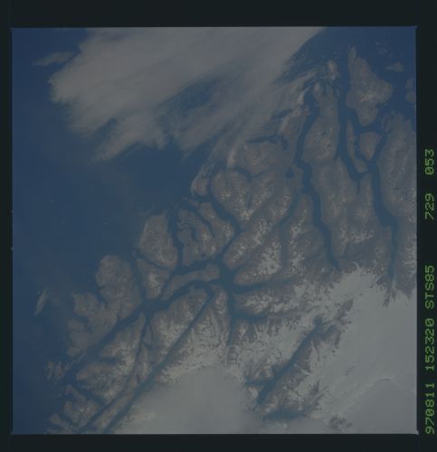
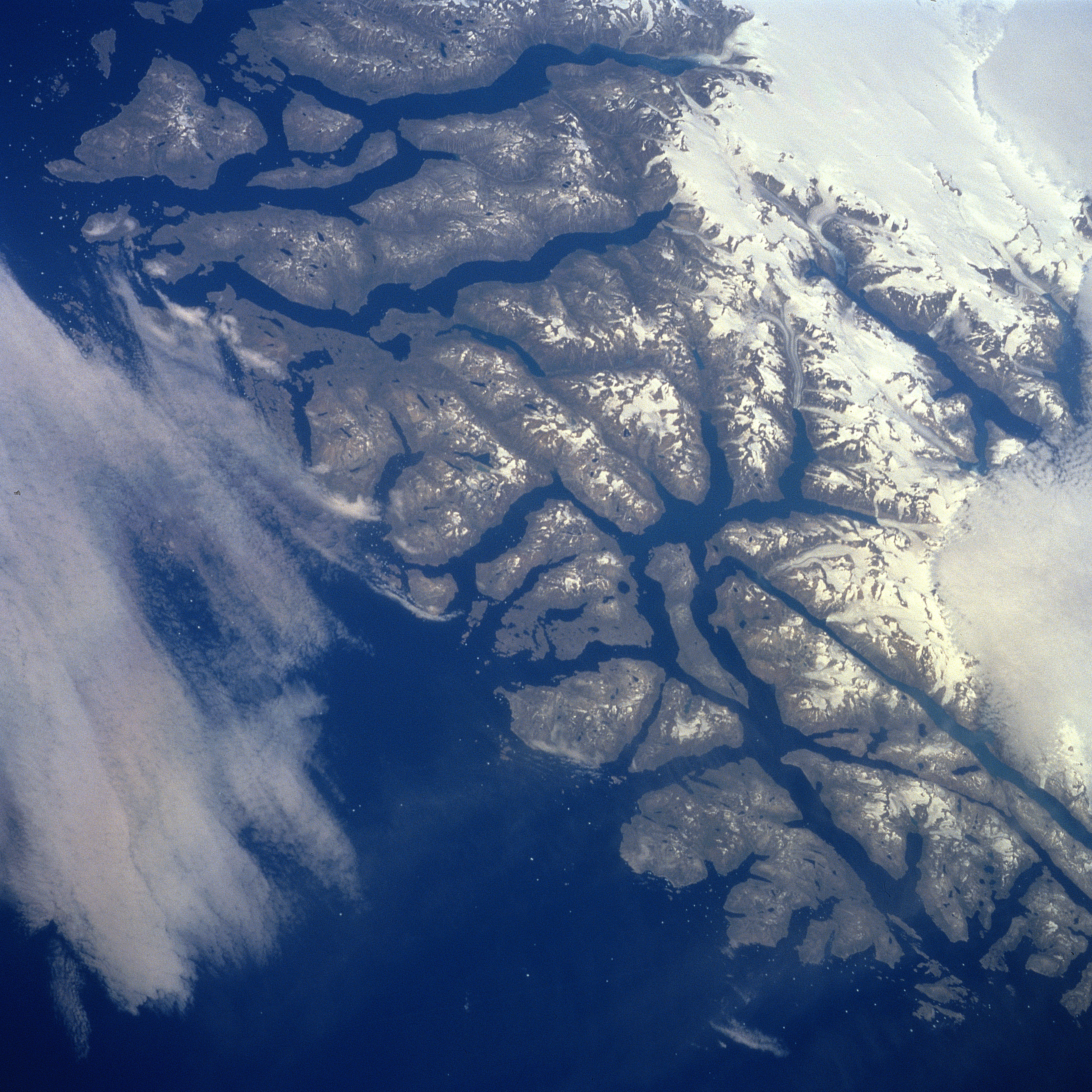
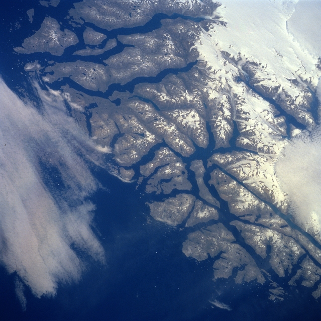
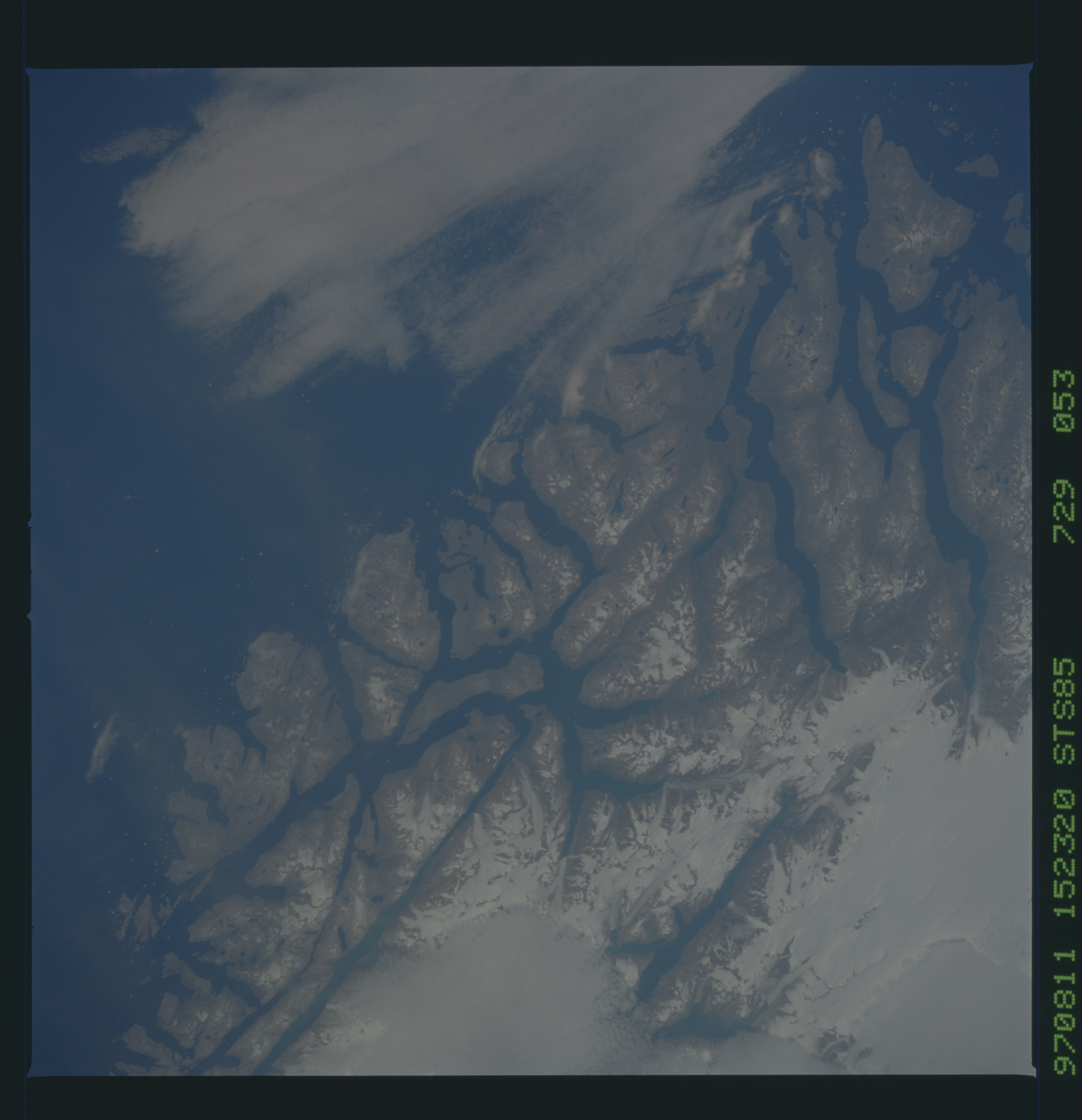
No GeoTIFF is available for this photo.Image Caption: STS085-729-053 Southern Coast, Greenland August 1997
Although the viewing angle (look direction) and the geographic area included in this image are different from STS85-713-074, both of these pictures show the southern tip of Greenland from slightly different prospectives. This particular image shows more of the southwestern tip with its extensively fjorded coastline. The large area of white in the upper right corner of the picture is part of a large, permanent ice field that extends southward through the mountainous area of southern Greenland. This summertime view of the rugged fjorded coastline shows an exposed landscape where a variety of flora (forest-like brush species) grows on the mountain slopes, isolated marshes, and alpine meadows. Two separate cloud patterns (whitish areas) are observed: one along the right edge (middle) and the other along the left edge (center) of the picture.
Although the viewing angle (look direction) and the geographic area included in this image are different from STS85-713-074, both of these pictures show the southern tip of Greenland from slightly different prospectives. This particular image shows more of the southwestern tip with its extensively fjorded coastline. The large area of white in the upper right corner of the picture is part of a large, permanent ice field that extends southward through the mountainous area of southern Greenland. This summertime view of the rugged fjorded coastline shows an exposed landscape where a variety of flora (forest-like brush species) grows on the mountain slopes, isolated marshes, and alpine meadows. Two separate cloud patterns (whitish areas) are observed: one along the right edge (middle) and the other along the left edge (center) of the picture.
