< STS081-711-5 >

| NASA Photo ID | STS081-711-5 |
| Focal Length | 40mm |
| Date taken | 1997.01.21 |
| Time taken | 15:11:42 GMT |

Cloud masks available for this image:
Spacecraft nadir point: 37.3° N, 103.1° W
Photo center point: 37.0° N, 105.5° W
Photo center point by machine learning:
Photo center point: 37.0° N, 105.5° W
Photo center point by machine learning:
Nadir to Photo Center: West
Spacecraft Altitude: 184 nautical miles (341km)
Country or Geographic Name: | USA-COLORADO |
Features: | SAN LUIS VALLEY |
| Features Found Using Machine Learning: | |
Cloud Cover Percentage: | 30 (26-50)% |
Sun Elevation Angle: | 11° |
Sun Azimuth: | 126° |
Camera: | Hasselblad |
Focal Length: | 40mm |
Camera Tilt: | 38 degrees |
Format: | 5046: Kodak, natural color positive, Lumiere 100/5046, ASA 100, standard base |
Film Exposure: | Normal |
| Additional Information | |
| Width | Height | Annotated | Cropped | Purpose | Links |
|---|---|---|---|---|---|
| 5700 pixels | 5900 pixels | No | No | Download Image | |
| 483 pixels | 500 pixels | No | No | Download Image | |
| 960 pixels | 944 pixels | Yes | No | Download Image |
Download Packaged File
Download a Google Earth KML for this Image
View photo footprint information
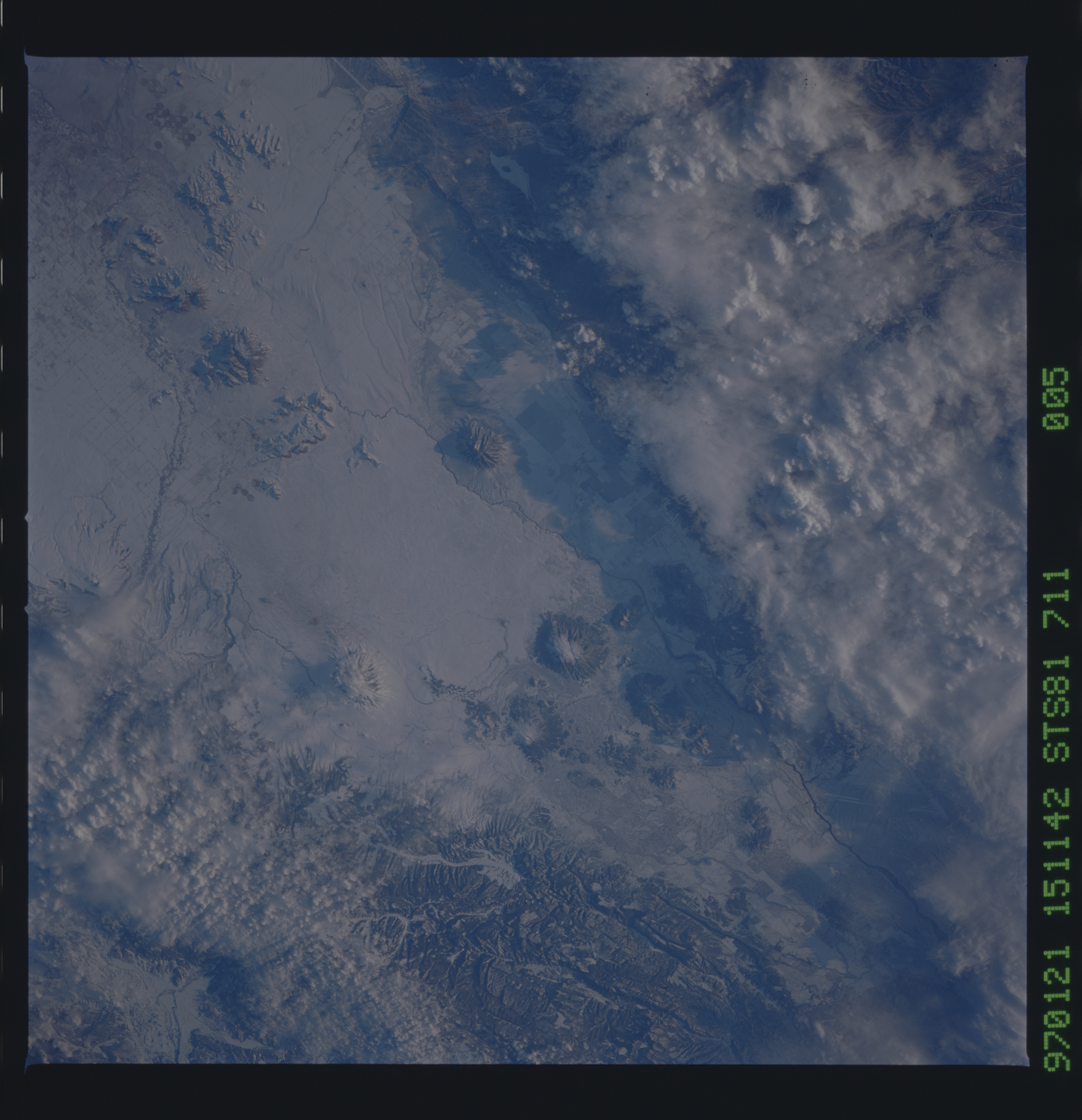
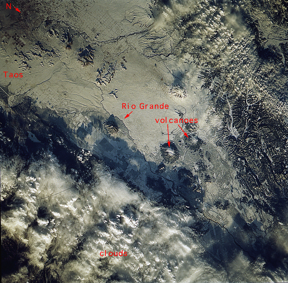
No GeoTIFF is available for this photo.Image Caption: wide view down Rio grande to Albuquerque
One of a stereopair of the Taos Plateau, New Mexico. Snow enhances structural details. Of particular note is Cerro de la Oja, a large round dome west of the irregularly-shaped 600'+ high obsidian flow at the west edge of the Rio Grande Gorge (first stop along the northern part of the gorge on the astronaut geological training trip). The Cerro appears to have NNE-trending faults cutting across it. In the many years that I have been working in that region I have never been aware that it might be faulted!
One of a stereopair of the Taos Plateau, New Mexico. Snow enhances structural details. Of particular note is Cerro de la Oja, a large round dome west of the irregularly-shaped 600'+ high obsidian flow at the west edge of the Rio Grande Gorge (first stop along the northern part of the gorge on the astronaut geological training trip). The Cerro appears to have NNE-trending faults cutting across it. In the many years that I have been working in that region I have never been aware that it might be faulted!
