STS061-98-5
| NASA Photo ID | STS061-98-5 |
| Focal Length | 40mm |
| Date taken | 1993.12.08 |
| Time taken | 08:37:34 GMT |
Resolutions offered for this image:
5248 x 5248 pixels 640 x 640 pixels 5700 x 5900 pixels 500 x 518 pixels 640 x 480 pixels
5248 x 5248 pixels 640 x 640 pixels 5700 x 5900 pixels 500 x 518 pixels 640 x 480 pixels
Cloud masks available for this image:
Spacecraft nadir point: 22.8° S, 45.6° E
Photo center point: 21.0° S, 47.0° E
Photo center point by machine learning:
Photo center point: 21.0° S, 47.0° E
Photo center point by machine learning:
Nadir to Photo Center: Northeast
Spacecraft Altitude: 320 nautical miles (593km)
Country or Geographic Name: | MADAGASCAR |
Features: | SOUTHERN, CENTRAL AREAS |
| Features Found Using Machine Learning: | |
Cloud Cover Percentage: | 10 (1-10)% |
Sun Elevation Angle: | 87° |
Sun Azimuth: | 91° |
Camera: | Hasselblad |
Focal Length: | 40mm |
Camera Tilt: | 23 degrees |
Format: | VELVI: Fuji, natural color positive, Velvia 50, CS 135-36, ASA 32, standard base |
Film Exposure: | Normal |
| Additional Information | |
| Width | Height | Annotated | Cropped | Purpose | Links |
|---|---|---|---|---|---|
| 5248 pixels | 5248 pixels | No | No | Earth From Space collection | Download Image |
| 640 pixels | 640 pixels | No | No | Earth From Space collection | Download Image |
| 5700 pixels | 5900 pixels | No | No | Download Image | |
| 500 pixels | 518 pixels | No | No | Download Image | |
| 640 pixels | 480 pixels | No | No | Download Image |
Download Packaged File
Download a Google Earth KML for this Image
View photo footprint information
Download a GeoTIFF for this photo
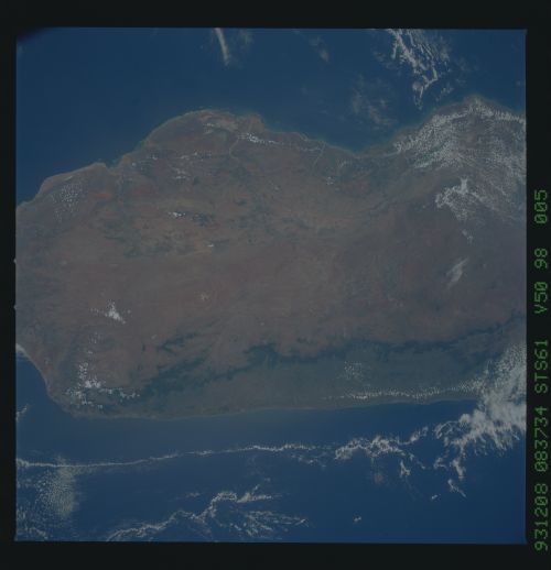
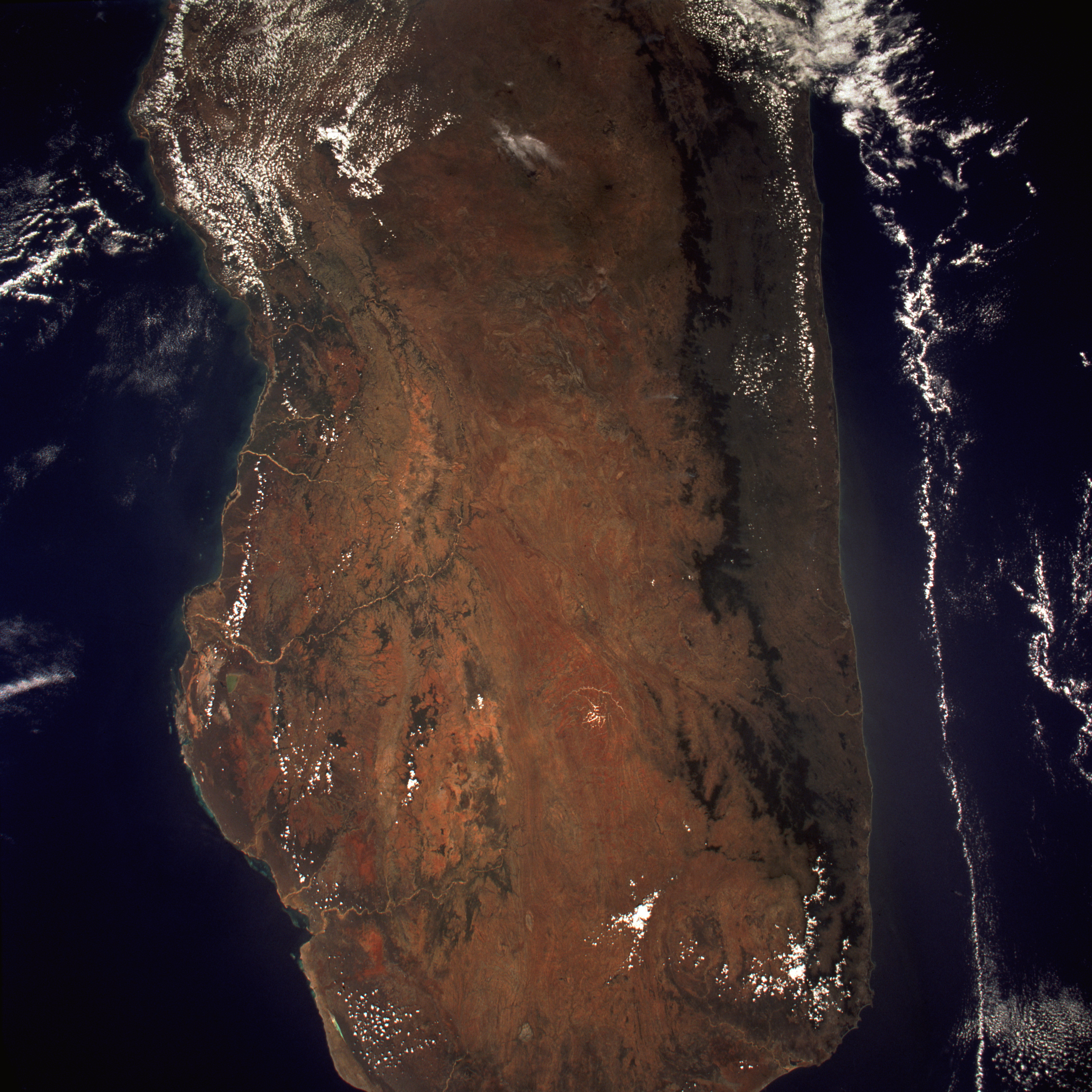
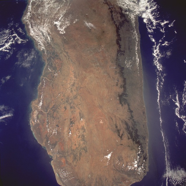
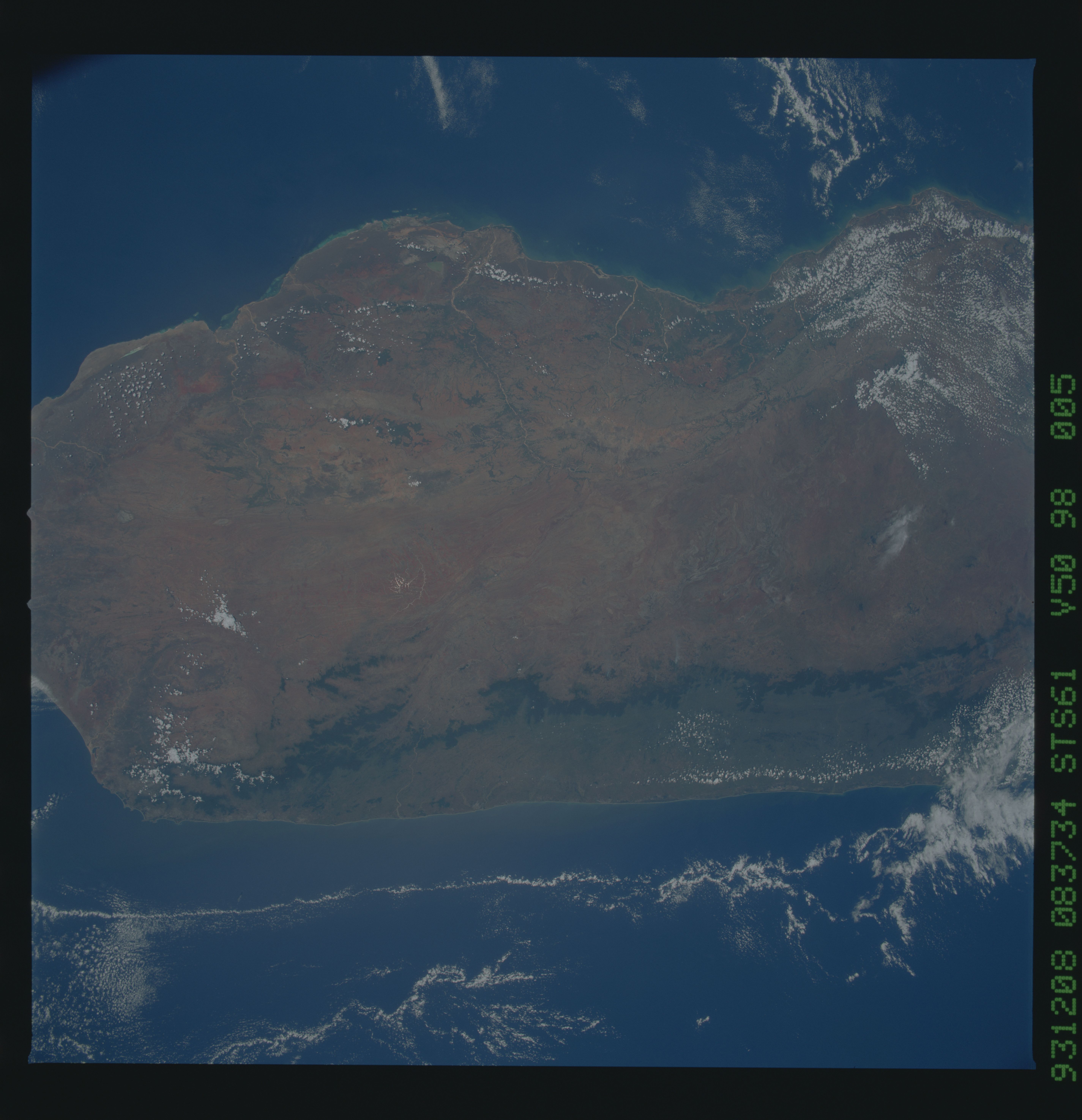
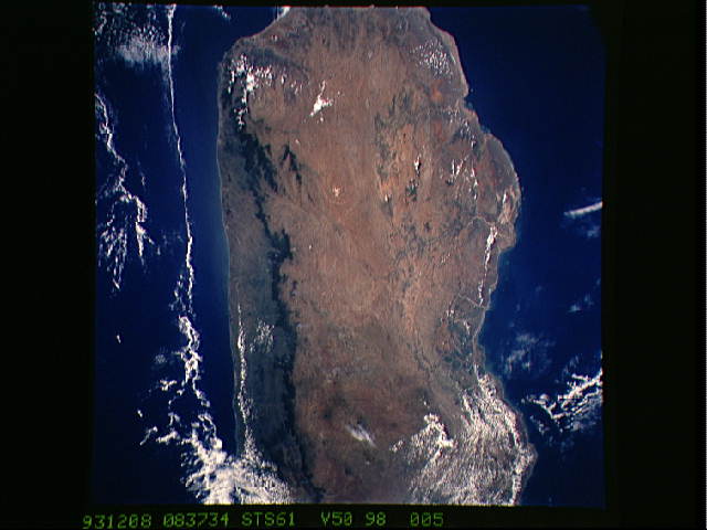
Image Caption: STS061-098-005 Southern Madagascar December 1993
Almost two-thirds of Madagascar, the world's fourth largest island, is seen in this near-vertical, almost cloud-free photograph. The island is composed of relatively narrow coastal plains on both the east and west coasts, with a much larger central plateau that extends generally north-south for the entire length of the country. The dark north-south line that parallels the east coast shows the remaining 10 percent of the original lowland and mountain rain forests that exist on Madagascar. The major cause of the dramatic decrease in forests has been the slash-and-burn agriculture practiced by small-scale farmers. The future will determine if imposed conservation strategies will be effective in reversing this destructive practice. Because the east coast lies in the path of the rain-bearing southeast trade winds that blow off the Indian Ocean, it receives an annual average rainfall of more than 70 inches (180 centimeters). A rain-shadow effect is created by the low mountains along the east coast of Madagascar, as precipitation amounts decrease appreciably to the west. The southwestern corner of the island is classified as arid to semiarid. Major soil erosion problems are common throughout most of the island, particularly along the western edge of the country where many of the westward-flowing rivers carry large quantities of sediment into the bays and estuaries.
Almost two-thirds of Madagascar, the world's fourth largest island, is seen in this near-vertical, almost cloud-free photograph. The island is composed of relatively narrow coastal plains on both the east and west coasts, with a much larger central plateau that extends generally north-south for the entire length of the country. The dark north-south line that parallels the east coast shows the remaining 10 percent of the original lowland and mountain rain forests that exist on Madagascar. The major cause of the dramatic decrease in forests has been the slash-and-burn agriculture practiced by small-scale farmers. The future will determine if imposed conservation strategies will be effective in reversing this destructive practice. Because the east coast lies in the path of the rain-bearing southeast trade winds that blow off the Indian Ocean, it receives an annual average rainfall of more than 70 inches (180 centimeters). A rain-shadow effect is created by the low mountains along the east coast of Madagascar, as precipitation amounts decrease appreciably to the west. The southwestern corner of the island is classified as arid to semiarid. Major soil erosion problems are common throughout most of the island, particularly along the western edge of the country where many of the westward-flowing rivers carry large quantities of sediment into the bays and estuaries.
