< ISS041-E-49111 >
| NASA Photo ID | ISS041-E-49111 |
| Focal Length | 200mm |
| Date taken | 2014.09.30 |
| Time taken | 21:43:05 GMT |
Resolutions offered for this image:
1000 x 665 pixels 540 x 359 pixels 2128 x 1416 pixels 720 x 480 pixels 4256 x 2832 pixels 640 x 426 pixels
1000 x 665 pixels 540 x 359 pixels 2128 x 1416 pixels 720 x 480 pixels 4256 x 2832 pixels 640 x 426 pixels


Spacecraft nadir point: 38.8° S, 179.4° E
Photo center point: 39.2° S, 174.1° E
Photo center point by machine learning: 39.32° S, 174.08° E
Photo center point: 39.2° S, 174.1° E
Photo center point by machine learning: 39.32° S, 174.08° E
Nadir to Photo Center: West
Spacecraft Altitude: 226 nautical miles (419km)

Country or Geographic Name: | NEW ZEALAND-NI |
Features: | MT. EGMONT, CIRCULAR NATURE PARK |
| Features Found Using Machine Learning: | |
Cloud Cover Percentage: | 10 (1-10)% |
Sun Elevation Angle: | 44° |
Sun Azimuth: | 48° |
Camera: | Nikon D3S Electronic Still Camera |
Focal Length: | 200mm |
Camera Tilt: | 55 degrees |
Format: | 4256E: 4256 x 2832 pixel CMOS sensor, 36.0mm x 23.9mm, total pixels: 12.87 million, Nikon FX format |
Film Exposure: | |
| Additional Information | |
| Width | Height | Annotated | Cropped | Purpose | Links |
|---|---|---|---|---|---|
| 1000 pixels | 665 pixels | No | No | Earth From Space collection | Download Image |
| 540 pixels | 359 pixels | Yes | No | Earth From Space collection | Download Image |
| 2128 pixels | 1416 pixels | No | No | NASA's Earth Observatory web site | Download Image |
| 720 pixels | 480 pixels | Yes | No | NASA's Earth Observatory web site | Download Image |
| 4256 pixels | 2832 pixels | No | No | Download Image | |
| 640 pixels | 426 pixels | No | No | Download Image |
Download Packaged File
Download a Google Earth KML for this Image
View photo footprint information
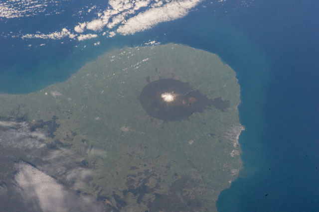
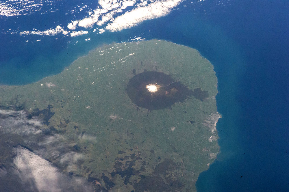
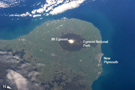
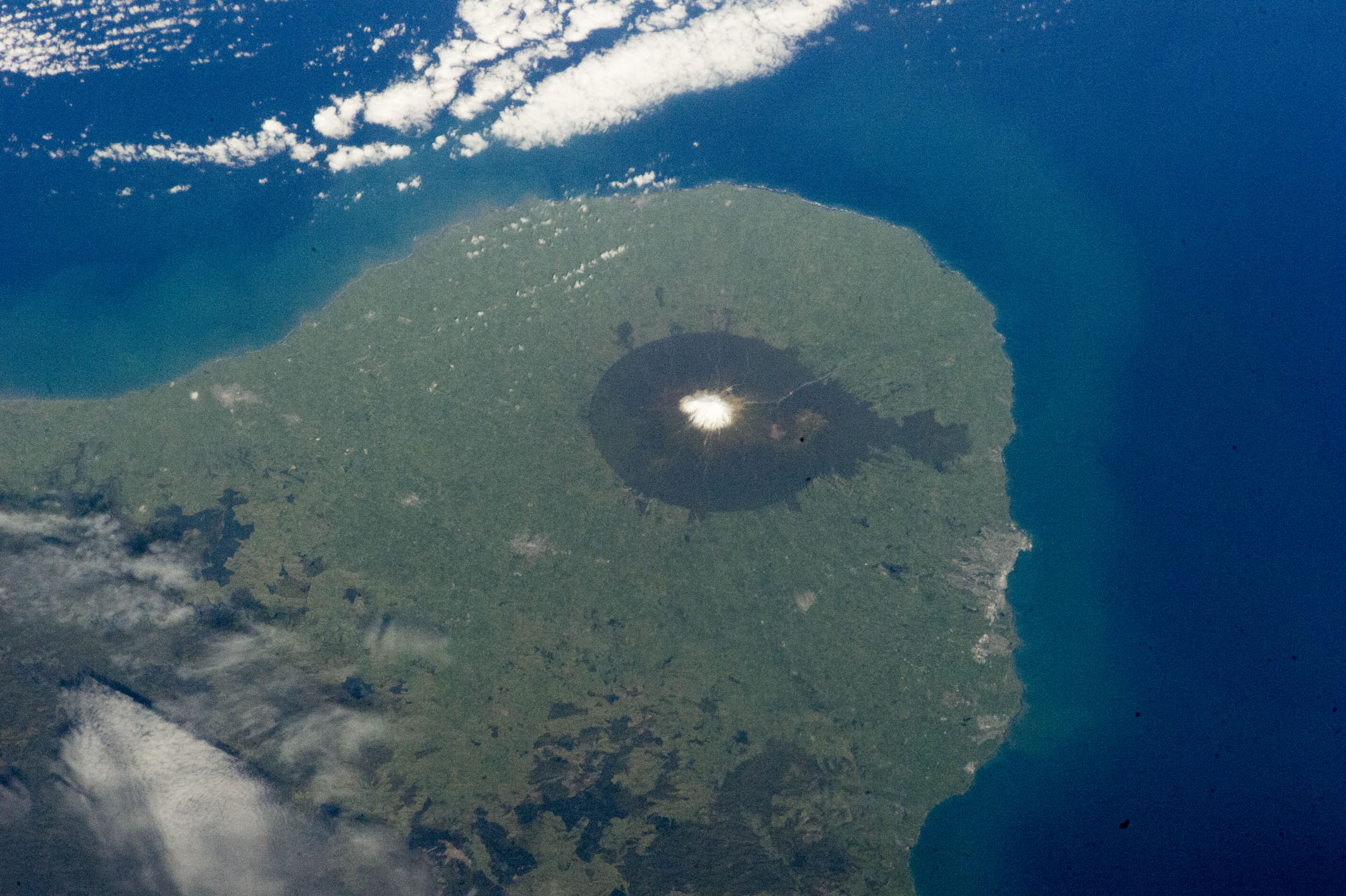
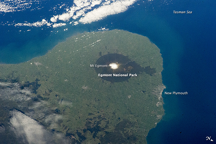
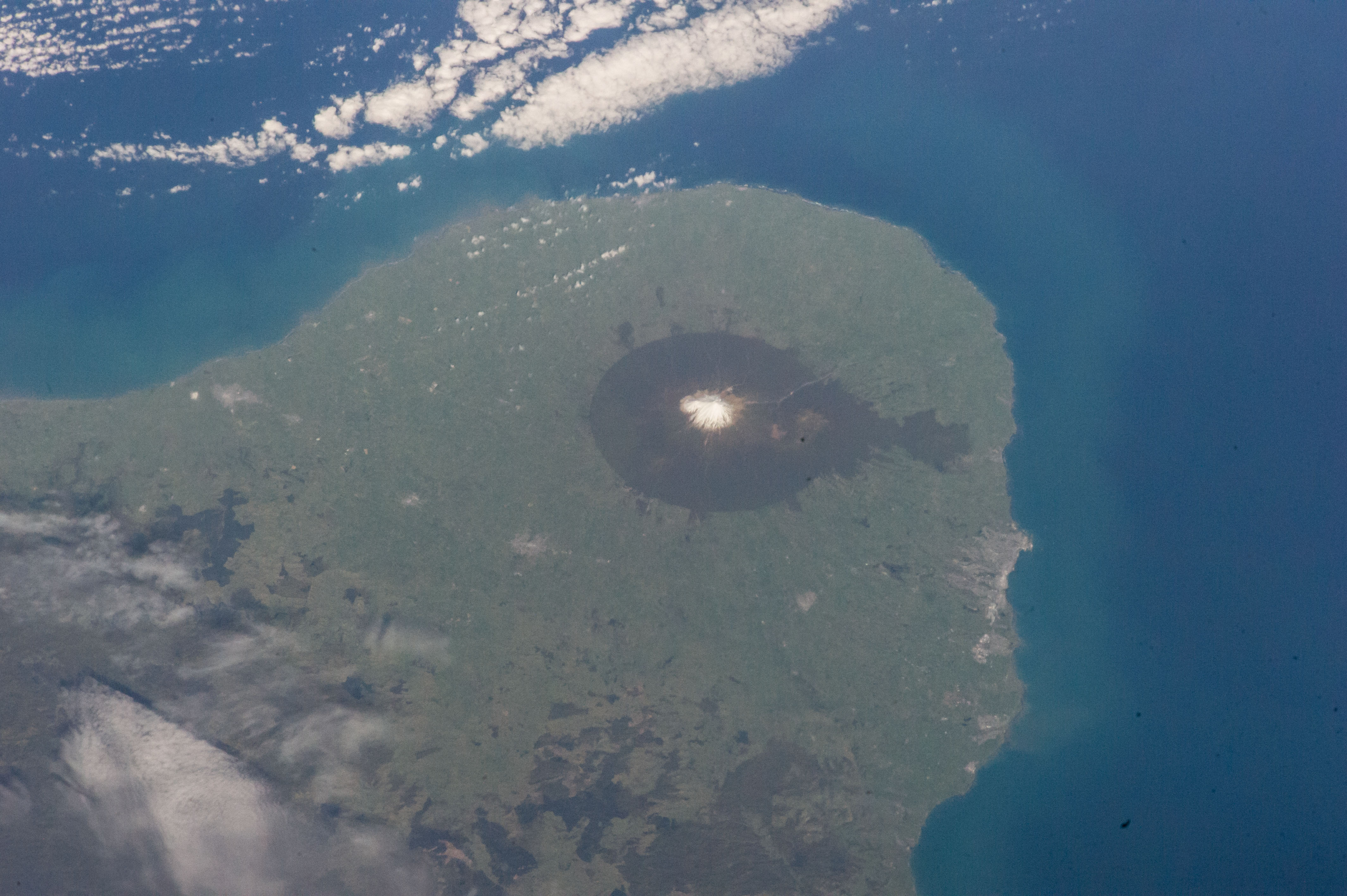
No GeoTIFF is available for this photo.Image Caption: Mount Egmont (Taranaki), North Island, New Zealand
The circular rain-forest of Egmont National Park is one of the most prominent features that crews aboard the International Space Station see when they fly over New Zealand. The park was originally planned in 1900 with a radius of 6 miles (9656 m) centered on the dramatic Mount Egmont, one of the world's most symmetric volcanoes. Its snow-capped peak reaches 2518 m (8,260 feet). The entire curved promontory where the park lies has been formed by volcanic lava flows spreading out on many occasions from Mount Egmont--also known by its Maori name Taranaki. The volcano has erupted roughly every 90 years with smaller eruptions. Geologists by dating lava flows know that major eruptions have taken place every 500 years since this young volcano began to erupt. Lighter colored sediments eroding all along the coast ring the peninsula with a faint arc of lighter-colored water.
The town of New Plymouth stands out from the surrounding agricultural lands as a gray patch (image right), and other smaller towns are stretched out across the plain on the inland side of the volcano.
