< STS034-72-48 >
| NASA Photo ID | STS034-72-48 |
| Focal Length | 250mm |
| Date taken | 1989.10.__ |
| Time taken | GMT |
Cloud masks available for this image:
Spacecraft nadir point:
Photo center point: 38.0° N, 119.0° W
Photo center point by machine learning:
Photo center point: 38.0° N, 119.0° W
Photo center point by machine learning:
Nadir to Photo Center:
Spacecraft Altitude: nautical miles (0km)Body: Earth
Camera: | Hasselblad |
Focal Length: | 250mm |
Camera Tilt: | Low Oblique |
Format: | 5017: Kodak, natural color positive, Ektachrome, X Professional, ASA 64, standard base |
Film Exposure: | Normal |
| Additional Information | |
| Width | Height | Annotated | Cropped | Purpose | Links |
|---|---|---|---|---|---|
| 5700 pixels | 5900 pixels | No | No | Download Image | |
| 500 pixels | 518 pixels | No | No | Download Image | |
| 640 pixels | 480 pixels | No | No | Download Image |
Download Packaged File
Download a Google Earth KML for this Image
View photo footprint information
No GeoTIFF is available for this photo.Image Caption:
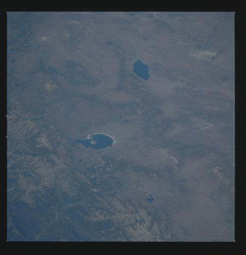
Mono Lake and the Owens Valley
Paleoshorelines of Mono Lake (1) mark higher stands of water dur-
ing recent interglacial times. However, the water demands by the
city of Los Angeles have diverted inlet water to the lake, so
that the shoreline has receded even more over the past few years.
Mono Lake has become increasingly alkaline, and wildlife is
threatened. Mono Lake has become a focal point for water rights
in the West. Chemically-deposited tufa forms strange towers in-
land around the lake. The Long Valley caldera (2) was created
with a catastrophic eruption around 600,000 years ago. The ash
from the eruption is cut by the Owens River (3). Several hot
springs heated by the underground magmas can be found in this
area. This scene also shows Tuolomne Meadow in Yosemite Park (4),
Mammoth Lakes (5), and Walker Lake (6). (STS34-72-048)
Mono Lake and the Owens Valley
Paleoshorelines of Mono Lake (1) mark higher stands of water dur-
ing recent interglacial times. However, the water demands by the
city of Los Angeles have diverted inlet water to the lake, so
that the shoreline has receded even more over the past few years.
Mono Lake has become increasingly alkaline, and wildlife is
threatened. Mono Lake has become a focal point for water rights
in the West. Chemically-deposited tufa forms strange towers in-
land around the lake. The Long Valley caldera (2) was created
with a catastrophic eruption around 600,000 years ago. The ash
from the eruption is cut by the Owens River (3). Several hot
springs heated by the underground magmas can be found in this
area. This scene also shows Tuolomne Meadow in Yosemite Park (4),
Mammoth Lakes (5), and Walker Lake (6). (STS34-72-048)

