< ISS037-E-4647 >

| NASA Photo ID | ISS037-E-4647 |
| Focal Length | 50mm |
| Date taken | 2013.10.01 |
| Time taken | 19:08:37 GMT |
Cloud masks available for this image:
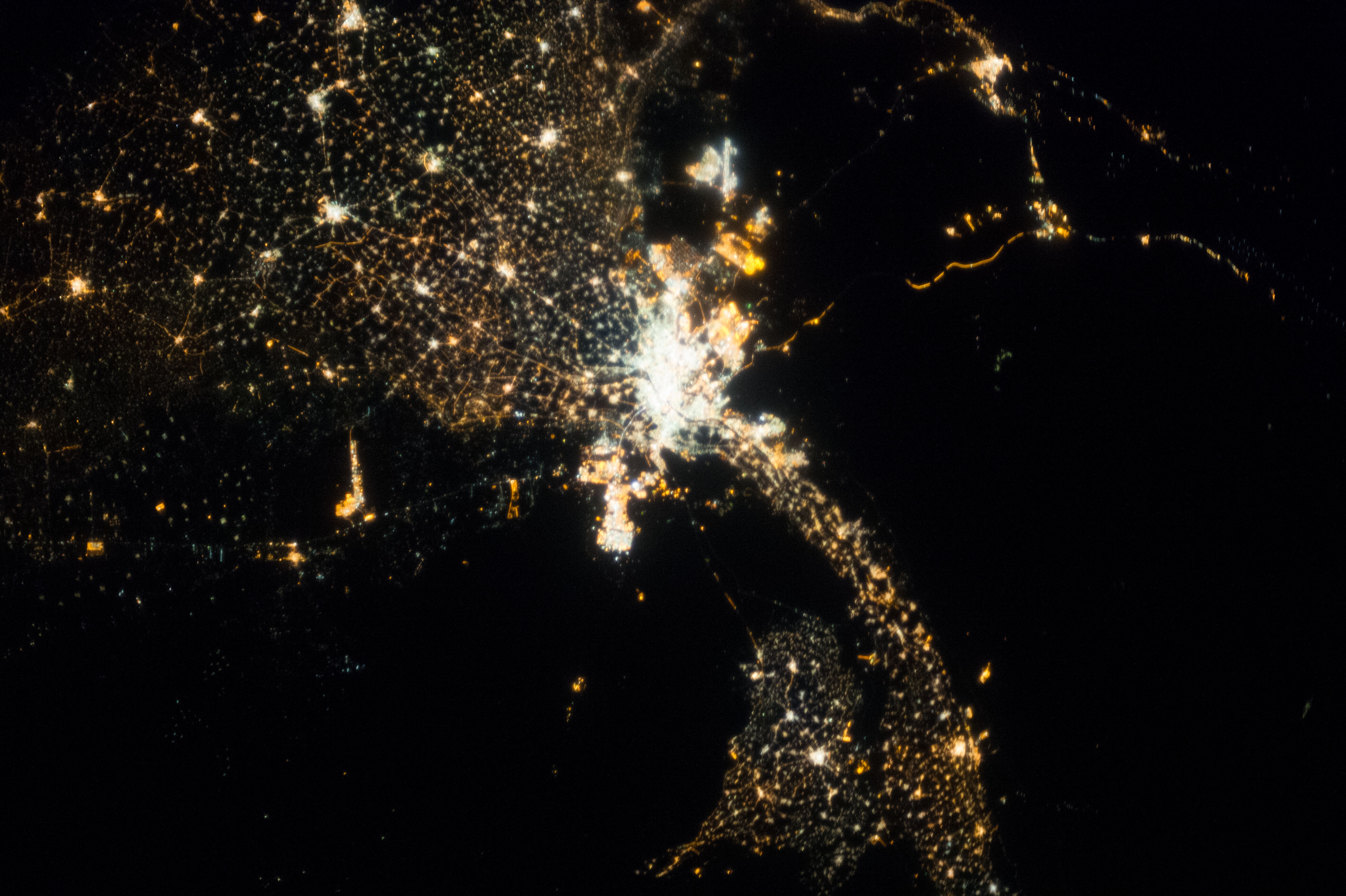
Spacecraft nadir point: 31.0° N, 30.4° E
Photo center point: 30.0° N, 31.0° E
Photo center point by machine learning:
Photo center point: 30.0° N, 31.0° E
Photo center point by machine learning:
Nadir to Photo Center: Southeast
Spacecraft Altitude: 221 nautical miles (409km)
Country or Geographic Name: | EGYPT |
Features: | CAIRO AT NIGHT, DAMANHOUR, TANTA, 6TH OF OCTOBER CITY, FAIYUM |
| Features Found Using Machine Learning: | |
Cloud Cover Percentage: | 0 (no clouds present) |
Sun Elevation Angle: | -44° |
Sun Azimuth: | 298° |
Camera: | Nikon D3S Electronic Still Camera |
Focal Length: | 50mm |
Camera Tilt: | 18 degrees |
Format: | 4256E: 4256 x 2832 pixel CMOS sensor, 36.0mm x 23.9mm, total pixels: 12.87 million, Nikon FX format |
Film Exposure: | |
| Additional Information | |
| Width | Height | Annotated | Cropped | Purpose | Links |
|---|---|---|---|---|---|
| 4256 pixels | 2832 pixels | No | No | Download Image | |
| 640 pixels | 426 pixels | No | No | Download Image |
Download Packaged File
Download a Google Earth KML for this Image
View photo footprint information
No GeoTIFF is available for this photo.Image Caption: none
