< STS073-725-46 >
| NASA Photo ID | STS073-725-46 |
| Focal Length | 250mm |
| Date taken | 1995.10.24 |
| Time taken | 16:55:00 GMT |
Resolutions offered for this image:
3904 x 3904 pixels 639 x 639 pixels 5700 x 5900 pixels 500 x 518 pixels 640 x 480 pixels
3904 x 3904 pixels 639 x 639 pixels 5700 x 5900 pixels 500 x 518 pixels 640 x 480 pixels


Cloud masks available for this image:
Spacecraft nadir point: 39.2° N, 109.0° W
Photo center point: 40.5° N, 109.5° W
Photo center point by machine learning:
Photo center point: 40.5° N, 109.5° W
Photo center point by machine learning:
Nadir to Photo Center: North
Spacecraft Altitude: 144 nautical miles (267km)
Country or Geographic Name: | USA-UTAH |
Features: | GREEN RIVER, DRAINAGE, MTS |
| Features Found Using Machine Learning: | |
Cloud Cover Percentage: | 10 (1-10)% |
Sun Elevation Angle: | 31° |
Sun Azimuth: | 143° |
Camera: | Hasselblad |
Focal Length: | 250mm |
Camera Tilt: | 30 degrees |
Format: | 5046: Kodak, natural color positive, Lumiere 100/5046, ASA 100, standard base |
Film Exposure: | Normal |
| Additional Information | |
| Width | Height | Annotated | Cropped | Purpose | Links |
|---|---|---|---|---|---|
| 3904 pixels | 3904 pixels | No | No | Earth From Space collection | Download Image |
| 639 pixels | 639 pixels | No | No | Earth From Space collection | Download Image |
| 5700 pixels | 5900 pixels | No | No | Download Image Download Color Calibration Image for this Image |
|
| 500 pixels | 518 pixels | No | No | Download Image Download Color Calibration Image for this Image |
|
| 640 pixels | 480 pixels | No | No | Download Image |
Download Packaged File
Download a Google Earth KML for this Image
View photo footprint information
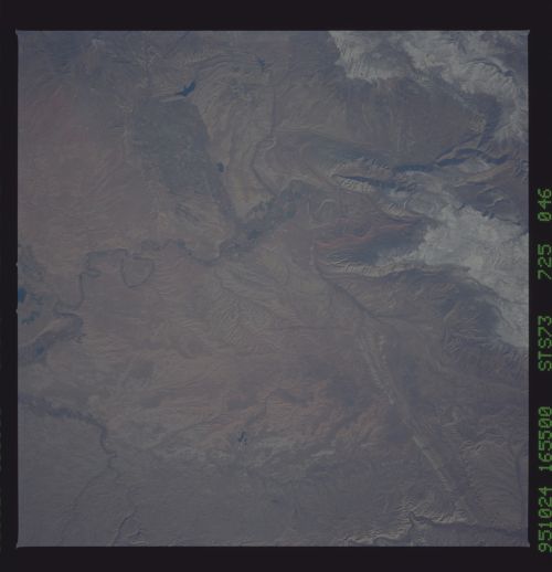
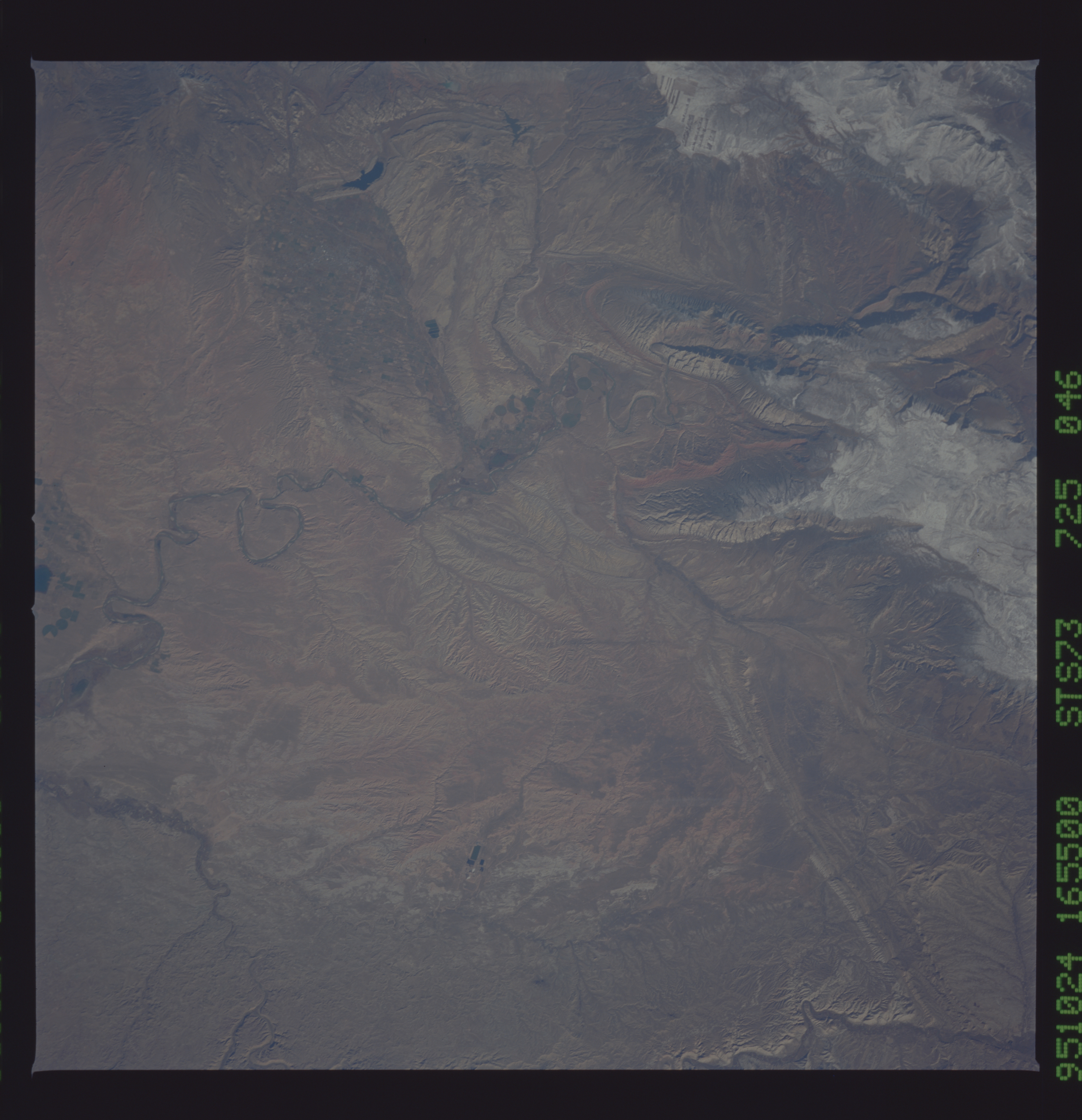
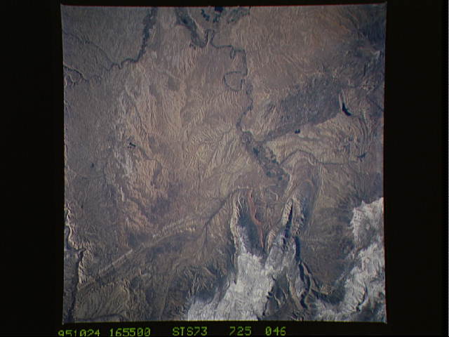
No GeoTIFF is available for this photo.Image Caption: STS073-725-046 Green River, Utah, U.S.A. September 1995
The Green River in northeastern Utah, the largest tributary of the Colorado River, flows southwest in this south-looking, low-oblique photograph. Visible south of the snow-covered Yampa Plateau (top left) is the White River, a major tributary of the Green River. Several wildlife refuges are scattered along the Green River, including Ouray National Wildlife Refuge (north of the confluence of the Green and White Rivers). The western portion of Dinosaur National Monument is barely discernible (below left center).
The Green River in northeastern Utah, the largest tributary of the Colorado River, flows southwest in this south-looking, low-oblique photograph. Visible south of the snow-covered Yampa Plateau (top left) is the White River, a major tributary of the Green River. Several wildlife refuges are scattered along the Green River, including Ouray National Wildlife Refuge (north of the confluence of the Green and White Rivers). The western portion of Dinosaur National Monument is barely discernible (below left center).
