< ISS040-E-45602 >

| NASA Photo ID | ISS040-E-45602 |
| Focal Length | 28mm |
| Date taken | 2014.07.07 |
| Time taken | 06:57:31 GMT |


Spacecraft nadir point: 19.8° N, 133.9° E
Photo center point:
Photo center point by machine learning:
Photo center point:
Photo center point by machine learning:
Nadir to Photo Center:
Spacecraft Altitude: 223 nautical miles (413km)
Country or Geographic Name: | |
Features: | |
| Features Found Using Machine Learning: | PAN- |
Cloud Cover Percentage: | 79 (76-100)% |
Sun Elevation Angle: | 37° |
Sun Azimuth: | 284° |
Camera: | NIKON D3S S/N: 2007945 |
Focal Length: | 28mm |
Camera Tilt: | |
Format: | |
Film Exposure: | |
| Additional Information | |
| Width | Height | Annotated | Cropped | Purpose | Links |
|---|---|---|---|---|---|
| 4256 pixels | 2832 pixels | No | No | Download Image | |
| 640 pixels | 426 pixels | No | No | Download Image |
Download Packaged File
Download a Google Earth KML for this Image
View photo footprint information
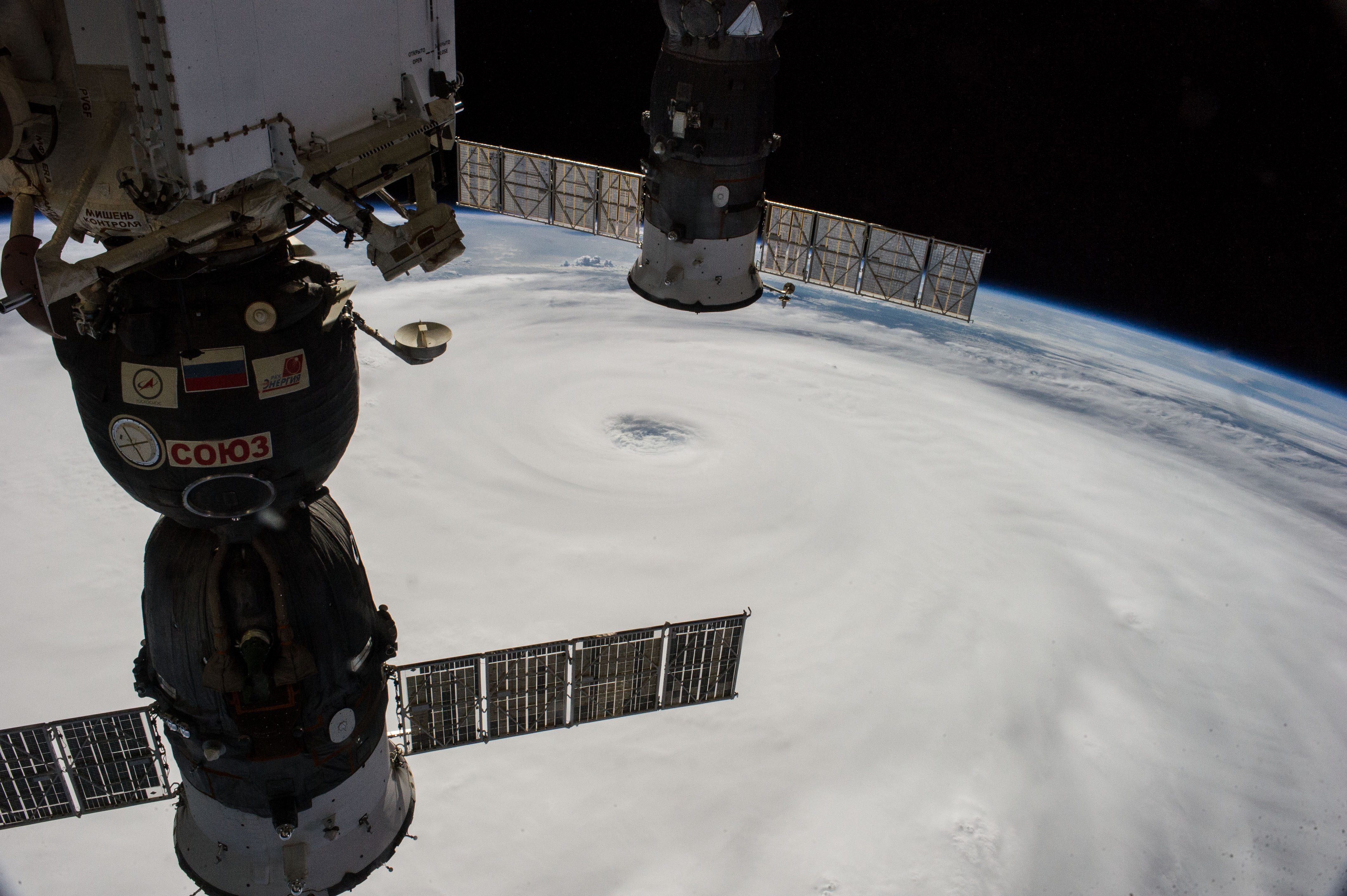
No GeoTIFF is available for this photo.Image Caption: ISS040-E-045602 (7 July 2014) --- The International Space Station, including these two temporarily docked Russian spacecraft, made more than one pass near Typhoon Neoguri on July 7, and Expedition 40 Flight Engineers Reid Wiseman of NASA and Alexander Gerst of the European Space Agency captured its startling dimensions in a day-long series of still photos. In a tweet later in the day, Gerst marveled that even with a fish-eye lens he couldn't capture the whole storm. A 28mm focal length was used for a small sequence of oblique pictures such as this one. The picture was taken at 06:57:31 GMT on July 7, 2014.
