< STS091-717-45 >
| NASA Photo ID | STS091-717-45 |
| Focal Length | 250mm |
| Date taken | 1998.06.11 |
| Time taken | 09:24:16 GMT |
Cloud masks available for this image:
Spacecraft nadir point: 26.3° S, 12.6° E
Photo center point: 25.5° S, 15.5° E
Photo center point by machine learning:
Photo center point: 25.5° S, 15.5° E
Photo center point by machine learning:
Nadir to Photo Center: East
Spacecraft Altitude: 205 nautical miles (380km)
Country or Geographic Name: | NAMIBIA |
Features: | COAST, NAMIB DESERT |
| Features Found Using Machine Learning: | |
Cloud Cover Percentage: | 5 (1-10)% |
Sun Elevation Angle: | 35° |
Sun Azimuth: | 30° |
Camera: | Hasselblad |
Focal Length: | 250mm |
Camera Tilt: | 41 degrees |
Format: | 5069: Kodak Elite 100S, E6 Reversal, Replaces Lumiere, Warmer in tone vs. Lumiere |
Film Exposure: | Normal |
| Additional Information | |
| Width | Height | Annotated | Cropped | Purpose | Links |
|---|---|---|---|---|---|
| 5700 pixels | 5900 pixels | No | No | Download Image Download Color Calibration Image for this Image |
|
| 483 pixels | 500 pixels | No | No | Download Image Download Color Calibration Image for this Image |
|
| 639 pixels | 595 pixels | Download Image |
Download Packaged File
Download a Google Earth KML for this Image
View photo footprint information
No GeoTIFF is available for this photo.Image Caption:
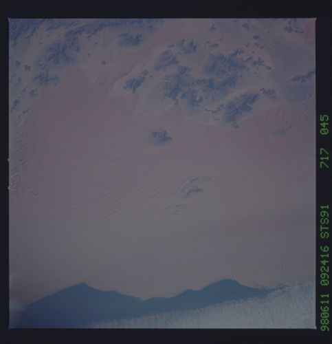
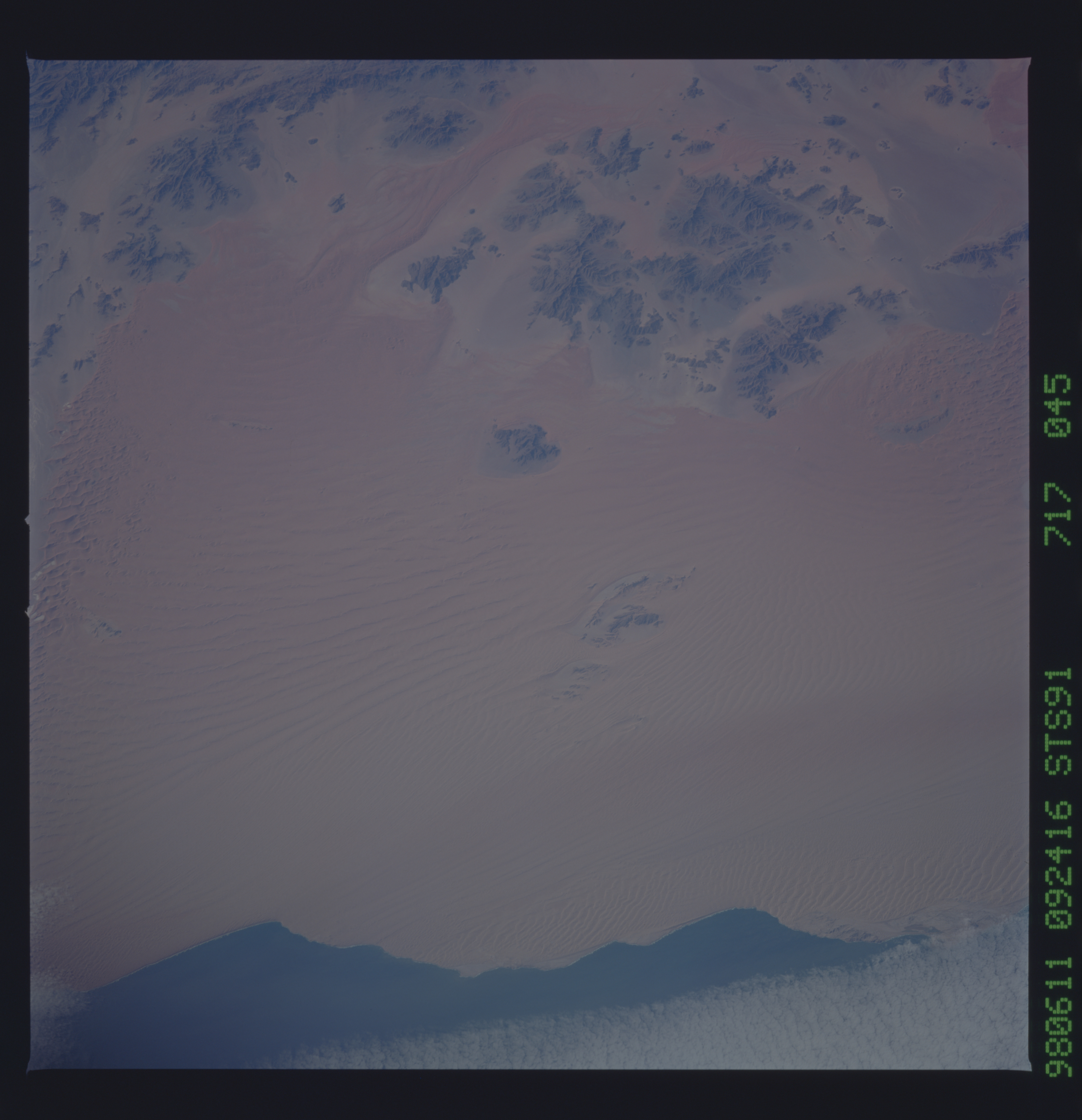
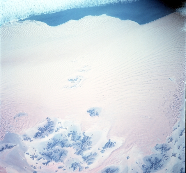
STS091-717-45 The Namib DesertThe Namib Desert is a cool coastal desert extending for 1,200 miles (1,900 kilometres) along the Atlantic coast from Namibe in Angola southward across Namibia to the Olifants River in the Cape Province of South Africa. It reaches inland 80 to 100 miles to the foot of the Great Escarpment. The southern portion merges with the Kalahari on the plateau atop the escarpment. Its name is derived from the Nama language, implying "an area where there is nothing." The dunes run in lines from north-northwest to south-southeast, with individual dunes having lengths of 10 to 20 miles and reaching heights of 200 to 800 feet. The troughs between these lines of dunes are interrupted by smaller transverse dunes. Average annual precipitation at the coast is generally about 0.5 inch (13 millimeters), increasing inland, until it reaches 2 inches at the foot of the escarpment. In some years, however, no rain falls at all. Dew or the fog along the coast, on the other hand, is heavy and for some types of vegetation is more important than the rainfall.The desert is important because of the trade routes that cross it, its mineral deposits, the fisheries of the bordering sea, and its increasing utilization for recreational purposes.
STS091-717-45 The Namib DesertThe Namib Desert is a cool coastal desert extending for 1,200 miles (1,900 kilometres) along the Atlantic coast from Namibe in Angola southward across Namibia to the Olifants River in the Cape Province of South Africa. It reaches inland 80 to 100 miles to the foot of the Great Escarpment. The southern portion merges with the Kalahari on the plateau atop the escarpment. Its name is derived from the Nama language, implying "an area where there is nothing." The dunes run in lines from north-northwest to south-southeast, with individual dunes having lengths of 10 to 20 miles and reaching heights of 200 to 800 feet. The troughs between these lines of dunes are interrupted by smaller transverse dunes. Average annual precipitation at the coast is generally about 0.5 inch (13 millimeters), increasing inland, until it reaches 2 inches at the foot of the escarpment. In some years, however, no rain falls at all. Dew or the fog along the coast, on the other hand, is heavy and for some types of vegetation is more important than the rainfall.The desert is important because of the trade routes that cross it, its mineral deposits, the fisheries of the bordering sea, and its increasing utilization for recreational purposes.
