< STS059-218-44 >
| NASA Photo ID | STS059-218-44 |
| Focal Length | 40mm |
| Date taken | 1994.04.14 |
| Time taken | 04:06:39 GMT |
Resolutions offered for this image:
5266 x 5214 pixels 639 x 633 pixels 5700 x 5900 pixels 500 x 518 pixels 640 x 480 pixels
5266 x 5214 pixels 639 x 633 pixels 5700 x 5900 pixels 500 x 518 pixels 640 x 480 pixels
Cloud masks available for this image:
Spacecraft nadir point: 32.9° N, 132.7° E
Photo center point: 34.5° N, 135.0° E
Photo center point by machine learning:
Photo center point: 34.5° N, 135.0° E
Photo center point by machine learning:
Nadir to Photo Center: Northeast
Spacecraft Altitude: 117 nautical miles (217km)
Country or Geographic Name: | JAPAN |
Features: | PAN- SHIKOKU, S HONSHU |
| Features Found Using Machine Learning: | |
Cloud Cover Percentage: | 20 (11-25)% |
Sun Elevation Angle: | 63° |
Sun Azimuth: | 213° |
Camera: | Hasselblad |
Focal Length: | 40mm |
Camera Tilt: | High Oblique |
Format: | 5048: Kodak, natural color positive, Lumiere 100x/5048, ASA 100x, standard base |
Film Exposure: | Normal |
| Additional Information | |
| Width | Height | Annotated | Cropped | Purpose | Links |
|---|---|---|---|---|---|
| 5266 pixels | 5214 pixels | No | No | Earth From Space collection | Download Image |
| 639 pixels | 633 pixels | No | No | Earth From Space collection | Download Image |
| 5700 pixels | 5900 pixels | No | No | Download Image Download Color Calibration Image for this Image |
|
| 500 pixels | 518 pixels | No | No | Download Image Download Color Calibration Image for this Image |
|
| 640 pixels | 480 pixels | No | No | Download Image |
Download Packaged File
Download a Google Earth KML for this Image
View photo footprint information
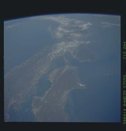
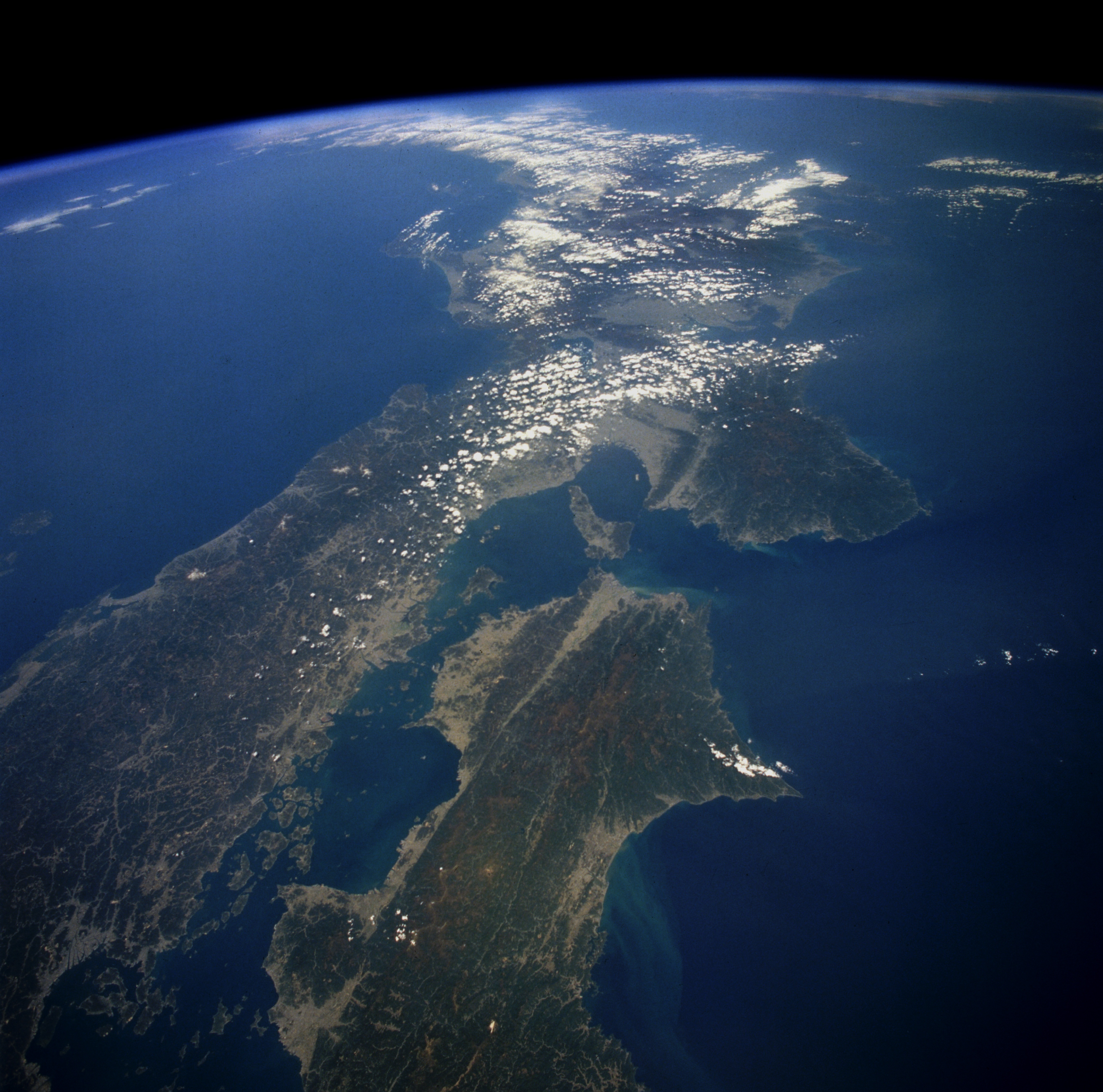
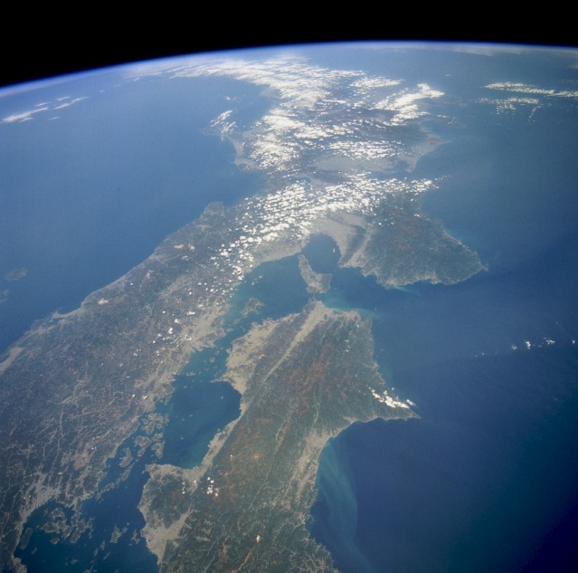
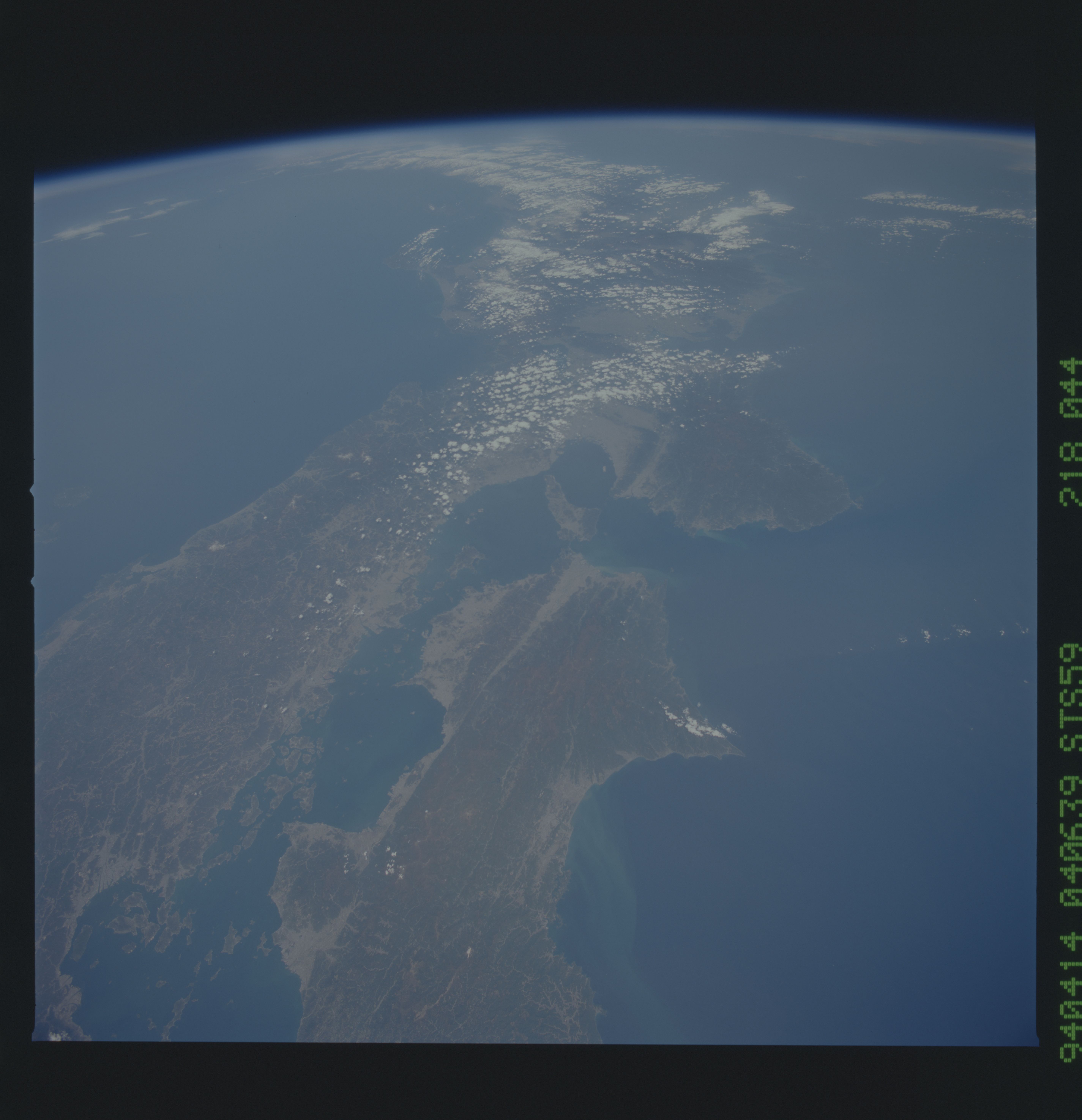
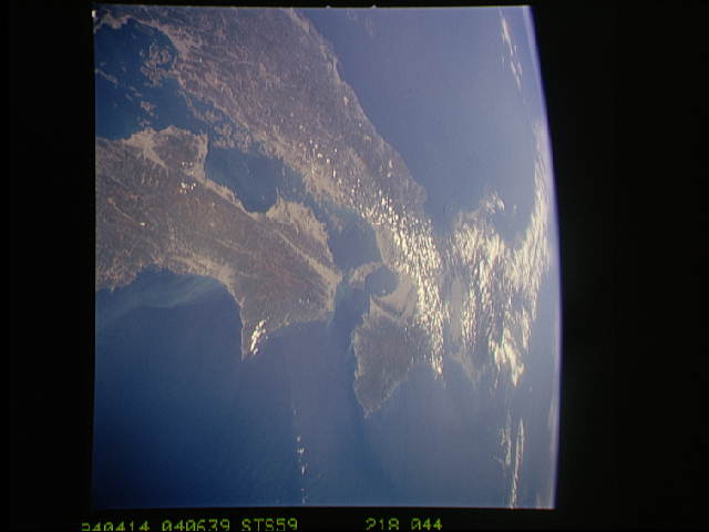
No GeoTIFF is available for this photo.Image Caption: STS059-218-044 Southern Honshu Island and Shikoku Island, Japan April 1994
This high-oblique, northeast-looking photograph captures a portion of the Japanese archipelago. The darker areas show volcanic, mountainous terrain that comprises more than 80 percent of Japan; the lighter, more highly reflective areas of the coastal plains and valleys are urban and agricultural areas. Separated by the Seto Inland Sea are Shikoku Island to the south and the Osaka-Kobe industrial metroplex on Honshu Island to the north. The Sea of Japan lies north of Honshu Island. Several lines, which are northeast-southwest-trending faults, appear on Shikoku Island, extend under the Kii Channel, and continue across southern Honshu Island. This geologically young, earthquake-prone area exists as a result of the collision of the southeast-moving Eurasian Plate and the northwest-moving Philippine Plate.
This high-oblique, northeast-looking photograph captures a portion of the Japanese archipelago. The darker areas show volcanic, mountainous terrain that comprises more than 80 percent of Japan; the lighter, more highly reflective areas of the coastal plains and valleys are urban and agricultural areas. Separated by the Seto Inland Sea are Shikoku Island to the south and the Osaka-Kobe industrial metroplex on Honshu Island to the north. The Sea of Japan lies north of Honshu Island. Several lines, which are northeast-southwest-trending faults, appear on Shikoku Island, extend under the Kii Channel, and continue across southern Honshu Island. This geologically young, earthquake-prone area exists as a result of the collision of the southeast-moving Eurasian Plate and the northwest-moving Philippine Plate.
