< STS080-752-43 >
| NASA Photo ID | STS080-752-43 |
| Focal Length | 250mm |
| Date taken | 1996.12.02 |
| Time taken | 05:08:28 GMT |
Cloud masks available for this image:
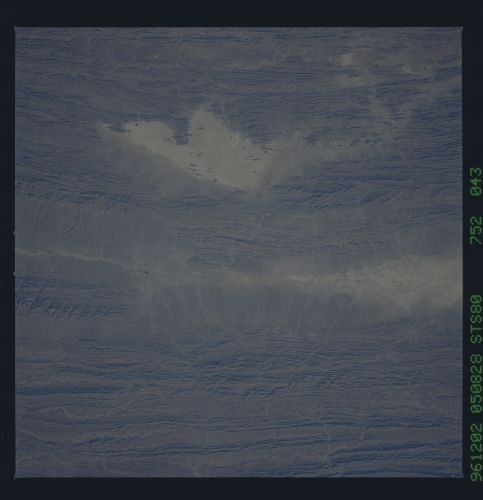
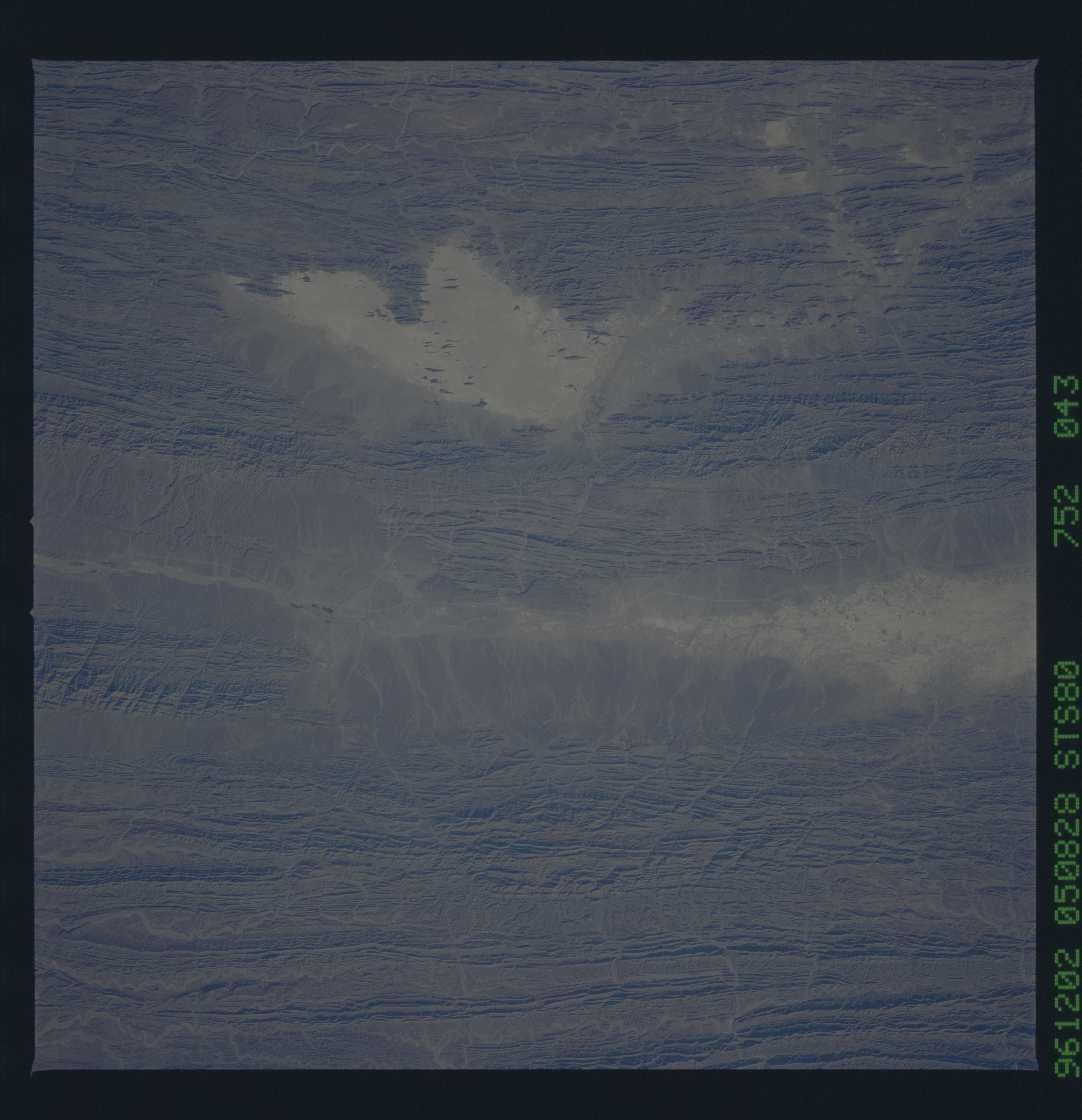
Spacecraft nadir point: 26.6° N, 63.6° E
Photo center point: 26.0° N, 64.5° E
Photo center point by machine learning:
Photo center point: 26.0° N, 64.5° E
Photo center point by machine learning:
Nadir to Photo Center: Southeast
Spacecraft Altitude: 186 nautical miles (344km)
Country or Geographic Name: | PAKISTAN |
Features: | SALT PANS |
| Features Found Using Machine Learning: | |
Cloud Cover Percentage: | 0 (no clouds present) |
Sun Elevation Angle: | 30° |
Sun Azimuth: | 140° |
Camera: | Hasselblad |
Focal Length: | 250mm |
Camera Tilt: | 19 degrees |
Format: | 5046: Kodak, natural color positive, Lumiere 100/5046, ASA 100, standard base |
Film Exposure: | Normal |
| Additional Information | |
| Width | Height | Annotated | Cropped | Purpose | Links |
|---|---|---|---|---|---|
| 5700 pixels | 5900 pixels | No | No | Download Image Download Color Calibration Image for this Image |
|
| 483 pixels | 500 pixels | No | No | Download Image Download Color Calibration Image for this Image |
Download Packaged File
Download a Google Earth KML for this Image
View photo footprint information
No GeoTIFF is available for this photo.Image Caption: The central Makran region of southern Iran, near the Gudri River. Sedimentary strata that were originally deposited in deep marine waters have been uplifted and folded into the ranges of the Makran. In this beautifully detailed view, individual rock layers can be traced in the folds, and discrete stream channels on the coalescing alluvial fans can be followed to the valley floors.
