< STS065-94-43 >
| NASA Photo ID | STS065-94-43 |
| Focal Length | 100mm |
| Date taken | 1994.07.13 |
| Time taken | 07:09:16 GMT |
Resolutions offered for this image:
4055 x 4056 pixels 639 x 640 pixels 5700 x 5900 pixels 500 x 518 pixels 640 x 480 pixels 528 x 519 pixels
4055 x 4056 pixels 639 x 640 pixels 5700 x 5900 pixels 500 x 518 pixels 640 x 480 pixels 528 x 519 pixels

Cloud masks available for this image:
Spacecraft nadir point: 5.5° S, 125.2° E
Photo center point: 8.5° S, 122.5° E
Photo center point by machine learning:
Photo center point: 8.5° S, 122.5° E
Photo center point by machine learning:
Nadir to Photo Center: Southwest
Spacecraft Altitude: 163 nautical miles (302km)
Camera: | Hasselblad |
Focal Length: | 100mm |
Camera Tilt: | Low Oblique |
Format: | 5048: Kodak, natural color positive, Lumiere 100x/5048, ASA 100x, standard base |
Film Exposure: | Normal |
| Additional Information | |
| Width | Height | Annotated | Cropped | Purpose | Links |
|---|---|---|---|---|---|
| 4055 pixels | 4056 pixels | No | No | Earth From Space collection | Download Image |
| 639 pixels | 640 pixels | No | No | Earth From Space collection | Download Image |
| 5700 pixels | 5900 pixels | No | No | Download Image Download Color Calibration Image for this Image |
|
| 500 pixels | 518 pixels | No | No | Download Image Download Color Calibration Image for this Image |
|
| 640 pixels | 480 pixels | No | No | Download Image | |
| 528 pixels | 519 pixels | Download Image |
Download Packaged File
Download a Google Earth KML for this Image
View photo footprint information
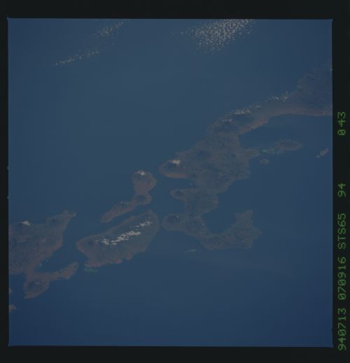
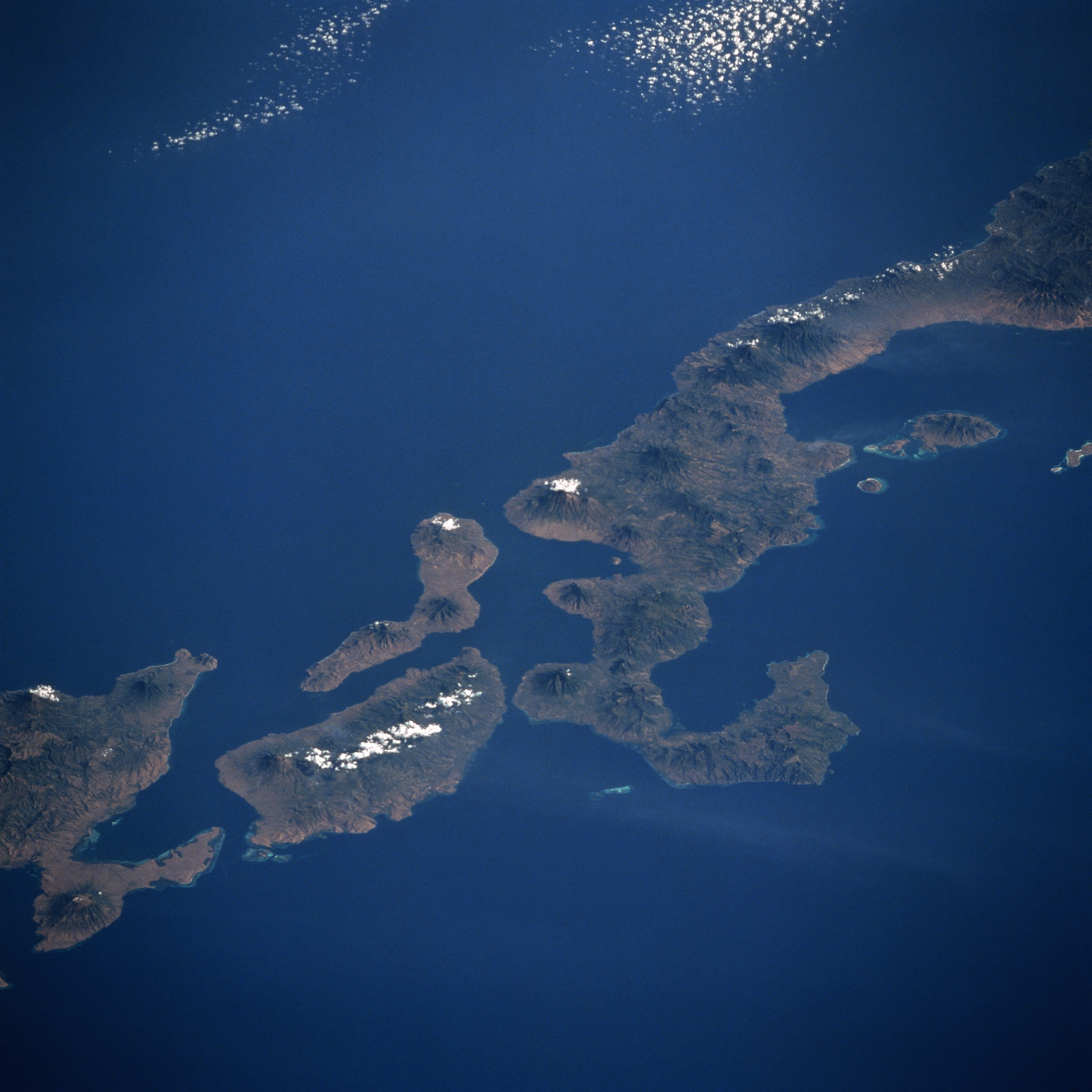
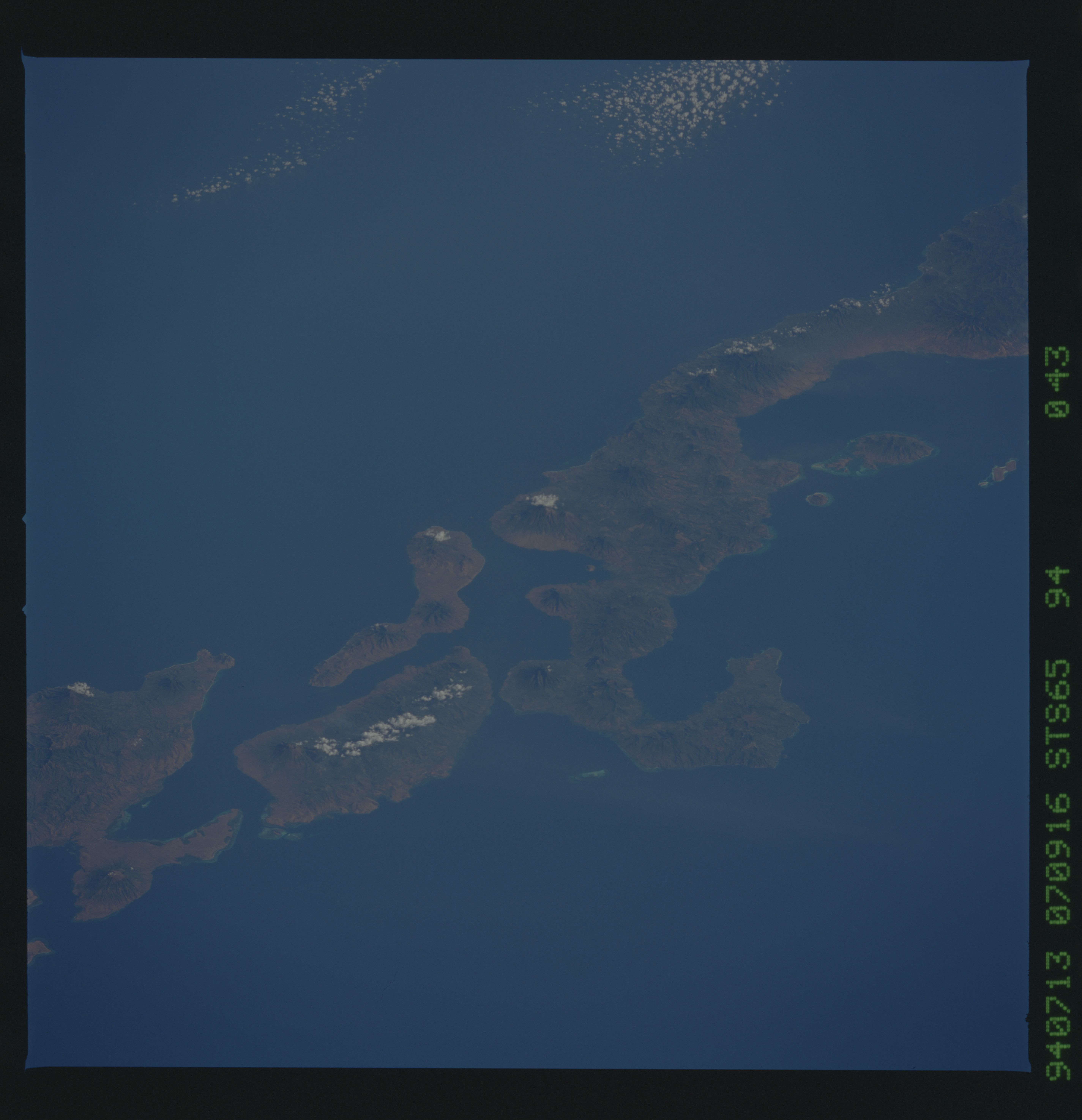
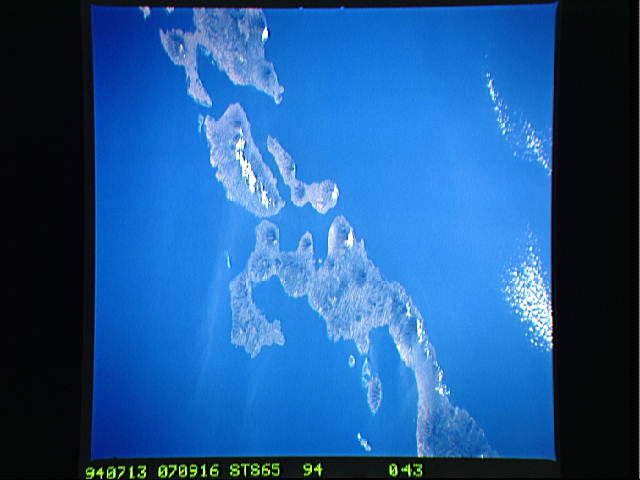
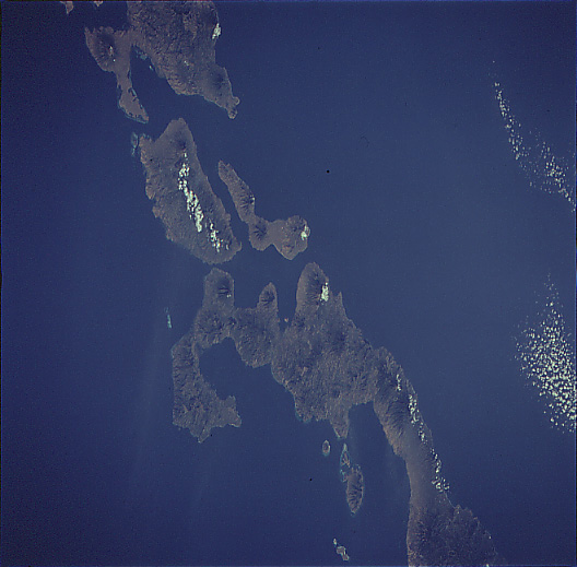
No GeoTIFF is available for this photo.Image Caption: STS065-094-043 Adonara, Flores, Lomblem Islands, Indonesia July 1994
Numerous volcanic peaks can be seen in this spectacular southwest-looking view of the Indonesian Islands of Flores, Adonara, Solor, and Lomblem. Extending from near the upper right to near the center of the image is the eastern half of Flores Island. Over 233 miles (375 km) long, Flores has many landscapes, including lush paddy fields, arid plains, rugged hills, and dense jungles. The coastline has few inlets and there are no large rivers on the island. There are however, numerous volcanoes, fourteen of which are active. Flores Island is considered to be one of the most geological unstable places on earth. Copra, rice, maize, and coffee are grown on the fertile volcanic soils and cattle are also raised. The small, elongated island east (left) of Flores is Solor Island. This small mountainous island, with at least 5 volcanoes, is 25 miles (40 km) long and 4 miles (6 km) wide. Raising copra and fishing are the main industries of the island. The larger island to the east (left) of Flores is Adonara Island with its major active volcano, Ile Boleng. The volcano is visible just to the left of a line of clouds on the southeastern part of Adonara. Adonara covers an area of 224 sq. miles (580 sq. km) and is 23 miles (37 km) long and 11 miles (18 km) wide. At the bottem left of the image, the western third of the irregular shaped and volcanic island of Lomblem is discernible.
Numerous volcanic peaks can be seen in this spectacular southwest-looking view of the Indonesian Islands of Flores, Adonara, Solor, and Lomblem. Extending from near the upper right to near the center of the image is the eastern half of Flores Island. Over 233 miles (375 km) long, Flores has many landscapes, including lush paddy fields, arid plains, rugged hills, and dense jungles. The coastline has few inlets and there are no large rivers on the island. There are however, numerous volcanoes, fourteen of which are active. Flores Island is considered to be one of the most geological unstable places on earth. Copra, rice, maize, and coffee are grown on the fertile volcanic soils and cattle are also raised. The small, elongated island east (left) of Flores is Solor Island. This small mountainous island, with at least 5 volcanoes, is 25 miles (40 km) long and 4 miles (6 km) wide. Raising copra and fishing are the main industries of the island. The larger island to the east (left) of Flores is Adonara Island with its major active volcano, Ile Boleng. The volcano is visible just to the left of a line of clouds on the southeastern part of Adonara. Adonara covers an area of 224 sq. miles (580 sq. km) and is 23 miles (37 km) long and 11 miles (18 km) wide. At the bottem left of the image, the western third of the irregular shaped and volcanic island of Lomblem is discernible.
