< STS089-707-42 >
| NASA Photo ID | STS089-707-42 |
| Focal Length | 100mm |
| Date taken | 1998.01.24 |
| Time taken | 00:57:11 GMT |
Cloud masks available for this image:
Spacecraft nadir point: 32.5° S, 127.5° E
Photo center point: 33.5° S, 124.0° E
Photo center point by machine learning:
Photo center point: 33.5° S, 124.0° E
Photo center point by machine learning:
Nadir to Photo Center: West
Spacecraft Altitude: 206 nautical miles (382km)
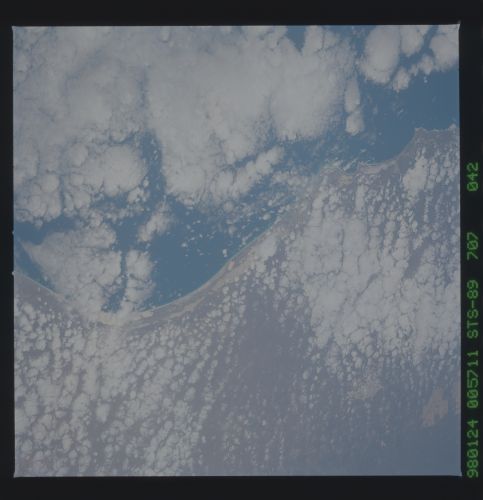
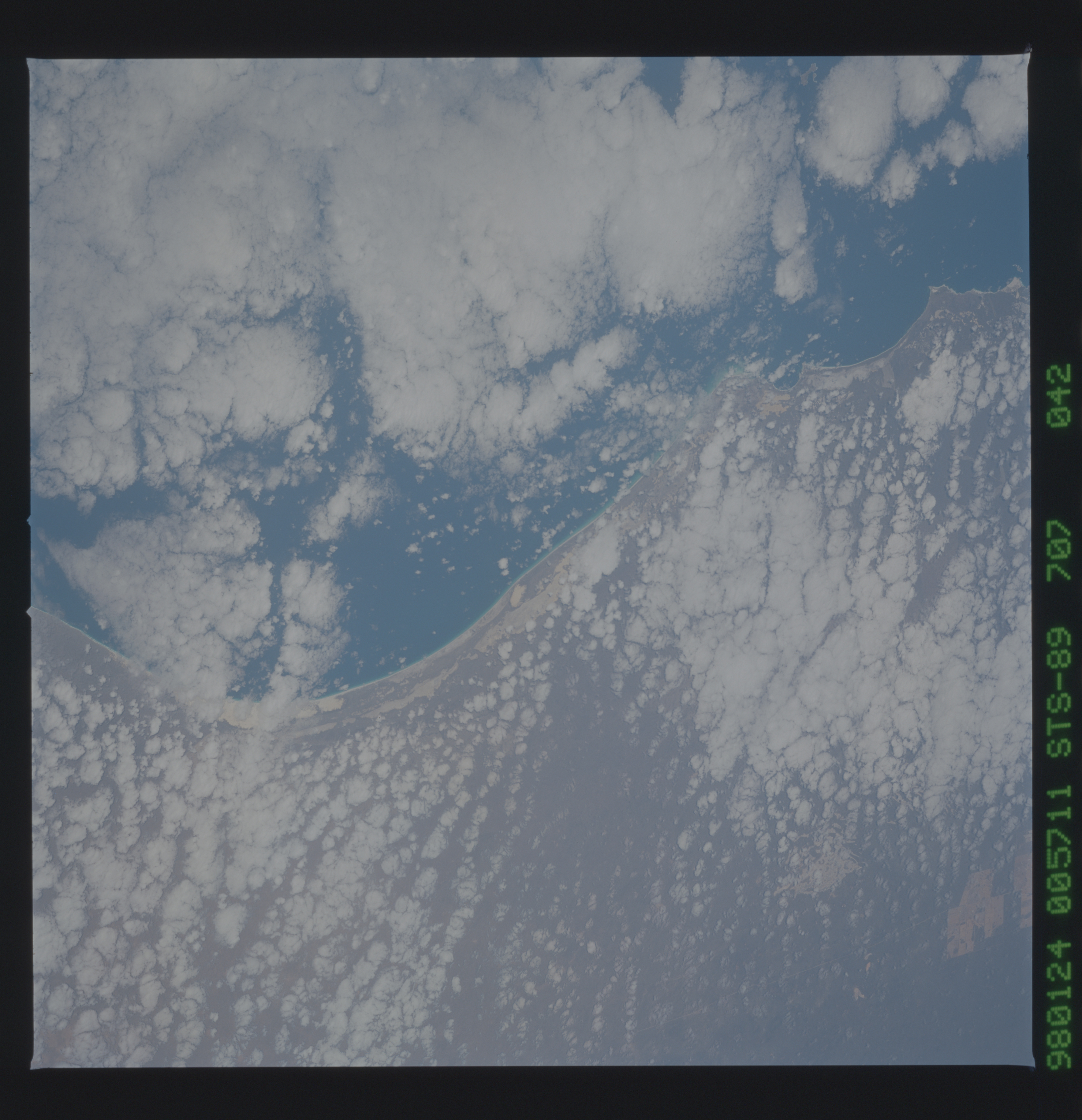
Country or Geographic Name: | AUSTRALIA-WA |
Features: | ISRAELITE BAY |
| Features Found Using Machine Learning: | |
Cloud Cover Percentage: | 55 (51-75)% |
Sun Elevation Angle: | 51° |
Sun Azimuth: | 81° |
Camera: | Hasselblad |
Focal Length: | 100mm |
Camera Tilt: | 47 degrees |
Format: | 5069: Kodak Elite 100S, E6 Reversal, Replaces Lumiere, Warmer in tone vs. Lumiere |
Film Exposure: | Normal |
| Additional Information | |
| Width | Height | Annotated | Cropped | Purpose | Links |
|---|---|---|---|---|---|
| 5700 pixels | 5900 pixels | No | No | Download Image Download Color Calibration Image for this Image |
|
| 483 pixels | 500 pixels | No | No | Download Image Download Color Calibration Image for this Image |
Download Packaged File
Download a Google Earth KML for this Image
View photo footprint information
No GeoTIFF is available for this photo.Image Caption: The Nullarbor Plain of southern Australia has been one of the least photographed features of the continents. Your work gives us new regional and detailed views of this coastline, the escarpment of which rises abruptly to 500 ft above sea level. In this fine photo of the entire Australian Bight, solution grooves can be seen to have localized sand deposits in long bands. Rounder solution-collapse features characteristic of karst terrains can also be seen.
