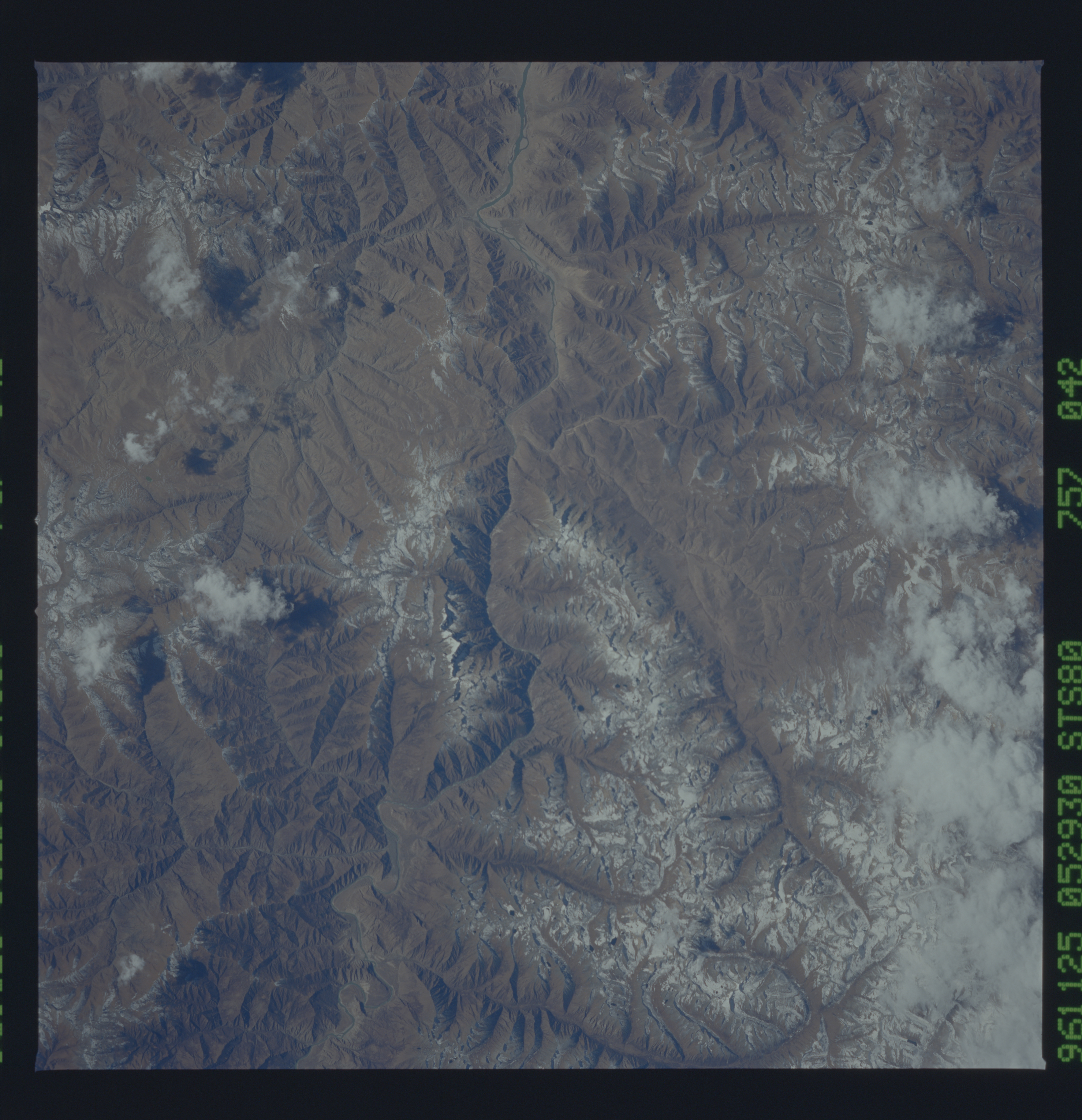
< STS080-757-42 >

| NASA Photo ID | STS080-757-42 |
| Focal Length | 250mm |
| Date taken | 1996.11.25 |
| Time taken | 05:29:30 GMT |
Cloud masks available for this image:
Spacecraft nadir point: 28.6° N, 93.3° E
Photo center point: 29.0° N, 92.0° E
Photo center point by machine learning:
Photo center point: 29.0° N, 92.0° E
Photo center point by machine learning:
Nadir to Photo Center: West
Spacecraft Altitude: 189 nautical miles (350km)
Country or Geographic Name: | CHINA |
Features: | BRAHMAPUTRA RIVER |
| Features Found Using Machine Learning: | |
Cloud Cover Percentage: | 5 (1-10)% |
Sun Elevation Angle: | 41° |
Sun Azimuth: | 179° |
Camera: | Hasselblad |
Focal Length: | 250mm |
Camera Tilt: | 23 degrees |
Format: | 5046: Kodak, natural color positive, Lumiere 100/5046, ASA 100, standard base |
Film Exposure: | Normal |
| Additional Information | |
| Width | Height | Annotated | Cropped | Purpose | Links |
|---|---|---|---|---|---|
| 5700 pixels | 5900 pixels | No | No | Download Image Download Color Calibration Image for this Image |
|
| 483 pixels | 500 pixels | No | No | Download Image Download Color Calibration Image for this Image |
Download Packaged File
Download a Google Earth KML for this Image
View photo footprint information
No GeoTIFF is available for this photo.Image Caption: Southward view of the high plateau east of Yamzho Yumco (lake), where the upper Brahmaputra leaves its braided plain and enters a 125-km-long gorge. One of a remarkable sequence of frames that follows the river eastward from the Tibetan Plateau, through the Eastern Syntaxis, back to the west down the broad valley of northeastern India, to the Bangladesh border where it again turns south.
