< STS095-747-41 >
| NASA Photo ID | STS095-747-41 |
| Focal Length | 250mm |
| Date taken | 1998.10.30 |
| Time taken | 20:52:12 GMT |
Cloud masks available for this image:
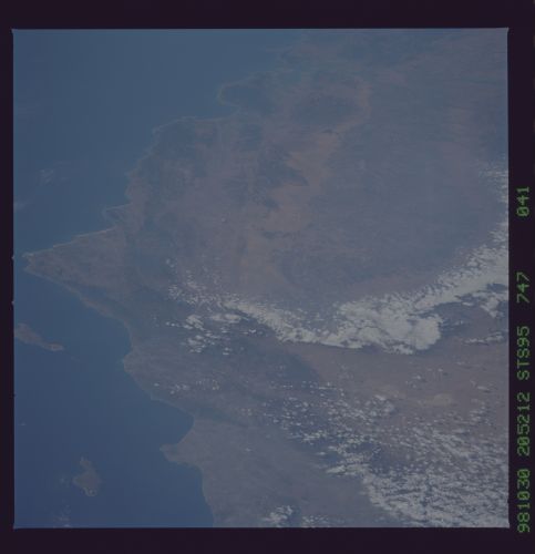
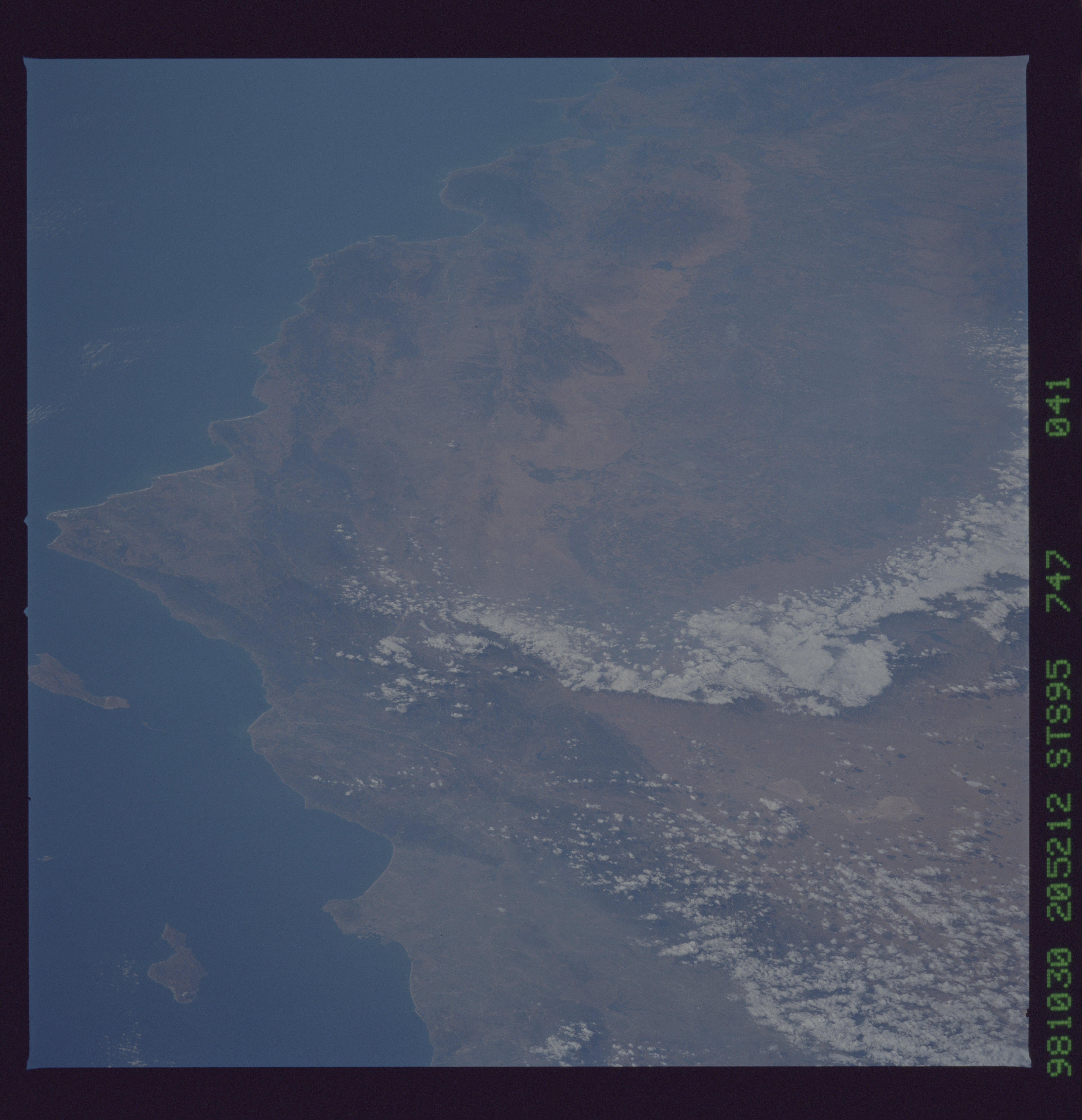
Spacecraft nadir point: 28.6° N, 112.5° W
Photo center point: 35.0° N, 119.0° W
Photo center point by machine learning:
Photo center point: 35.0° N, 119.0° W
Photo center point by machine learning:
Nadir to Photo Center: Northwest
Spacecraft Altitude: 295 nautical miles (546km)
Country or Geographic Name: | USA-CALIFORNIA |
Features: | LOS ANGELES, COAST RANGES |
| Features Found Using Machine Learning: | |
Cloud Cover Percentage: | 10 (1-10)% |
Sun Elevation Angle: | 41° |
Sun Azimuth: | 213° |
Camera: | Hasselblad |
Focal Length: | 250mm |
Camera Tilt: | Low Oblique |
Format: | 5069: Kodak Elite 100S, E6 Reversal, Replaces Lumiere, Warmer in tone vs. Lumiere |
Film Exposure: | Normal |
| Additional Information | |
| Width | Height | Annotated | Cropped | Purpose | Links |
|---|---|---|---|---|---|
| 5700 pixels | 5900 pixels | No | No | Download Image Download Color Calibration Image for this Image |
|
| 483 pixels | 500 pixels | No | No | Download Image Download Color Calibration Image for this Image |
Download Packaged File
Download a Google Earth KML for this Image
View photo footprint information
No GeoTIFF is available for this photo.Image Caption: California. Virtually the entire San Andreas fault zone can be traced in this splended northward photo! From its junction with structures of the Gulf of California complex, the San Andreas continues northward through San Francisco Bay to Point Reyes, where it heads out to sea.
