< STS091-719-4 >
| NASA Photo ID | STS091-719-4 |
| Focal Length | 250mm |
| Date taken | 1998.06.12 |
| Time taken | 08:45:23 GMT |
Resolutions offered for this image:
4096 x 4096 pixels 640 x 640 pixels 5700 x 5900 pixels 483 x 500 pixels 1310 x 1279 pixels 524 x 511 pixels
4096 x 4096 pixels 640 x 640 pixels 5700 x 5900 pixels 483 x 500 pixels 1310 x 1279 pixels 524 x 511 pixels


Cloud masks available for this image:
Spacecraft nadir point: 43.8° N, 88.1° E
Photo center point: 43.6° N, 87.8° E
Photo center point by machine learning:
Photo center point: 43.6° N, 87.8° E
Photo center point by machine learning:
Nadir to Photo Center: Southwest
Spacecraft Altitude: 186 nautical miles (344km)
Camera: | Hasselblad |
Focal Length: | 250mm |
Camera Tilt: | 7 degrees |
Format: | 5069: Kodak Elite 100S, E6 Reversal, Replaces Lumiere, Warmer in tone vs. Lumiere |
Film Exposure: | Normal |
| Additional Information | |
| Width | Height | Annotated | Cropped | Purpose | Links |
|---|---|---|---|---|---|
| 4096 pixels | 4096 pixels | No | No | Earth From Space collection | Download Image |
| 640 pixels | 640 pixels | No | No | Earth From Space collection | Download Image |
| 5700 pixels | 5900 pixels | No | No | Download Image Download Color Calibration Image for this Image |
|
| 483 pixels | 500 pixels | No | No | Download Image Download Color Calibration Image for this Image |
|
| 1310 pixels | 1279 pixels | No | No | Download Image | |
| 524 pixels | 511 pixels | No | No | Download Image |
Download Packaged File
Download a Google Earth KML for this Image
View photo footprint information
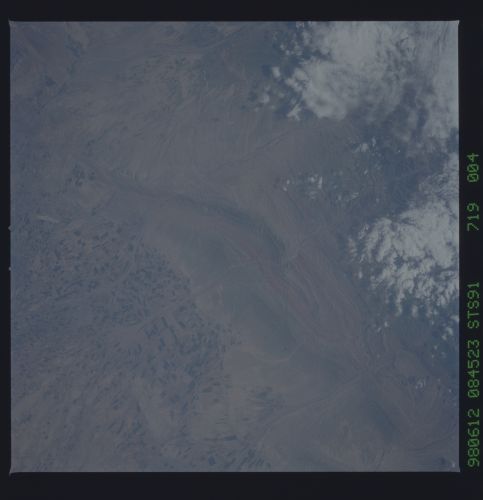
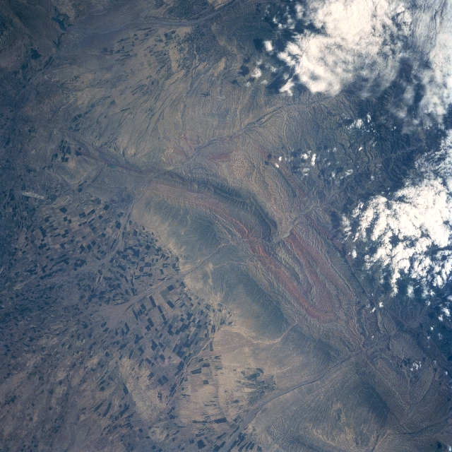
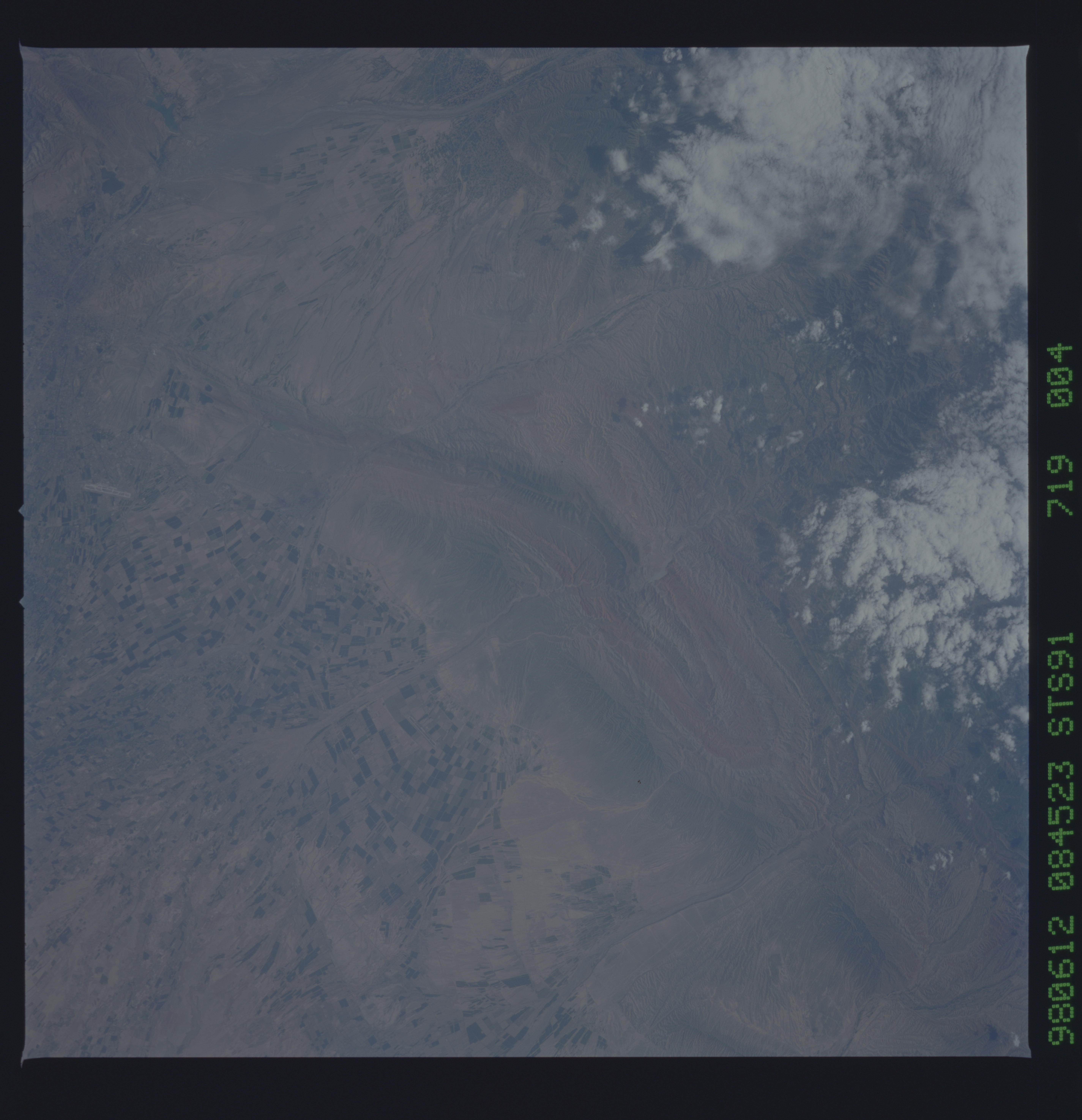
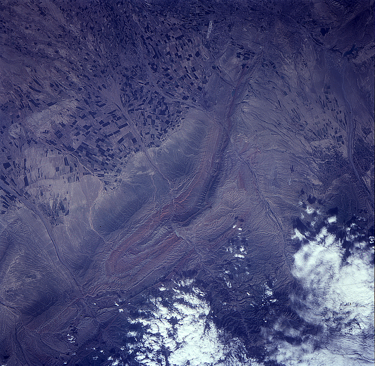
No GeoTIFF is available for this photo.Image Caption: STS091-719-004 Dzungarian Basin, China June 1998
The northern foothills of the Tien Shan (mountains) slope into the southern margin of the arid Dzungarian Basin in northwest China. The eroded material from the higher mountains to the south, have produced large, fertile, alluvial fans that are being used extensively for irrigated farming (alternating and angular color patterns). Several intermittently flowing streams have cut perpendicular valleys through the mountain ridgeline (linear geologic feature) that extends diagonally through the center of the image. The Chinese city of Urumqi is located near the upper left corner of the image. An airport runway (light-colored linear feature near the left middle edge of the frame) is visible northwest of the city.
The northern foothills of the Tien Shan (mountains) slope into the southern margin of the arid Dzungarian Basin in northwest China. The eroded material from the higher mountains to the south, have produced large, fertile, alluvial fans that are being used extensively for irrigated farming (alternating and angular color patterns). Several intermittently flowing streams have cut perpendicular valleys through the mountain ridgeline (linear geologic feature) that extends diagonally through the center of the image. The Chinese city of Urumqi is located near the upper left corner of the image. An airport runway (light-colored linear feature near the left middle edge of the frame) is visible northwest of the city.
