< STS028-73-39 >
| NASA Photo ID | STS028-73-39 |
| Focal Length | 250mm |
| Date taken | 1989.08.11 |
| Time taken | 20:55:06 GMT |
Resolutions offered for this image:
3904 x 3850 pixels 639 x 631 pixels 5700 x 5900 pixels 500 x 518 pixels 640 x 480 pixels
3904 x 3850 pixels 639 x 631 pixels 5700 x 5900 pixels 500 x 518 pixels 640 x 480 pixels


Cloud masks available for this image:
Spacecraft nadir point: 55.8° N, 135.1° W
Photo center point: 55.5° N, 131.0° W
Photo center point by machine learning:
Photo center point: 55.5° N, 131.0° W
Photo center point by machine learning:
Nadir to Photo Center: East
Spacecraft Altitude: 162 nautical miles (300km)
Country or Geographic Name: | USA-ALASKA |
Features: | REVILLAGIGEDO ISLAND |
| Features Found Using Machine Learning: | |
Cloud Cover Percentage: | 5 (1-10)% |
Sun Elevation Angle: | 49° |
Sun Azimuth: | 177° |
Camera: | Hasselblad |
Focal Length: | 250mm |
Camera Tilt: | Low Oblique |
Format: | 5017: Kodak, natural color positive, Ektachrome, X Professional, ASA 64, standard base |
Film Exposure: | Normal |
| Additional Information | |
| Width | Height | Annotated | Cropped | Purpose | Links |
|---|---|---|---|---|---|
| 3904 pixels | 3850 pixels | No | No | Earth From Space collection | Download Image |
| 639 pixels | 631 pixels | No | No | Earth From Space collection | Download Image |
| 5700 pixels | 5900 pixels | No | No | Download Image | |
| 500 pixels | 518 pixels | No | No | Download Image | |
| 640 pixels | 480 pixels | No | No | Download Image |
Download Packaged File
Download a Google Earth KML for this Image
View photo footprint information
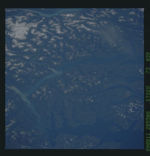
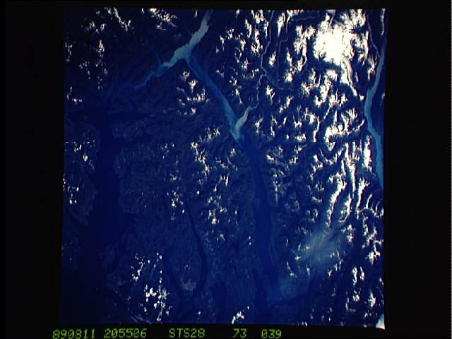
No GeoTIFF is available for this photo.Image Caption: STS028-073-039 Revillagigedo Island, Alaska, U.S.A August 1989
Part of the southern Alaskan panhandle is discernible in this photograph. Snow accentuates the ridge lines and peaks in the higher elevations. A small glacier can be seen in the lower-right corner. The light blue water of the Behm Canal, which separates Revillagigedo Island from the mainland of North America, is created by "rock-flour" sediment that is the result of glacial erosion. The Portland Canal, visible at the bottom of the photograph, forms part of the U.S.-Canada border.
Part of the southern Alaskan panhandle is discernible in this photograph. Snow accentuates the ridge lines and peaks in the higher elevations. A small glacier can be seen in the lower-right corner. The light blue water of the Behm Canal, which separates Revillagigedo Island from the mainland of North America, is created by "rock-flour" sediment that is the result of glacial erosion. The Portland Canal, visible at the bottom of the photograph, forms part of the U.S.-Canada border.
