< STS108-723-38 >
| NASA Photo ID | STS108-723-38 |
| Focal Length | 110mm |
| Date taken | 2001.12.16 |
| Time taken | 14:15:39 GMT |
Resolutions offered for this image:
1031 x 1024 pixels 2063 x 2048 pixels 4127 x 4096 pixels 5700 x 5900 pixels 515 x 512 pixels 483 x 500 pixels 4095 x 4095 pixels 640 x 640 pixels 400 x 400 pixels
1031 x 1024 pixels 2063 x 2048 pixels 4127 x 4096 pixels 5700 x 5900 pixels 515 x 512 pixels 483 x 500 pixels 4095 x 4095 pixels 640 x 640 pixels 400 x 400 pixels


Cloud masks available for this image:
Spacecraft nadir point: 42.3° N, 2.7° W
Photo center point: 42.5° N, 0.5° W
Photo center point by machine learning:
Photo center point: 42.5° N, 0.5° W
Photo center point by machine learning:
Nadir to Photo Center: East
Spacecraft Altitude: 192 nautical miles (356km)
Country or Geographic Name: | SPAIN |
Features: | PYRENEES MTS., LOURDES |
| Features Found Using Machine Learning: | |
Cloud Cover Percentage: | 10 (1-10)% |
Sun Elevation Angle: | 18° |
Sun Azimuth: | 211° |
Camera: | Hasselblad |
Focal Length: | 110mm |
Camera Tilt: | 35 degrees |
Format: | 5069: Kodak Elite 100S, E6 Reversal, Replaces Lumiere, Warmer in tone vs. Lumiere |
Film Exposure: | |
| Additional Information | |
| Width | Height | Annotated | Cropped | Purpose | Links |
|---|---|---|---|---|---|
| 1031 pixels | 1024 pixels | No | No | Download Image | |
| 2063 pixels | 2048 pixels | No | No | Download Image | |
| 4127 pixels | 4096 pixels | No | No | Download Image | |
| 5700 pixels | 5900 pixels | No | No | Download Image Download Color Calibration Image for this Image |
|
| 515 pixels | 512 pixels | No | No | Download Image | |
| 483 pixels | 500 pixels | No | No | Download Image Download Color Calibration Image for this Image |
|
| 4095 pixels | 4095 pixels | No | No | Public Affairs Office (PAO) | Download Image |
| 640 pixels | 640 pixels | No | No | Public Affairs Office (PAO) | Download Image |
| 400 pixels | 400 pixels | No | No | Photographic Highlights | Download Image |
Download Packaged File
Download a Google Earth KML for this Image
View photo footprint information
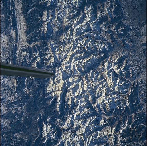
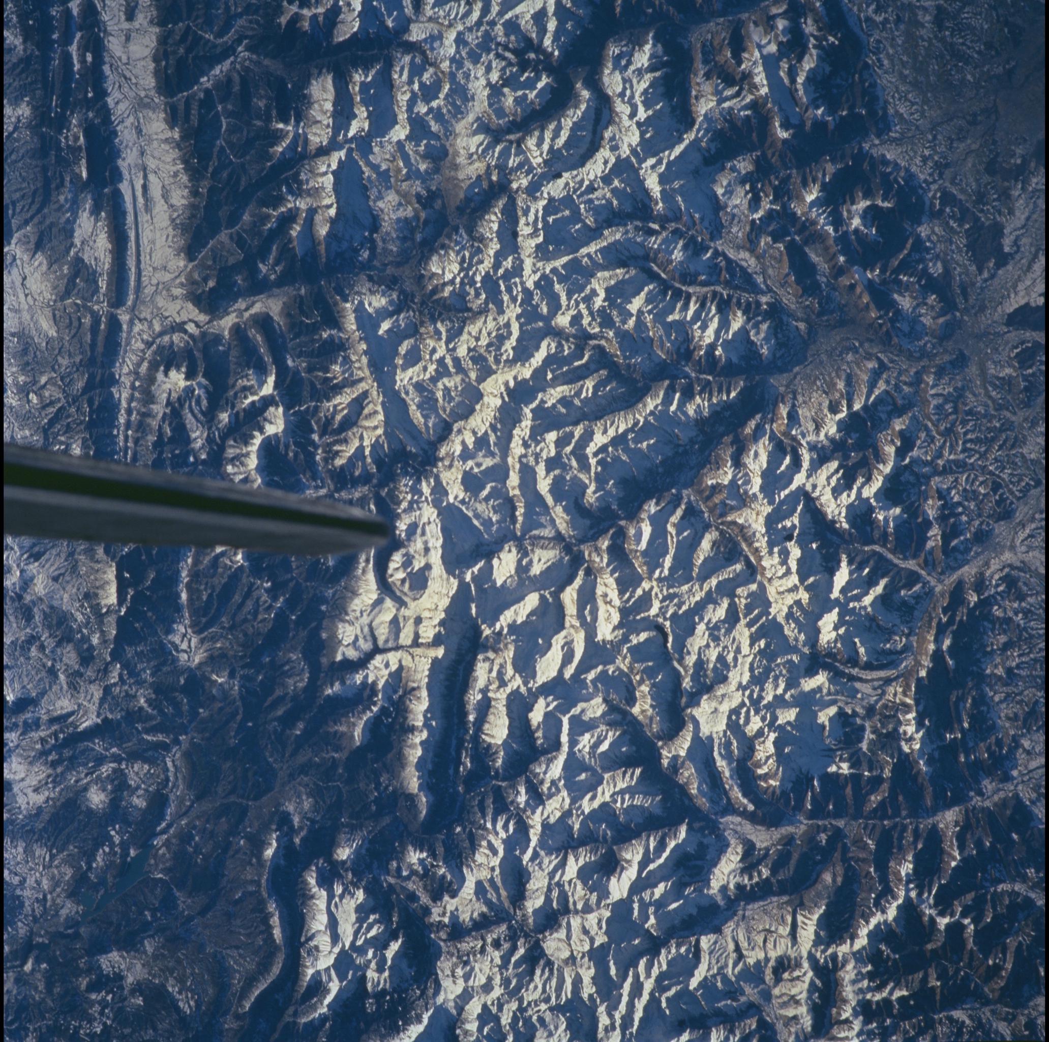
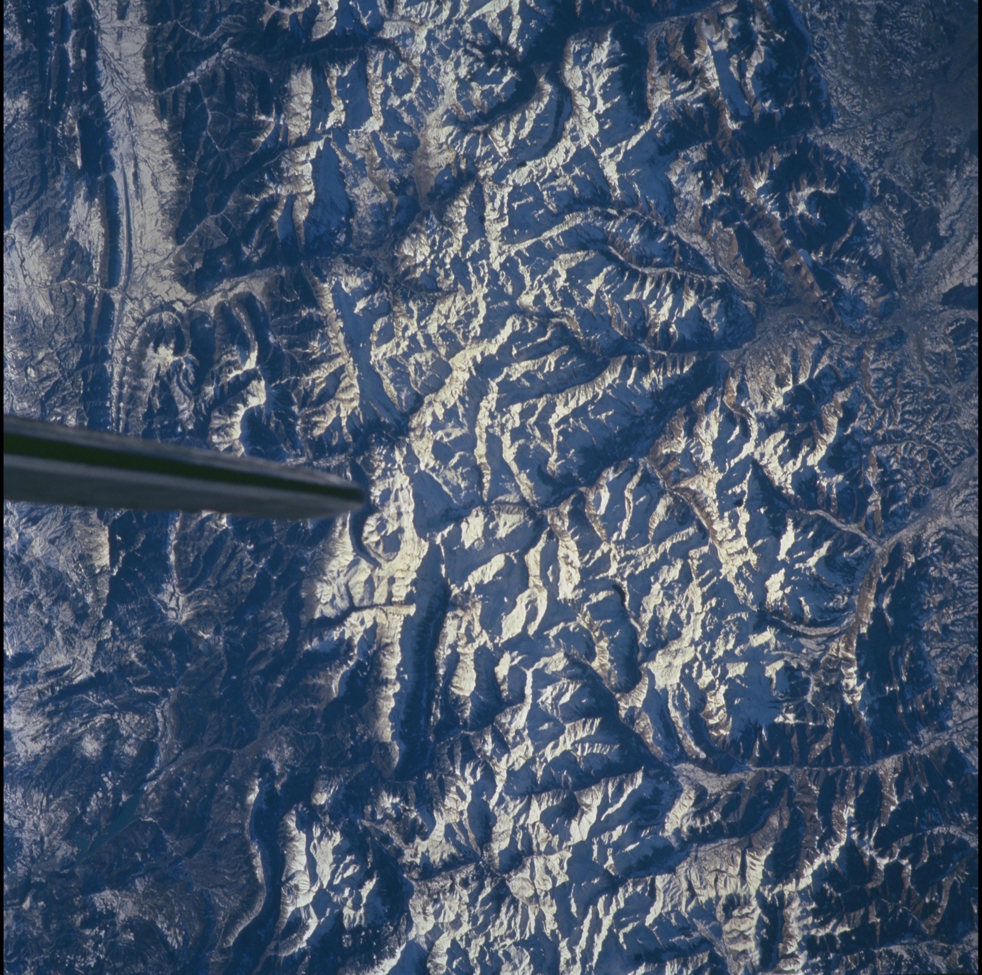
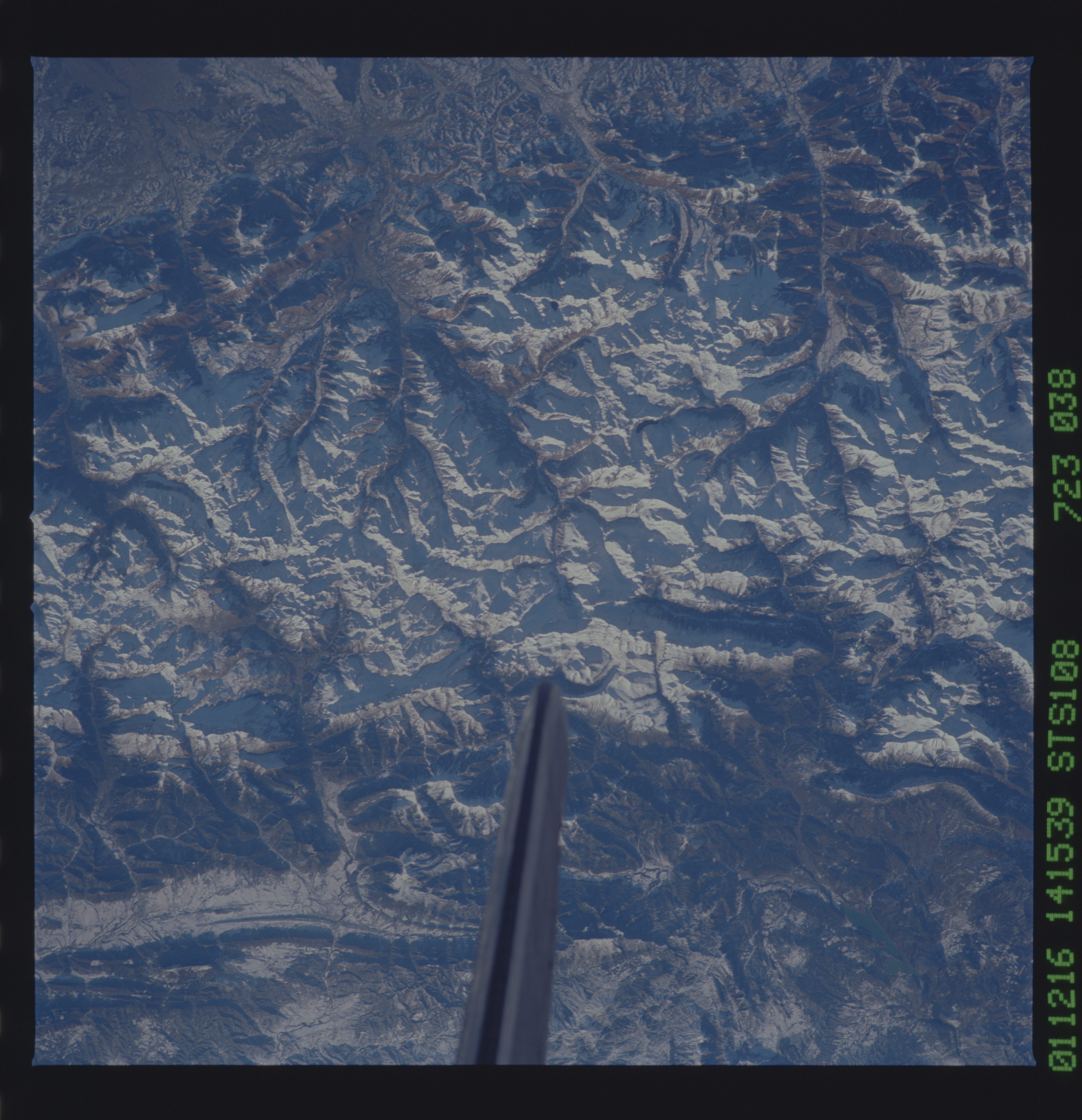
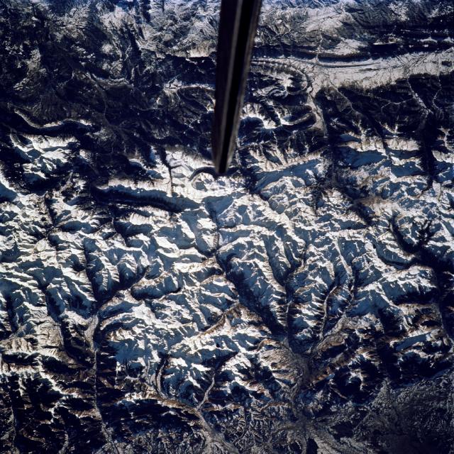
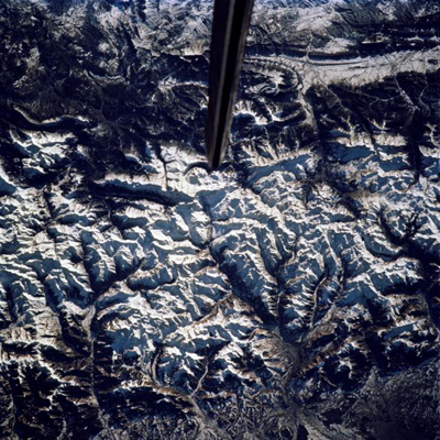
No GeoTIFF is available for this photo.Image Caption: The high spine of the Pyrenees Mts are snow covered and stretch across the
lower part of the picture from left to right)(highest point of the Pyrenees is
3404 m, outside this picture). Snowfree foothills of the Pyrennes in Aquitaine
(France) appear at the bottom (north is to the bottom of the view). The
Pyrenees range began forming about 320 million years ago and was strongly
uplifted again during early stages of Eurasian-African plate collision. Complex
folded strata on the Spanish side (near Pamplona) appear as bends and waves in
foothill rock across the top of the view. Tin, tungsten, talc, fluorite, barium
and gold have been mined from the mountains, and petroleum is produced from the
adjacent Aquitaine sedimentary basin.
