< ISS028-E-37978 >

| NASA Photo ID | ISS028-E-37978 |
| Focal Length | 12mm |
| Date taken | 2011.09.06 |
| Time taken | 16:11:40 GMT |
Resolutions offered for this image:
1000 x 659 pixels 540 x 356 pixels 720 x 480 pixels 4288 x 2848 pixels 640 x 425 pixels
1000 x 659 pixels 540 x 356 pixels 720 x 480 pixels 4288 x 2848 pixels 640 x 425 pixels

Spacecraft nadir point: 28.3° N, 92.6° W
Photo center point: 30.0° N, 97.0° W
Photo center point by machine learning:
Photo center point: 30.0° N, 97.0° W
Photo center point by machine learning:
Nadir to Photo Center: West
Spacecraft Altitude: 209 nautical miles (387km)
Country or Geographic Name: | USA-TEXAS |
Features: | SMOKE PLUMES, GULF OF MEXICO, HOUSTON, LAKE SAM RAYBURN, SHREVEPORT |
| Features Found Using Machine Learning: | PAN- |
Cloud Cover Percentage: | 10 (1-10)% |
Sun Elevation Angle: | 55° |
Sun Azimuth: | 123° |
Camera: | Nikon D2Xs Electronic Still Camera |
Focal Length: | 12mm |
Camera Tilt: | 54 degrees |
Format: | 4288E: 4288 x 2848 pixel CMOS sensor, RGBG imager color filter |
Film Exposure: | |
| Additional Information | |
| Width | Height | Annotated | Cropped | Purpose | Links |
|---|---|---|---|---|---|
| 1000 pixels | 659 pixels | No | Yes | Earth From Space collection | Download Image |
| 540 pixels | 356 pixels | Yes | Yes | Earth From Space collection | Download Image |
| 720 pixels | 480 pixels | Yes | Yes | NASA's Earth Observatory web site | Download Image |
| 4288 pixels | 2848 pixels | No | No | Download Image | |
| 640 pixels | 425 pixels | No | No | Download Image |
Download Packaged File
Download a Google Earth KML for this Image
View photo footprint information
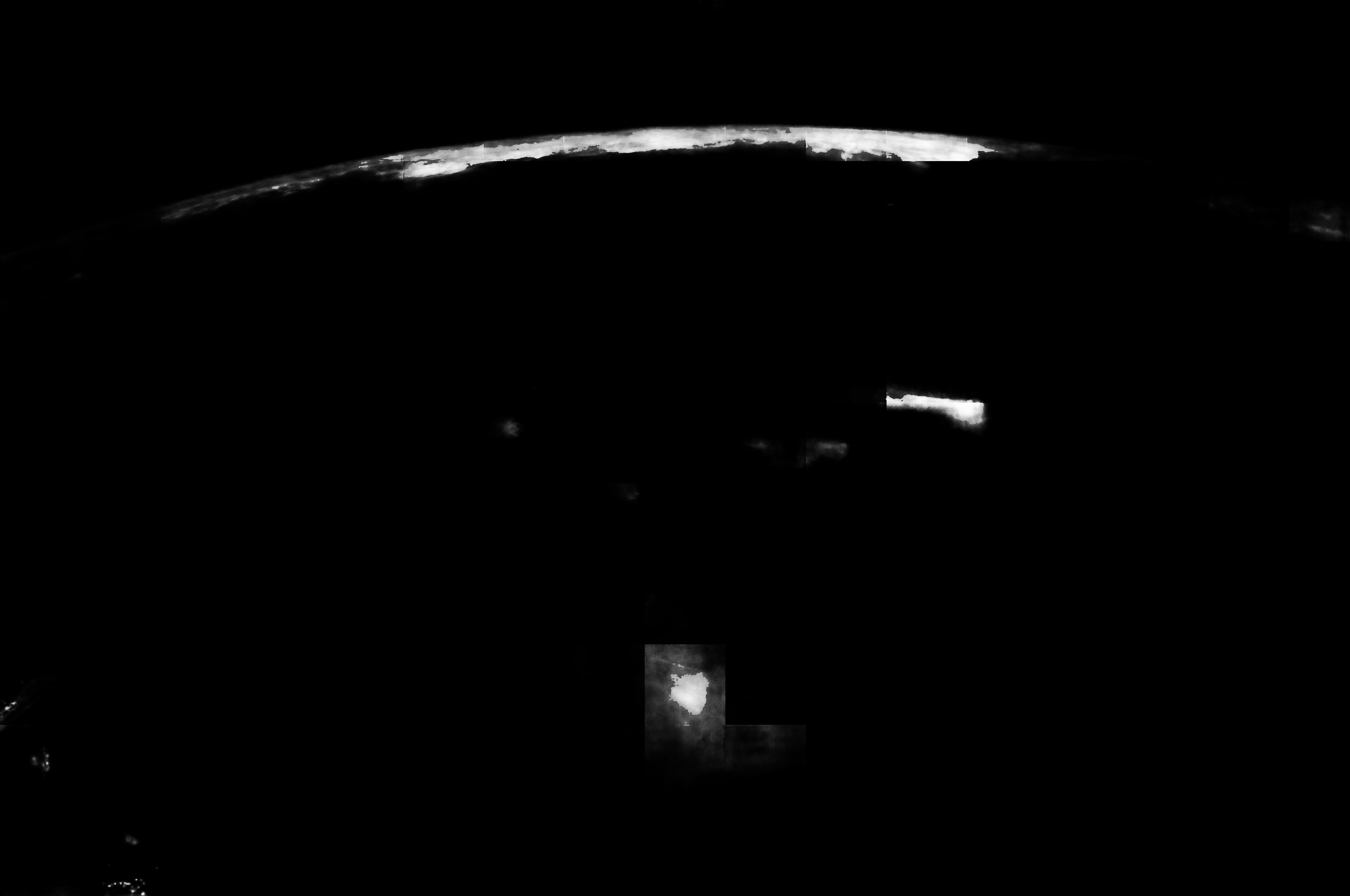
No GeoTIFF is available for this photo.Image Caption: Wildfire Smoke Plumes, Texas
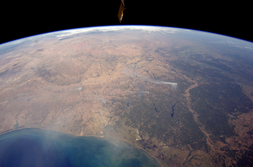
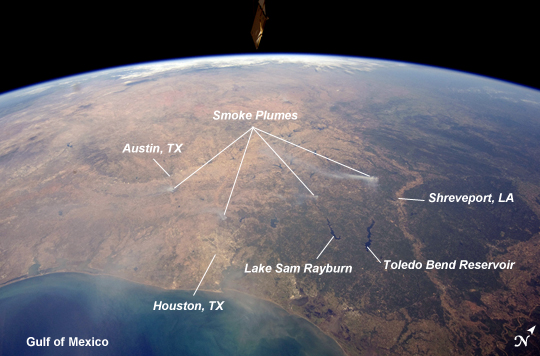
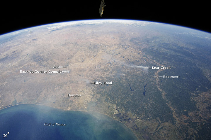
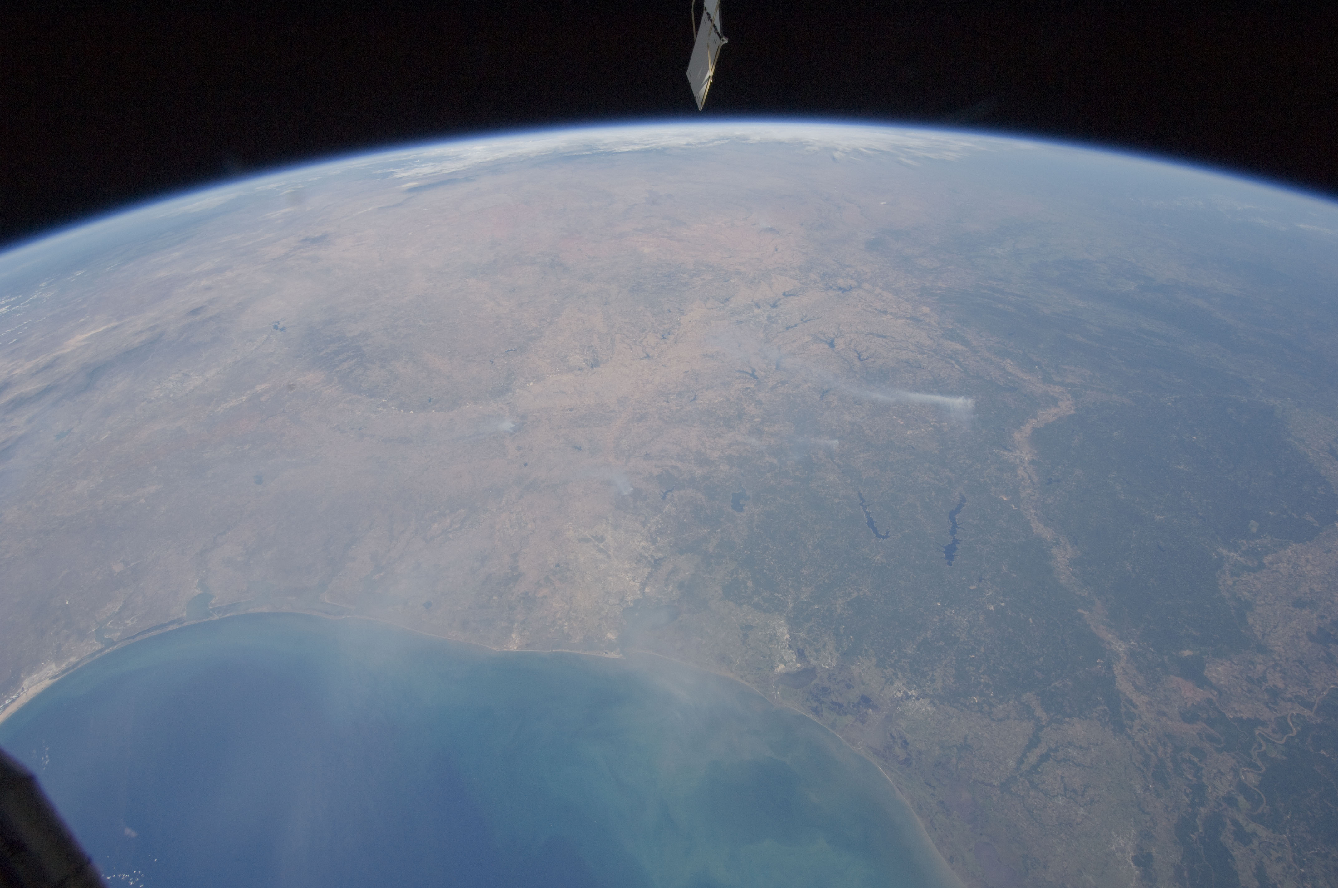
This panoramic view of east-central Texas, taken by astronauts aboard the International Space Station (ISS), highlights numerous smoke plumes caused by wildfires burning across the state. The image was taken using a short focal length lens (12 mm), which captures a wide field of view at the cost of fine feature resolution. Smoke plumes are clearly visible in the image to the east of Austin; to the north of Houston; to the northwest of Lake Sam Rayburn and Toledo Bend Reservoir; and to the west of Shreveport, LA. More diffuse smoke moving offshore into the Gulf of Mexico is visible at image bottom. Part of an ISS photovoltaic radiator panel is visible at image top center.
Record-setting drought conditions have effected much of Texas since early 2011 and have dried out both forest and grassland, providing ample fuel for wildfires. Relatively high winds and low humidity levels have also contributed to the rapid spread and expansion of fires. According to a Texas Forest Service (TXFS) Incident Management Situation Report dated September 7, 2011, TXFS had responded to 172 fires affecting an area of 546.53 km2 (135,051 acres) over the preceding seven days. Fires near Bastrop, TX to the east of Austin had destroyed 785 homes as of September 7, 2011.
