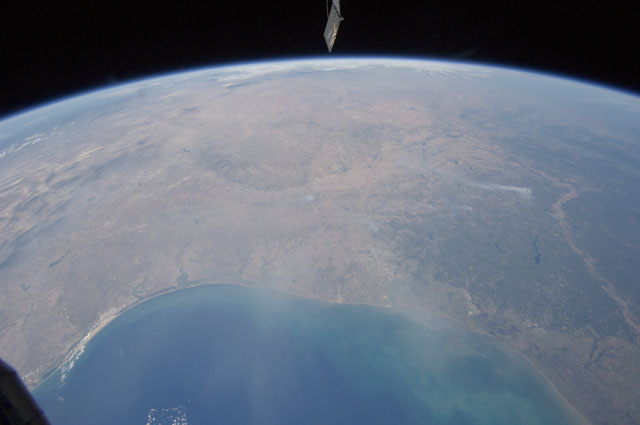
< ISS028-E-37977 >
| NASA Photo ID | ISS028-E-37977 |
| Focal Length | 12mm |
| Date taken | 2011.09.06 |
| Time taken | 16:11:22 GMT |
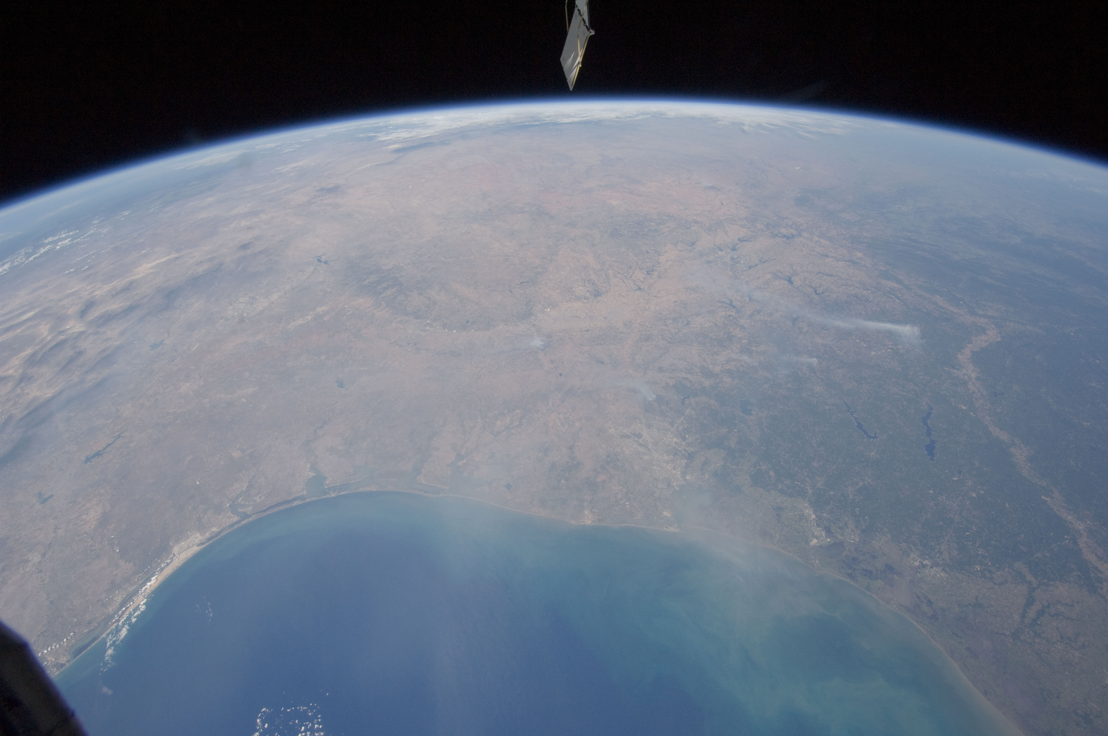


Spacecraft nadir point: 27.5° N, 93.5° W
Photo center point:
Photo center point by machine learning:
Photo center point:
Photo center point by machine learning:
Nadir to Photo Center:
Spacecraft Altitude: 209 nautical miles (387km)
Country or Geographic Name: | |
Features: | |
| Features Found Using Machine Learning: | PAN- |
Cloud Cover Percentage: | 1 (1-10)% |
Sun Elevation Angle: | 54° |
Sun Azimuth: | 121° |
Camera: | NIKON D2Xs S/N: 6027269 |
Focal Length: | 12mm |
Camera Tilt: | |
Format: | |
Film Exposure: | |
| Additional Information | |
| Width | Height | Annotated | Cropped | Purpose | Links |
|---|---|---|---|---|---|
| 4288 pixels | 2848 pixels | No | No | Download Image | |
| 640 pixels | 425 pixels | No | No | Download Image |
Download Packaged File
Download a Google Earth KML for this Image
View photo footprint information
No GeoTIFF is available for this photo.Image Caption: ISS028-E-037977 (6 Sept. 2011) --- The Texas wild fires that have destroyed and continue to destroy thousands of acres of timber and prairie land, as well as hundreds of residences, are visible basically over many of the dozens of affected points across the nation's second largest state. The Expedition 28 crew members on the International Space Station, flying approximately 220 miles above Earth, recorded this wide panoramic image of Texas and beyond, from a point over the Gulf of Mexico, at 16:11:22 GMT, Sept. 6, 2011.
