ISS064-E-37124
| NASA Photo ID | ISS064-E-37124 |
| Focal Length | 50mm |
| Date taken | 2021.02.23 |
| Time taken | 07:25:56 GMT |
5568 x 3712 pixels 720 x 480 pixels 5568 x 3712 pixels 640 x 427 pixels
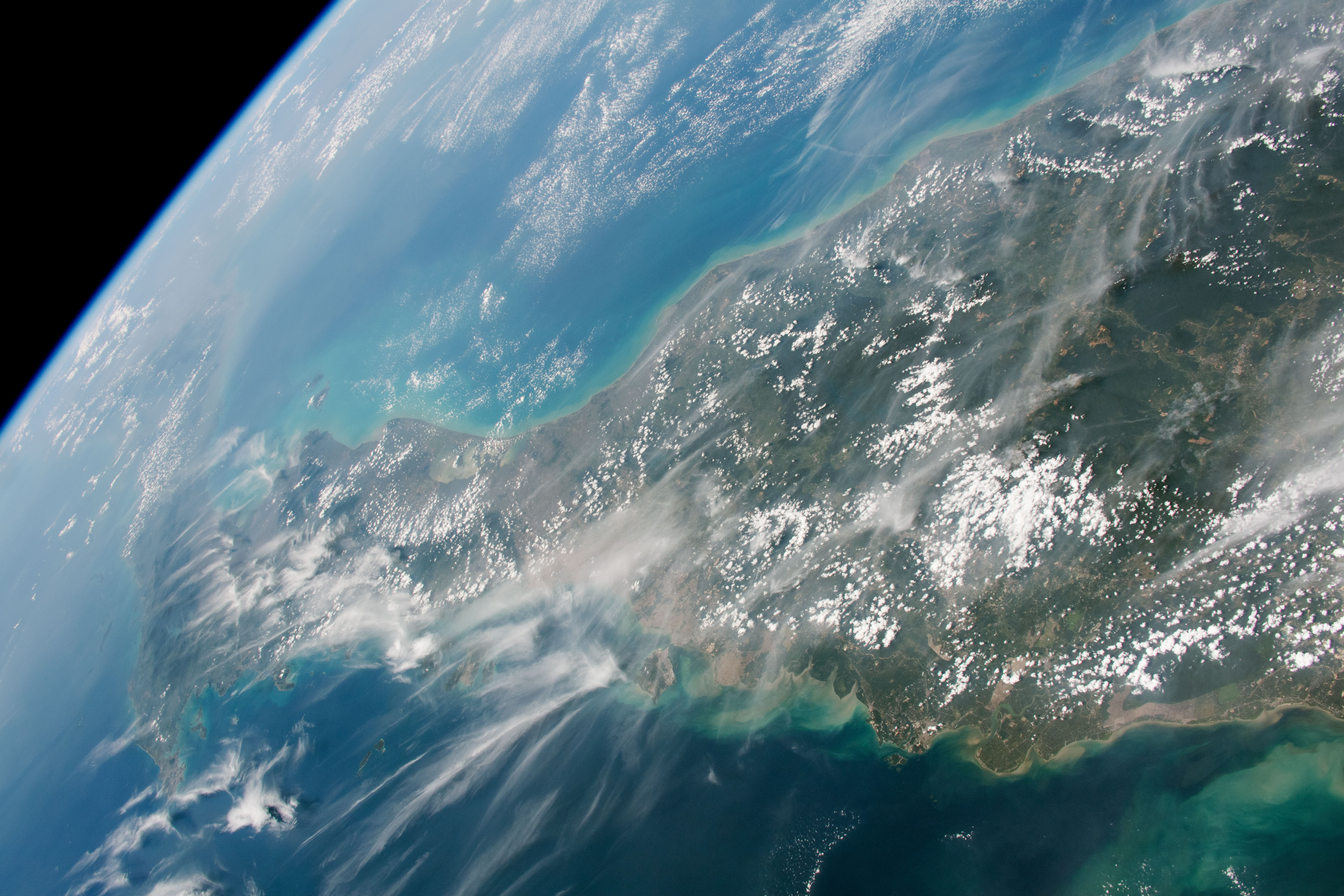
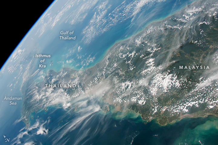

Photo center point: 6.5° N, 101.5° E
Photo center point by machine learning:
Country or Geographic Name: | THAILAND |
Features: | MALAYSIA, MALACCA STRAIT, GULF OF THAILAND |
| Features Found Using Machine Learning: | PAN- |
Cloud Cover Percentage: | 50 (26-50)% |
Sun Elevation Angle: | 59° |
Sun Azimuth: | 251° |
Camera: | Nikon D5 Electronic Still Camera |
Focal Length: | 50mm |
Camera Tilt: | High Oblique |
Format: | 5568E: 5568 x 3712 pixel CMOS sensor, 35.9 x 23.9 mm, total pixels: 21.33 million, Nikon FX format |
Film Exposure: | |
| Additional Information | |
| Width | Height | Annotated | Cropped | Purpose | Links |
|---|---|---|---|---|---|
| 5568 pixels | 3712 pixels | Yes | No | Download Image | |
| 720 pixels | 480 pixels | Yes | No | Download Image | |
| 5568 pixels | 3712 pixels | No | No | Download Image | |
| 640 pixels | 427 pixels | No | No | Download Image |
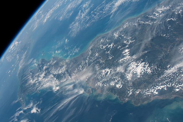
An astronaut onboard the International Space Station (ISS) took this photo while orbiting over Thailand and Malaysia. This region of the world is not often photographed from space due to persistent clouds. While still cloudy, this view offers a rare peek at both coasts of the Malay Peninsula.
This photo was taken near the end of Malaysia's northeast monsoon season (November to March). The oblique and panoramic view shows thin clouds and possibly small smoke plumes being blown from the northeast—typical of wind patterns for this time of year. Malaysia experiences a second monsoon season from May to September each year.
The Isthmus of Kra, at 70 kilometers (45 miles) wide, is the narrowest part of the peninsula that separates the Gulf of Thailand and the Andaman Sea. Looking toward Earth's limb, mainland Thailand is hardly distinguishable through the atmospheric haze, due in part to Southeast Asia's burning season. On the day this photo was taken, hundreds of fires were detected in the region by the Visible Infrared Imaging Radiometer Suite (VIIRS) on the Suomi NPP satellite.
