< STS068-249-37 >
| NASA Photo ID | STS068-249-37 |
| Focal Length | 100mm |
| Date taken | 1994.10.09 |
| Time taken | 17:34:55 GMT |
Resolutions offered for this image:
3904 x 3904 pixels 639 x 639 pixels 5700 x 5900 pixels 500 x 518 pixels 640 x 480 pixels
3904 x 3904 pixels 639 x 639 pixels 5700 x 5900 pixels 500 x 518 pixels 640 x 480 pixels

Cloud masks available for this image:
Spacecraft nadir point: 44.2° N, 107.3° W
Photo center point: 44.5° N, 109.0° W
Photo center point by machine learning:
Photo center point: 44.5° N, 109.0° W
Photo center point by machine learning:
Nadir to Photo Center: West
Spacecraft Altitude: 111 nautical miles (206km)
Country or Geographic Name: | USA-WYOMING |
Features: | MTS, YELLOWSTONE LAKE |
| Features Found Using Machine Learning: | |
Cloud Cover Percentage: | 0 (no clouds present) |
Sun Elevation Angle: | 36° |
Sun Azimuth: | 155° |
Camera: | Hasselblad |
Focal Length: | 100mm |
Camera Tilt: | 43 degrees |
Format: | 5046: Kodak, natural color positive, Lumiere 100/5046, ASA 100, standard base |
Film Exposure: | Normal |
| Additional Information | |
| Width | Height | Annotated | Cropped | Purpose | Links |
|---|---|---|---|---|---|
| 3904 pixels | 3904 pixels | No | No | Earth From Space collection | Download Image |
| 639 pixels | 639 pixels | No | No | Earth From Space collection | Download Image |
| 5700 pixels | 5900 pixels | No | No | Download Image Download Color Calibration Image for this Image |
|
| 500 pixels | 518 pixels | No | No | Download Image Download Color Calibration Image for this Image |
|
| 640 pixels | 480 pixels | No | No | Download Image |
Download Packaged File
Download a Google Earth KML for this Image
View photo footprint information
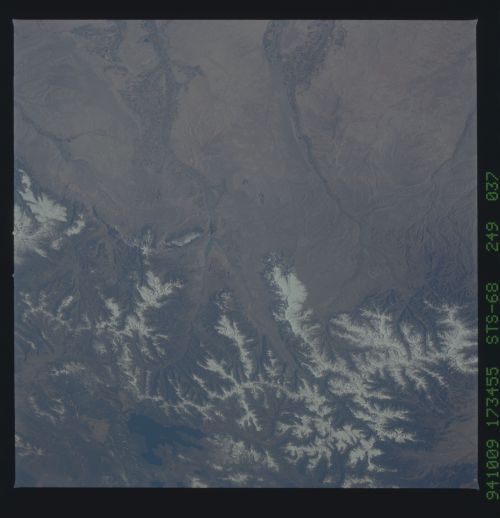
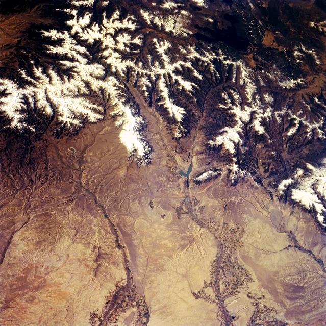
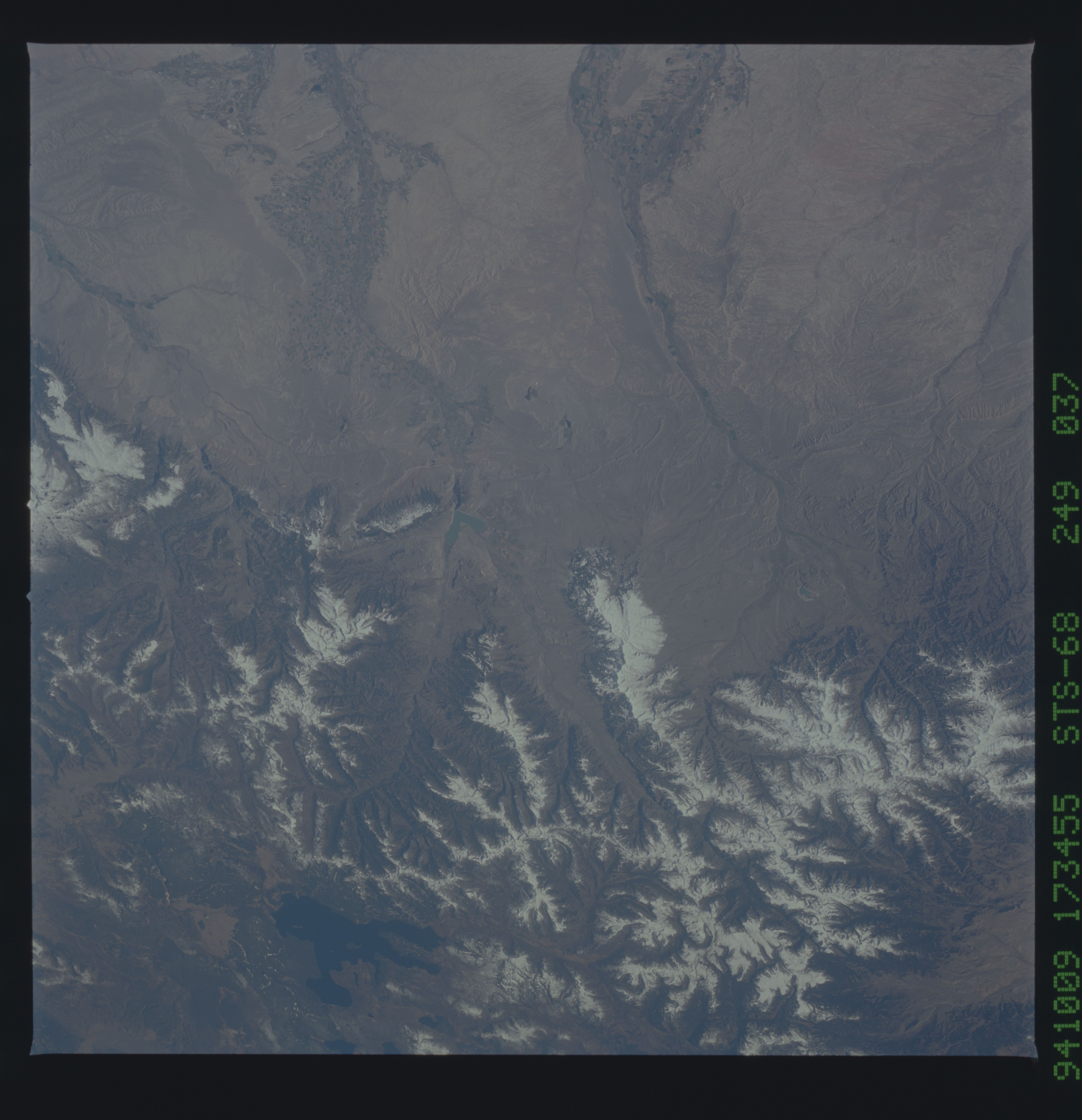
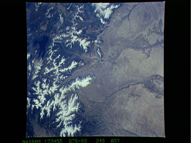
No GeoTIFF is available for this photo.Image Caption: STS068-249-037 Bighorn Basin, Cody, and Yellowstone, Wyoming, U.S.A. October 1994
The snow-covered peaks of the Absaroka Range and the western portion of the Bighorn Basin, a large, oval depression that is almost completely surrounded by mountain ranges, are visible in this west-looking, low-oblique photograph. The north and south forks of the Shoshone River converge at the Buffalo Bill Reservoir and flow northeastward through the city of Cody (barely discernible) and irrigated agricultural land to the Bighorn River near the Montana-Wyoming border. The Greybull River flows northeastward from the southern Absaroka Range (upper left) through irrigated agricultural land (bottom center) before joining the Bighorn River at the city of Greybull. Buffalo Bill Dam, completed in 1910 and the first concrete arch dam in the world, and its reservoir are used for hydroelectric power, downstream irrigation, and recreation. East of the dam on the Shoshone River lies Cody, founded and incorporated in 1901 by William F. Cody (Buffalo Bill). The city is a tourist resort at the eastern entrance to Yellowstone National Park. Dark blue Yellowstone Lake is the largest high altitude lake in North America at 7331 feet (2236 meters) and covers 139 square miles (360 square kilometers).
The snow-covered peaks of the Absaroka Range and the western portion of the Bighorn Basin, a large, oval depression that is almost completely surrounded by mountain ranges, are visible in this west-looking, low-oblique photograph. The north and south forks of the Shoshone River converge at the Buffalo Bill Reservoir and flow northeastward through the city of Cody (barely discernible) and irrigated agricultural land to the Bighorn River near the Montana-Wyoming border. The Greybull River flows northeastward from the southern Absaroka Range (upper left) through irrigated agricultural land (bottom center) before joining the Bighorn River at the city of Greybull. Buffalo Bill Dam, completed in 1910 and the first concrete arch dam in the world, and its reservoir are used for hydroelectric power, downstream irrigation, and recreation. East of the dam on the Shoshone River lies Cody, founded and incorporated in 1901 by William F. Cody (Buffalo Bill). The city is a tourist resort at the eastern entrance to Yellowstone National Park. Dark blue Yellowstone Lake is the largest high altitude lake in North America at 7331 feet (2236 meters) and covers 139 square miles (360 square kilometers).
