< STS080-711-36 >

| NASA Photo ID | STS080-711-36 |
| Focal Length | 100mm |
| Date taken | 1996.__.__ |
| Time taken | GMT |
Resolutions offered for this image:
789 x 795 pixels 5700 x 5900 pixels 483 x 500 pixels 640 x 628 pixels
789 x 795 pixels 5700 x 5900 pixels 483 x 500 pixels 640 x 628 pixels

Cloud masks available for this image:
Spacecraft nadir point:
Photo center point: 25.5° N, 100.5° W
Photo center point by machine learning:
Photo center point: 25.5° N, 100.5° W
Photo center point by machine learning:
Nadir to Photo Center:
Spacecraft Altitude: nautical miles (0km)
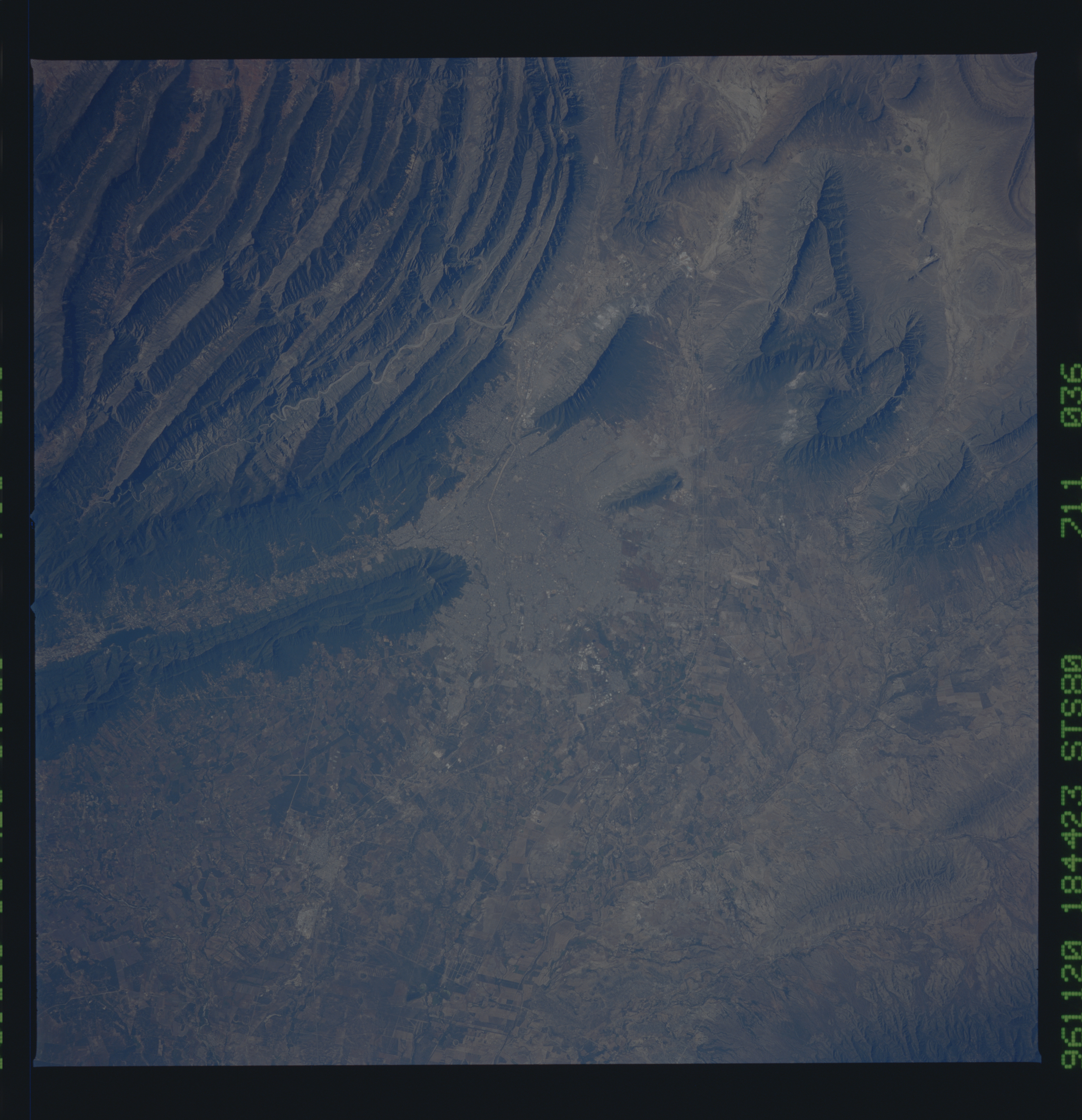
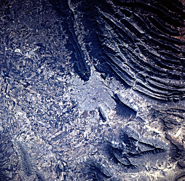
Country or Geographic Name: | MEXICO |
Features: | MONTERREY, SIERRA MADRE |
| Features Found Using Machine Learning: | |
Cloud Cover Percentage: | 0 (no clouds present) |
Sun Elevation Angle: | ° |
Sun Azimuth: | ° |
Camera: | Hasselblad |
Focal Length: | 100mm |
Camera Tilt: | Low Oblique |
Format: | 5046: Kodak, natural color positive, Lumiere 100/5046, ASA 100, standard base |
Film Exposure: | Normal |
| Additional Information | |
| Width | Height | Annotated | Cropped | Purpose | Links |
|---|---|---|---|---|---|
| 789 pixels | 795 pixels | No | No | Cities collection | Download Image |
| 5700 pixels | 5900 pixels | No | No | Download Image Download Color Calibration Image for this Image |
|
| 483 pixels | 500 pixels | No | No | Download Image Download Color Calibration Image for this Image |
|
| 640 pixels | 628 pixels | No | No | Photographic Highlights | Download Image |
Download Packaged File
Download a Google Earth KML for this Image
View photo footprint information
No GeoTIFF is available for this photo.Image Caption: Potrero Garcia and Potrero La Mula are breached salt-cored folds
immediately north of the Sierra and Monterey. Individual limestone
layers can be resolved in this beautifully detailed view, as can the
tilt of the layers outward from the center of the fold
(anticline). Most of the salt has been eroded from the core of the
structure, but what remains is now being mined. In Las Grutas de
Garcia (Garcia Caverns) the limestone bedrock has been dissolved and
both limestone and gypsum formations decorate the cave.
