< STS079-784-35 >
| NASA Photo ID | STS079-784-35 |
| Focal Length | 250mm |
| Date taken | 1996.09.20 |
| Time taken | 02:32:25 GMT |
Resolutions offered for this image:
4085 x 4062 pixels 640 x 636 pixels 5700 x 5900 pixels 483 x 500 pixels 633 x 624 pixels 437 x 426 pixels 518 x 510 pixels
4085 x 4062 pixels 640 x 636 pixels 5700 x 5900 pixels 483 x 500 pixels 633 x 624 pixels 437 x 426 pixels 518 x 510 pixels


Cloud masks available for this image:
Spacecraft nadir point: 34.0° N, 116.4° E
Photo center point: 38.0° N, 119.0° E
Photo center point by machine learning:
Photo center point: 38.0° N, 119.0° E
Photo center point by machine learning:
Nadir to Photo Center: Northeast
Spacecraft Altitude: 202 nautical miles (374km)
Country or Geographic Name: | CHINA |
Features: | YELLOW R. DELTA, AGR., SED. |
| Features Found Using Machine Learning: | |
Cloud Cover Percentage: | 0 (no clouds present) |
Sun Elevation Angle: | 50° |
Sun Azimuth: | 141° |
Camera: | Hasselblad |
Focal Length: | 250mm |
Camera Tilt: | 55 degrees |
Format: | 5046: Kodak, natural color positive, Lumiere 100/5046, ASA 100, standard base |
Film Exposure: | Normal |
| Additional Information | |
| Width | Height | Annotated | Cropped | Purpose | Links |
|---|---|---|---|---|---|
| 4085 pixels | 4062 pixels | No | No | Earth From Space collection | Download Image |
| 640 pixels | 636 pixels | No | No | Earth From Space collection | Download Image |
| 5700 pixels | 5900 pixels | No | No | Download Image Download Color Calibration Image for this Image |
|
| 483 pixels | 500 pixels | No | No | Download Image Download Color Calibration Image for this Image |
|
| 633 pixels | 624 pixels | Yes | No | Download Image | |
| 437 pixels | 426 pixels | Download Image | |||
| 518 pixels | 510 pixels | No | No | Download Image |
Download Packaged File
Download a Google Earth KML for this Image
View photo footprint information
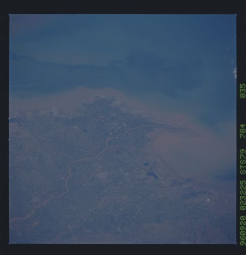
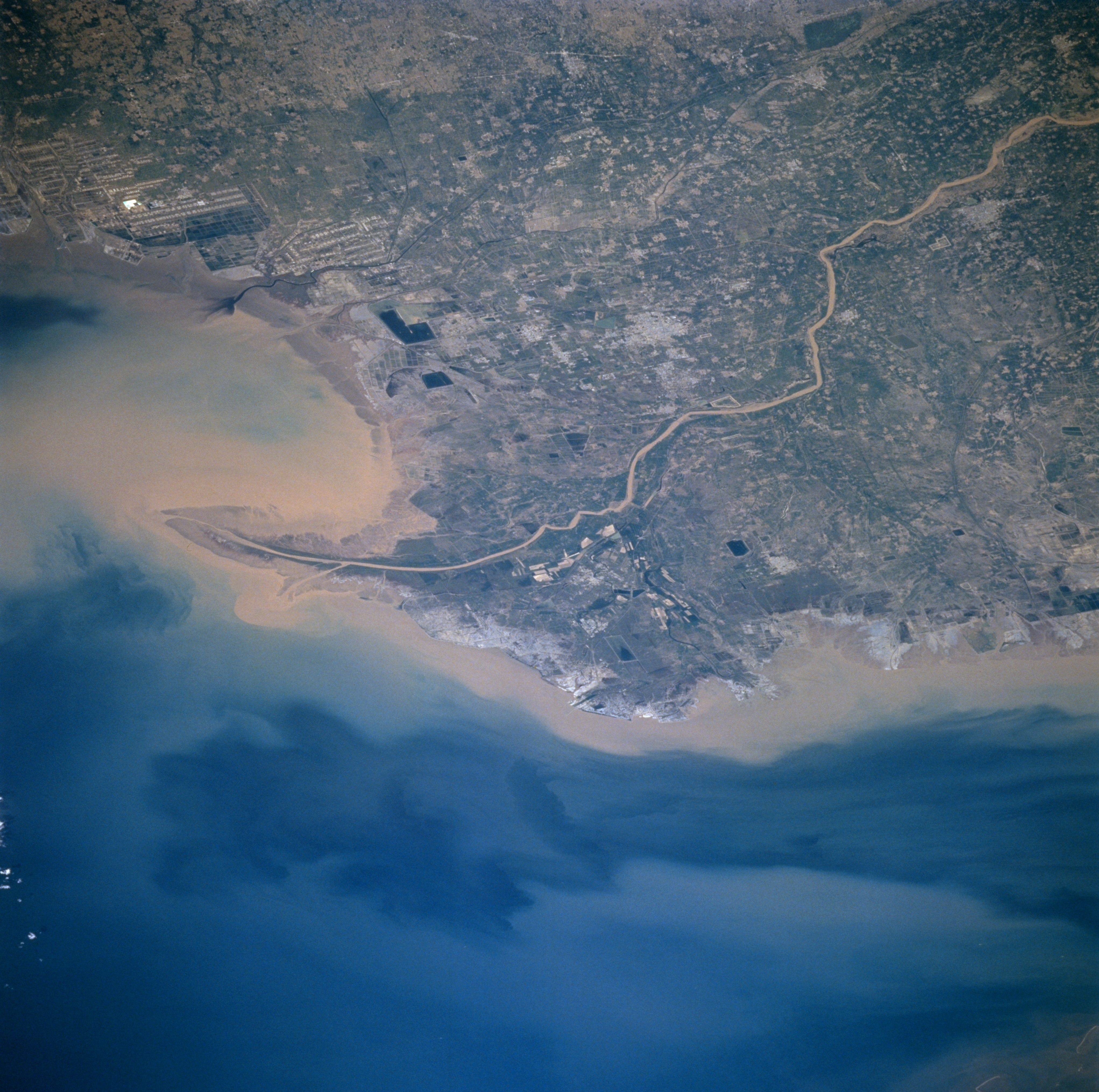
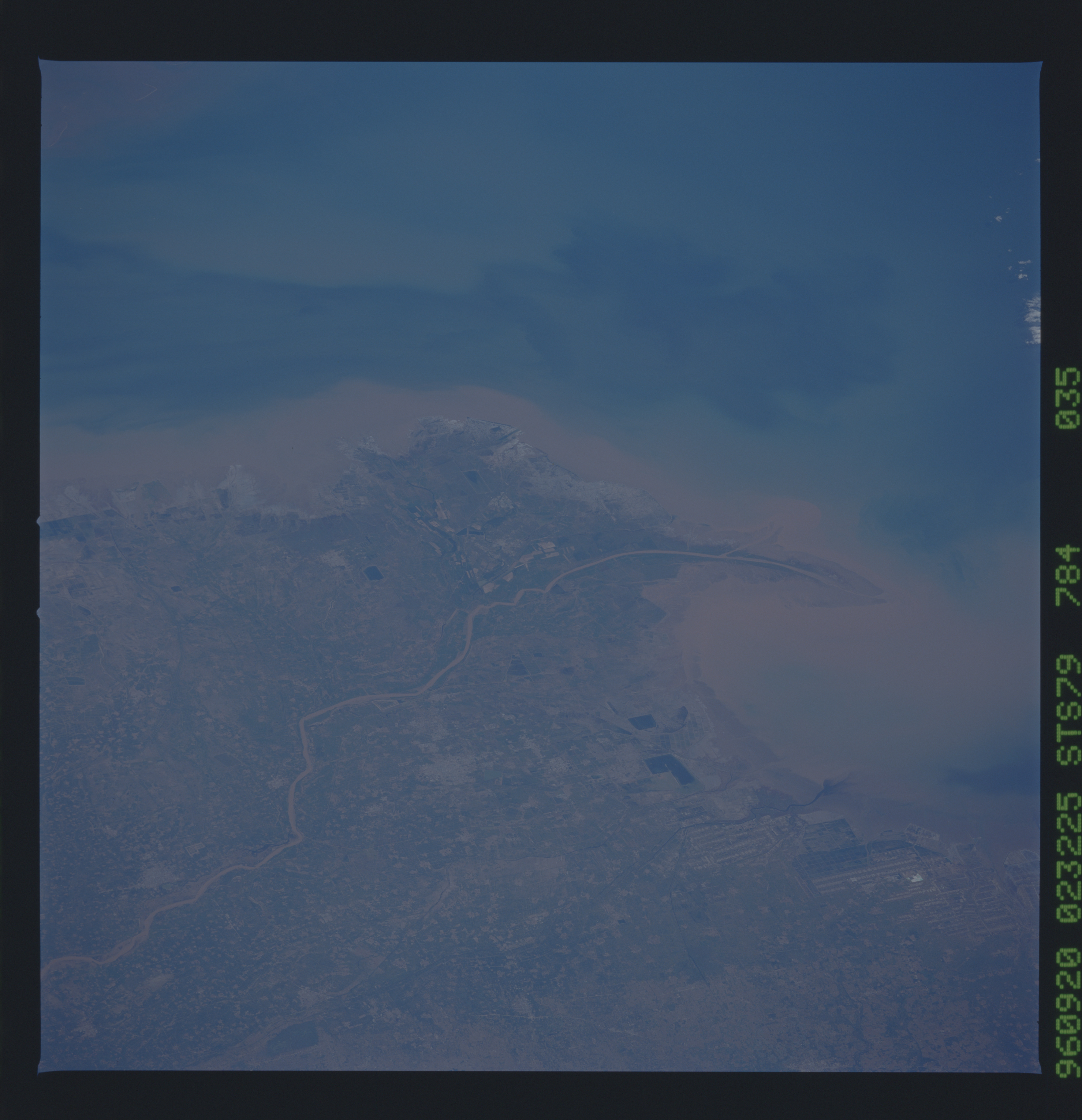
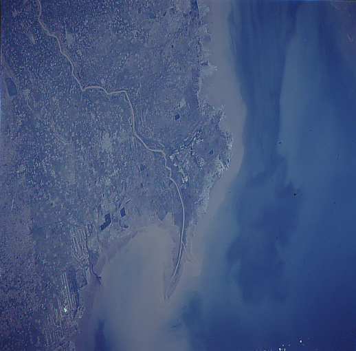
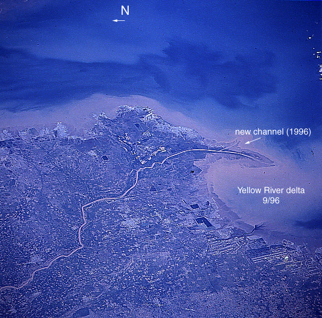
No GeoTIFF is available for this photo.Image Caption: STS079-784-035 Yellow River Mouth, China September 1996
Considered to be one of the most silt-laden rivers in the world, the mouth of the Yellow River can be seen in this southwest-looking view. The Yellow River discharges over one billon tons of sediment each year into the Gulf of Bohai (bottom portion of the image). The delta of the Yellow River is being extended into the gulf steadily at a rate of one mile (1.6 km) a year, adding roughly 14 sq. miles (40 sq. km) of land in the process. The river rises in the Kunlun Mountains of western China and flows generally eastward 3000 miles (4830 km) before emptying into the Gulf of Bohai. The Yellow River is the second longest river in China and one of the longest rivers in the world. The river's middle course is considered to be where Chinese civilization had its beginnings. The delta is used extensively for agriculture. Near the center of the image, the small commercial city of Dongying is discernible. To the east (left) of the city is the Shengli Oilfield, the second largest oilfield in China.
Considered to be one of the most silt-laden rivers in the world, the mouth of the Yellow River can be seen in this southwest-looking view. The Yellow River discharges over one billon tons of sediment each year into the Gulf of Bohai (bottom portion of the image). The delta of the Yellow River is being extended into the gulf steadily at a rate of one mile (1.6 km) a year, adding roughly 14 sq. miles (40 sq. km) of land in the process. The river rises in the Kunlun Mountains of western China and flows generally eastward 3000 miles (4830 km) before emptying into the Gulf of Bohai. The Yellow River is the second longest river in China and one of the longest rivers in the world. The river's middle course is considered to be where Chinese civilization had its beginnings. The delta is used extensively for agriculture. Near the center of the image, the small commercial city of Dongying is discernible. To the east (left) of the city is the Shengli Oilfield, the second largest oilfield in China.
