< STS056-152-35 >
| NASA Photo ID | STS056-152-35 |
| Focal Length | 250mm |
| Date taken | 1993.04.10 |
| Time taken | 03:10:53 GMT |
Cloud masks available for this image:
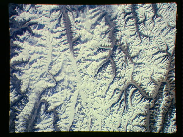
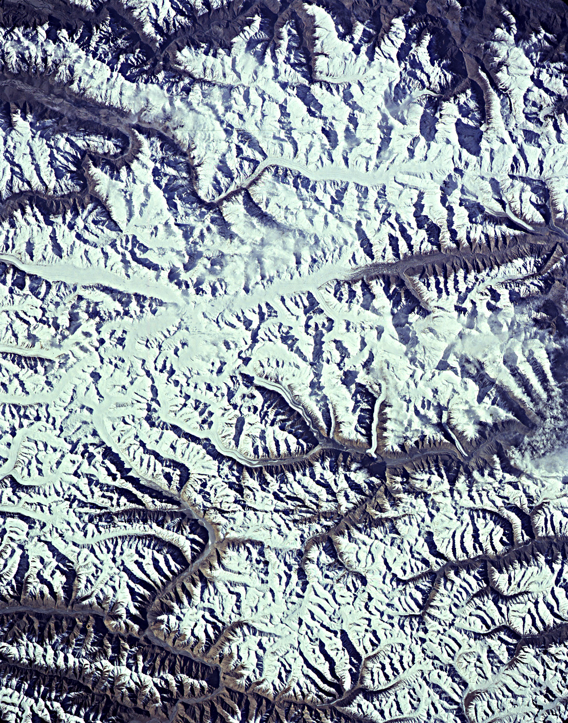
Spacecraft nadir point: 36.3° N, 75.6° E
Photo center point: 36.0° N, 76.0° E
Photo center point by machine learning:
Photo center point: 36.0° N, 76.0° E
Photo center point by machine learning:
Nadir to Photo Center: Southeast
Spacecraft Altitude: 162 nautical miles (300km)
Country or Geographic Name: | PAKISTAN |
Features: | KARAKORAM RA, GLACIERS |
| Features Found Using Machine Learning: | |
Cloud Cover Percentage: | 5 (1-10)% |
Sun Elevation Angle: | 31° |
Sun Azimuth: | 104° |
Camera: | Linhof |
Focal Length: | 250mm |
Camera Tilt: | 11 degrees |
Format: | QX868: Kodak, natural color positive, Ektachrome QX868(5017 emulsion), ASA 64, thin base |
Film Exposure: | Normal |
| Additional Information | |
| Width | Height | Annotated | Cropped | Purpose | Links |
|---|---|---|---|---|---|
| 640 pixels | 480 pixels | No | No | ISD 1 | Download Image |
| 1111 pixels | 1415 pixels | No | No | Download Image |
Download Packaged File
Download a Google Earth KML for this Image
View photo footprint information
No GeoTIFF is available for this photo.Image Caption: none
