< STS113-347-34 >
| NASA Photo ID | STS113-347-34 |
| Focal Length | mm |
| Date taken | |
| Time taken | GMT |
Resolutions offered for this image:
3070 x 2044 pixels 1200 x 798 pixels 1024 x 768 pixels 540 x 405 pixels 3070 x 2044 pixels 2960 x 1960 pixels 515 x 342 pixels
3070 x 2044 pixels 1200 x 798 pixels 1024 x 768 pixels 540 x 405 pixels 3070 x 2044 pixels 2960 x 1960 pixels 515 x 342 pixels


Cloud masks available for this image:
Spacecraft nadir point:
Photo center point:
Photo center point by machine learning:
Photo center point:
Photo center point by machine learning:
Nadir to Photo Center:
Spacecraft Altitude: nautical miles (0km)Body:
Country or Geographic Name: | |
Features: | |
| Features Found Using Machine Learning: | |
Cloud Cover Percentage: | |
Sun Elevation Angle: | ° |
Sun Azimuth: | ° |
Camera: | |
Focal Length: | mm |
Camera Tilt: | |
Format: | |
Film Exposure: | |
| Additional Information | |
| Width | Height | Annotated | Cropped | Purpose | Links |
|---|---|---|---|---|---|
| 3070 pixels | 2044 pixels | No | No | Photographic Highlights | Download Image |
| 1200 pixels | 798 pixels | No | No | Photographic Highlights | Download Image |
| 1024 pixels | 768 pixels | Photographic Highlights | Download Image | ||
| 540 pixels | 405 pixels | Photographic Highlights | Download Image | ||
| 3070 pixels | 2044 pixels | No | No | Download Image | |
| 2960 pixels | 1960 pixels | No | No | Download Image | |
| 515 pixels | 342 pixels | No | No | Download Image |
Download Packaged File
Download a Google Earth KML for this Image
View photo footprint information
No GeoTIFF is available for this photo.Image Caption: STS113-347-34
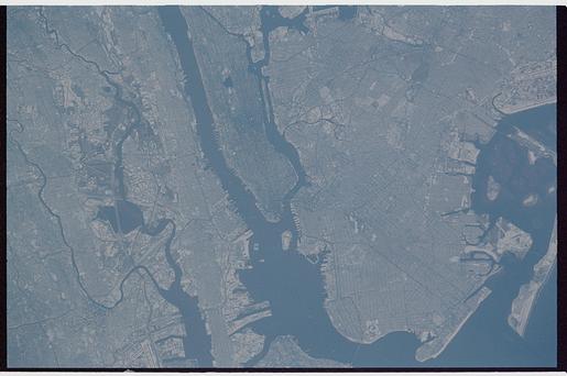
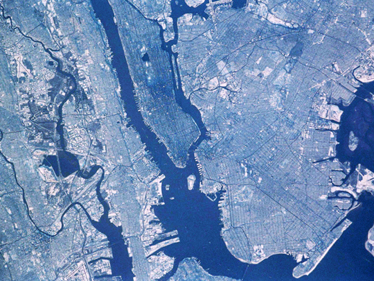
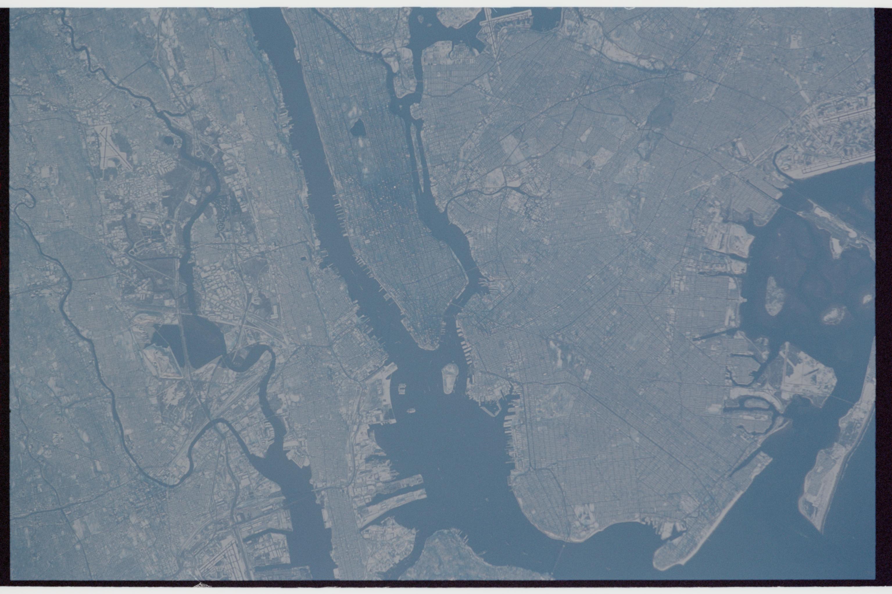
New York City: Manhattan Island appears just left of center, flanked by the lower Hudson River (left), and the East River (right). Several bridges can be discerned. The lake in Central Park is particularly visible. The Verrazano Narrows Bridge appears center on the bottom margin of the view, dividing upper New York Bay from Lower New York Bay. Newark Bay is the waterbody lower left. Three famous islands appear at the north (top) end of Upper New York Bay, the smallest being Liberty Island (Statue of Liberty not visible at this resolution), Ellis Island, the middle-sized island, and Governor's Island, the largest. Queens appears top right and Brooklyn lower right, with the Naval Air Station on Jamaica Bay on the right margin.
New York City: Manhattan Island appears just left of center, flanked by the lower Hudson River (left), and the East River (right). Several bridges can be discerned. The lake in Central Park is particularly visible. The Verrazano Narrows Bridge appears center on the bottom margin of the view, dividing upper New York Bay from Lower New York Bay. Newark Bay is the waterbody lower left. Three famous islands appear at the north (top) end of Upper New York Bay, the smallest being Liberty Island (Statue of Liberty not visible at this resolution), Ellis Island, the middle-sized island, and Governor's Island, the largest. Queens appears top right and Brooklyn lower right, with the Naval Air Station on Jamaica Bay on the right margin.
