< ISS040-E-33303 >
| NASA Photo ID | ISS040-E-33303 |
| Focal Length | 28mm |
| Date taken | 2014.07.03 |
| Time taken | 14:41:16 GMT |

Spacecraft nadir point: 35.4° N, 22.3° E
Photo center point:
Photo center point by machine learning:
Photo center point:
Photo center point by machine learning:
Nadir to Photo Center:
Spacecraft Altitude: 221 nautical miles (409km)
Country or Geographic Name: | |
Features: | |
| Features Found Using Machine Learning: | |
Cloud Cover Percentage: | 1 (1-10)% |
Sun Elevation Angle: | 36° |
Sun Azimuth: | 275° |
Camera: | NIKON D3S S/N: 2007931 |
Focal Length: | 28mm |
Camera Tilt: | |
Format: | |
Film Exposure: | |
| Additional Information | |
| Width | Height | Annotated | Cropped | Purpose | Links |
|---|---|---|---|---|---|
| 4256 pixels | 2832 pixels | No | No | Download Image | |
| 640 pixels | 426 pixels | No | No | Download Image |
Download Packaged File
Download a Google Earth KML for this Image
View photo footprint information
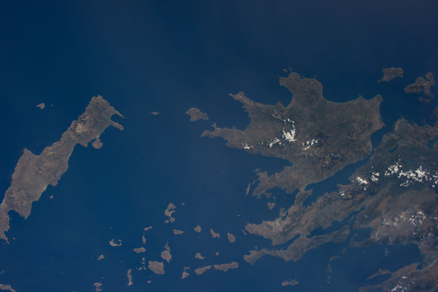
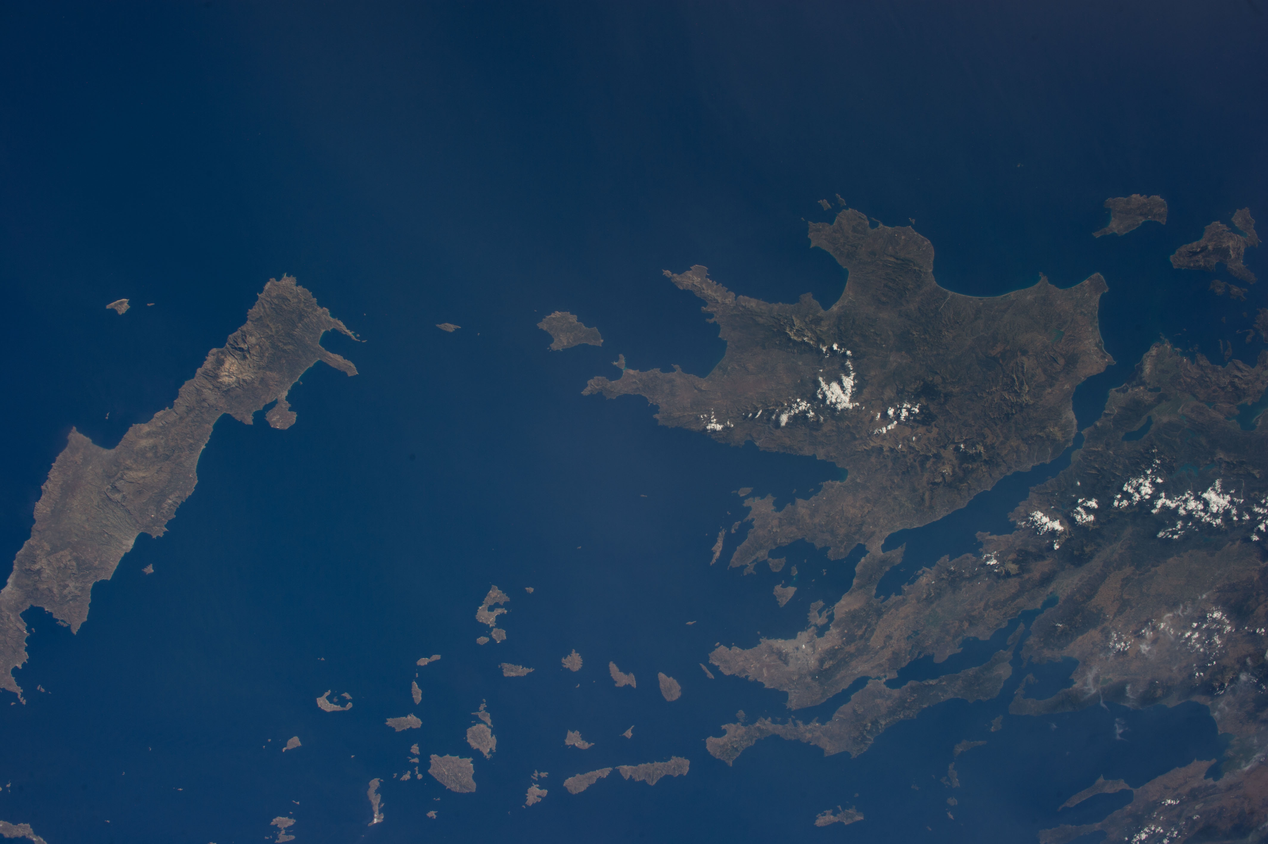
No GeoTIFF is available for this photo.Image Caption: ISS040-E-033303 (3 July 2014) --- One of the Expedition 40 crew members aboard the International Space Station photographed this image from an altitude of 225 nautical miles, featuring the Ionian Sea (top), Crete (southernmost island at left), the Cyclades (bottom center) and much of Greece's land mass
(right, or northernmost part of the frame).
(right, or northernmost part of the frame).
