< STS079-817-31 >
| NASA Photo ID | STS079-817-31 |
| Focal Length | 40mm |
| Date taken | 1996.09.20 |
| Time taken | 12:16:11 GMT |
Resolutions offered for this image:
5700 x 5900 pixels 483 x 500 pixels 1296 x 1291 pixels 5196 x 5155 pixels 640 x 640 pixels
5700 x 5900 pixels 483 x 500 pixels 1296 x 1291 pixels 5196 x 5155 pixels 640 x 640 pixels


Cloud masks available for this image:
Spacecraft nadir point: 49.7° S, 68.1° E
Photo center point:
Photo center point by machine learning:
Photo center point:
Photo center point by machine learning:
Nadir to Photo Center:
Spacecraft Altitude: 207 nautical miles (383km)
Country or Geographic Name: | INDIAN OCEAN |
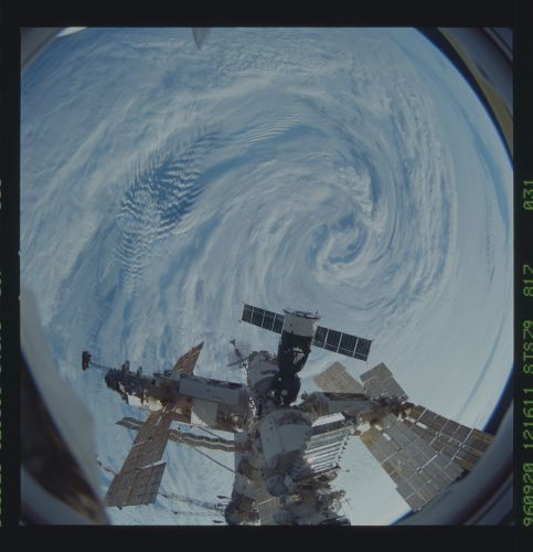
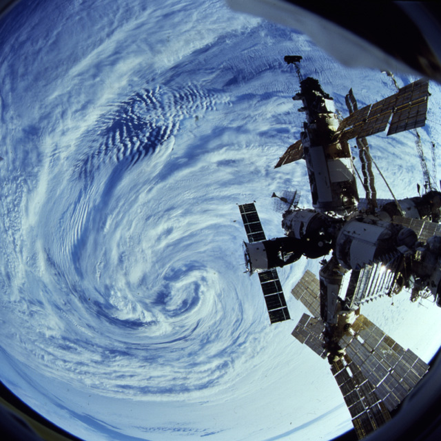
Features: | PAN-CLOUD EDDY, MIR |
| Features Found Using Machine Learning: | |
Cloud Cover Percentage: | 85 (76-100)% |
Sun Elevation Angle: | 10° |
Sun Azimuth: | 283° |
Camera: | Hasselblad |
Focal Length: | 40mm |
Camera Tilt: | High Oblique |
Format: | 5046: Kodak, natural color positive, Lumiere 100/5046, ASA 100, standard base |
Film Exposure: | Normal |
| Additional Information | |
| Width | Height | Annotated | Cropped | Purpose | Links |
|---|---|---|---|---|---|
| 5700 pixels | 5900 pixels | No | No | Download Image Download Color Calibration Image for this Image |
|
| 483 pixels | 500 pixels | No | No | Download Image Download Color Calibration Image for this Image |
|
| 1296 pixels | 1291 pixels | No | No | Download Image | |
| 5196 pixels | 5155 pixels | No | No | Download Image | |
| 640 pixels | 640 pixels | No | No | Photographic Highlights | Download Image |
Download Packaged File
Download a Google Earth KML for this Image
View photo footprint information
No GeoTIFF is available for this photo.Image Caption: The Mir over Indian Ocean low pressure system. (50S,
68E)
68E)
