< STS081-741-30 >
| NASA Photo ID | STS081-741-30 |
| Focal Length | 100mm |
| Date taken | 1997.01.22 |
| Time taken | 06:31:23 GMT |
Cloud masks available for this image:
Spacecraft nadir point: 30.6° N, 32.2° E
Photo center point: 29.0° N, 33.0° E
Photo center point by machine learning:
Photo center point: 29.0° N, 33.0° E
Photo center point by machine learning:
Nadir to Photo Center: South
Spacecraft Altitude: 186 nautical miles (344km)
Country or Geographic Name: | EGYPT |
Features: | GULF OF SUEZ, SINAI |
| Features Found Using Machine Learning: | |
Cloud Cover Percentage: | 10 (1-10)% |
Sun Elevation Angle: | 19° |
Sun Azimuth: | 128° |
Camera: | Hasselblad |
Focal Length: | 100mm |
Camera Tilt: | 30 degrees |
Format: | 5046: Kodak, natural color positive, Lumiere 100/5046, ASA 100, standard base |
Film Exposure: | Normal |
| Additional Information | |
| Width | Height | Annotated | Cropped | Purpose | Links |
|---|---|---|---|---|---|
| 5700 pixels | 5900 pixels | No | No | Download Image | |
| 483 pixels | 500 pixels | No | No | Download Image | |
| 640 pixels | 624 pixels | No | No | Photographic Highlights | Download Image |
Download Packaged File
Download a Google Earth KML for this Image
View photo footprint information
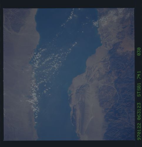
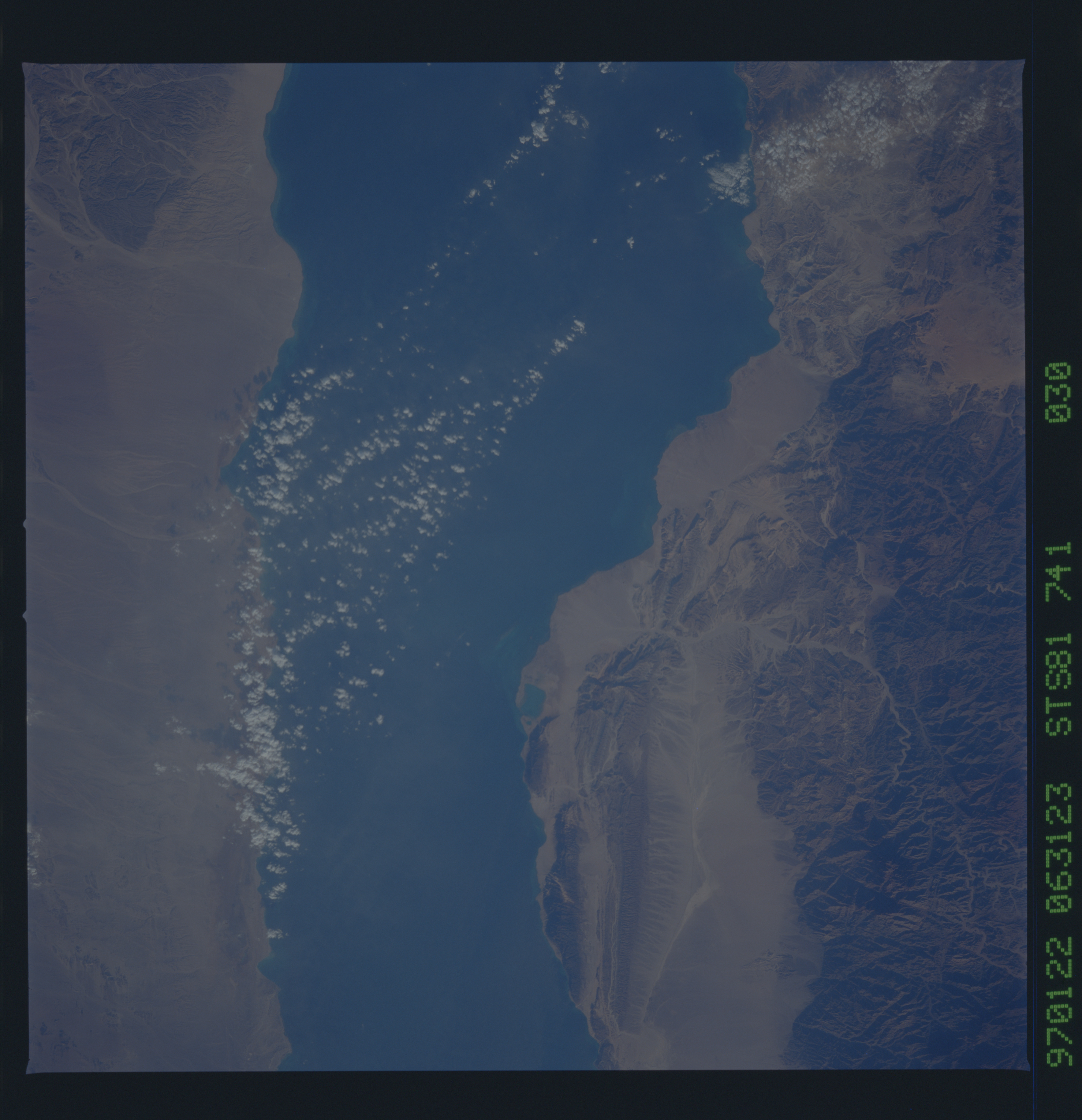
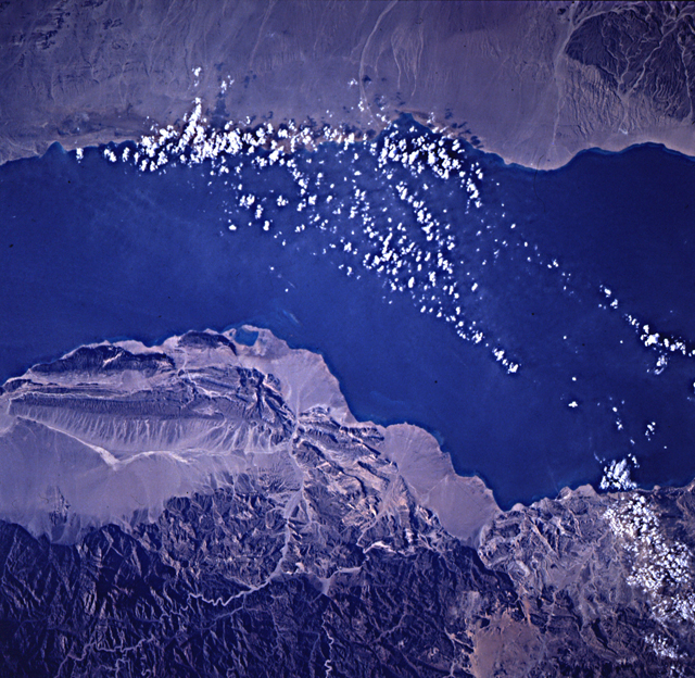
No GeoTIFF is available for this photo.Image Caption: Excellent photo of the fault-bounded block that extends from Gebel
Ikma to Gebel Abu Huswa, along the western margin of the Sinai
Peninsula. North-northwesterly faults related to Gulf of Suez/Red Sea
rifting are dominant but faults of other orientations are also well
defined. This frame is one of a fine series (Frames 28-33) of detailed
views along the eastern margin of the Red Sea rift; several pairs are
well spaced for stereo viewing.
