< STS034-83-30 >
| NASA Photo ID | STS034-83-30 |
| Focal Length | 100mm |
| Date taken | 1989.10.21 |
| Time taken | 02:26:51 GMT |
Resolutions offered for this image:
4096 x 4096 pixels 640 x 640 pixels 5700 x 5900 pixels 500 x 518 pixels 640 x 480 pixels
4096 x 4096 pixels 640 x 640 pixels 5700 x 5900 pixels 500 x 518 pixels 640 x 480 pixels
Cloud masks available for this image:
Spacecraft nadir point: 32.4° N, 133.6° E
Photo center point: 34.0° N, 135.0° E
Photo center point by machine learning:
Photo center point: 34.0° N, 135.0° E
Photo center point by machine learning:
Nadir to Photo Center: Northeast
Spacecraft Altitude: 178 nautical miles (330km)
Camera: | Hasselblad |
Focal Length: | 100mm |
Camera Tilt: | Near Vertical |
Format: | 5017: Kodak, natural color positive, Ektachrome, X Professional, ASA 64, standard base |
Film Exposure: | Normal |
| Additional Information | |
| Width | Height | Annotated | Cropped | Purpose | Links |
|---|---|---|---|---|---|
| 4096 pixels | 4096 pixels | No | No | Earth From Space collection | Download Image |
| 640 pixels | 640 pixels | No | No | Earth From Space collection | Download Image |
| 5700 pixels | 5900 pixels | No | No | Download Image Download Color Calibration Image for this Image |
|
| 500 pixels | 518 pixels | No | No | Download Image Download Color Calibration Image for this Image |
|
| 640 pixels | 480 pixels | No | No | Download Image |
Download Packaged File
Download a Google Earth KML for this Image
View photo footprint information
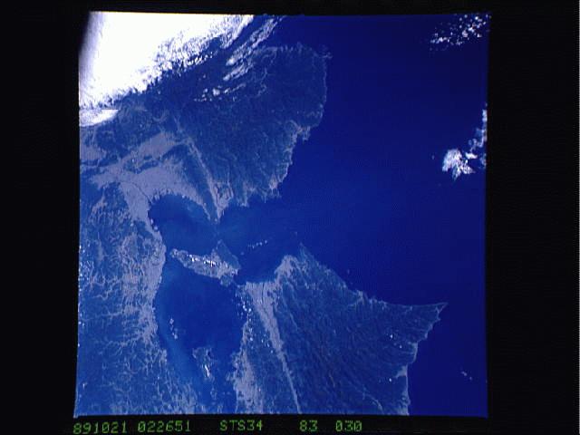
No GeoTIFF is available for this photo.Image Caption: STS034-083-030 Inland Sea, Japan October 1989
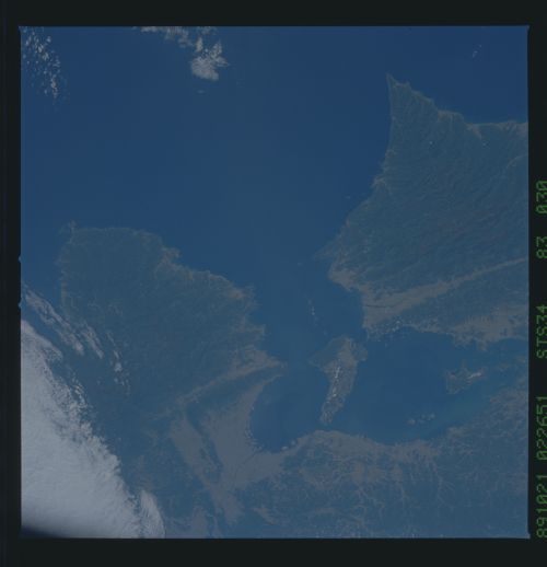
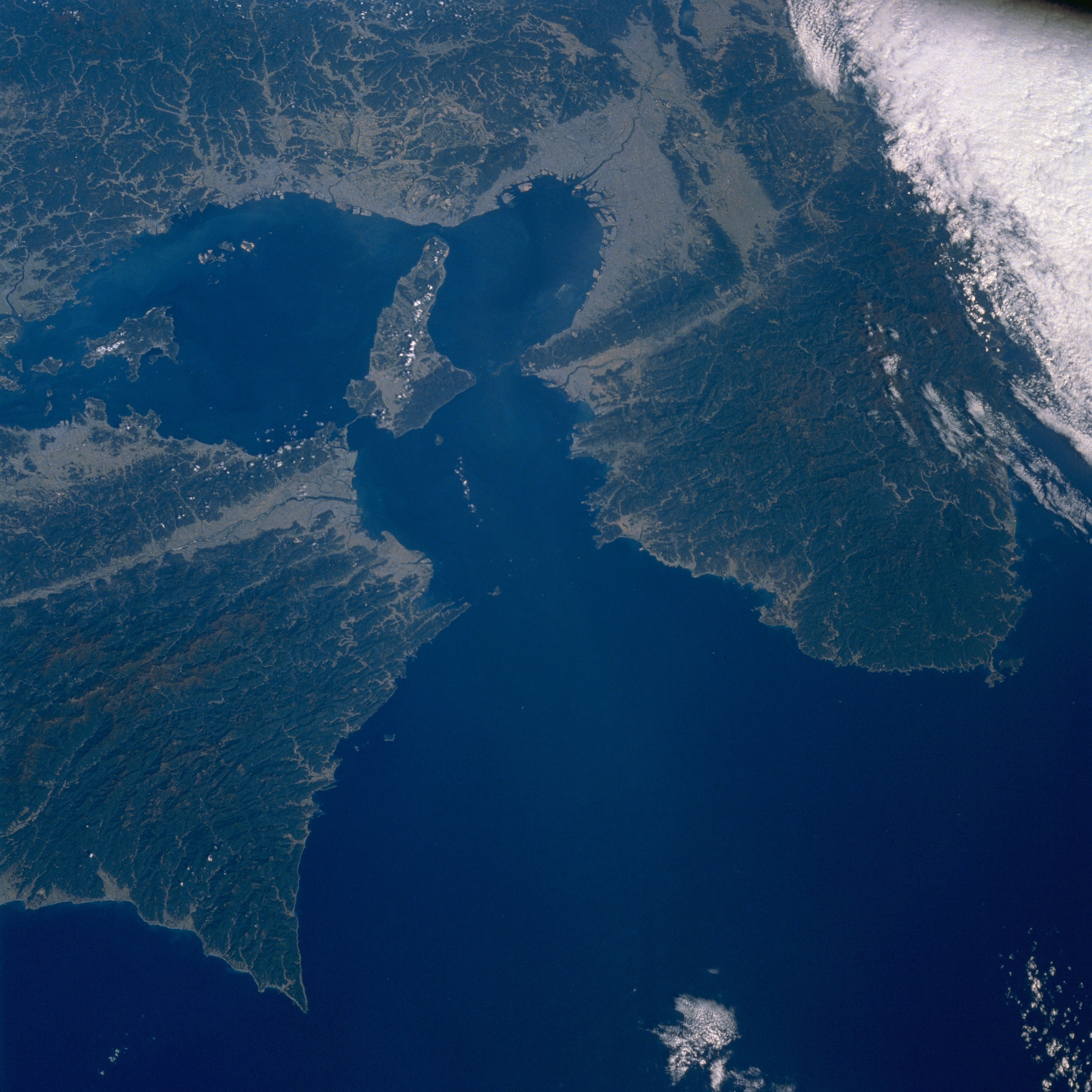
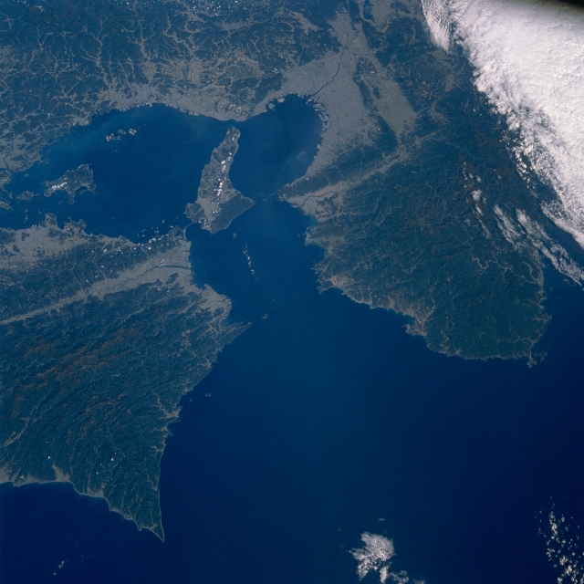
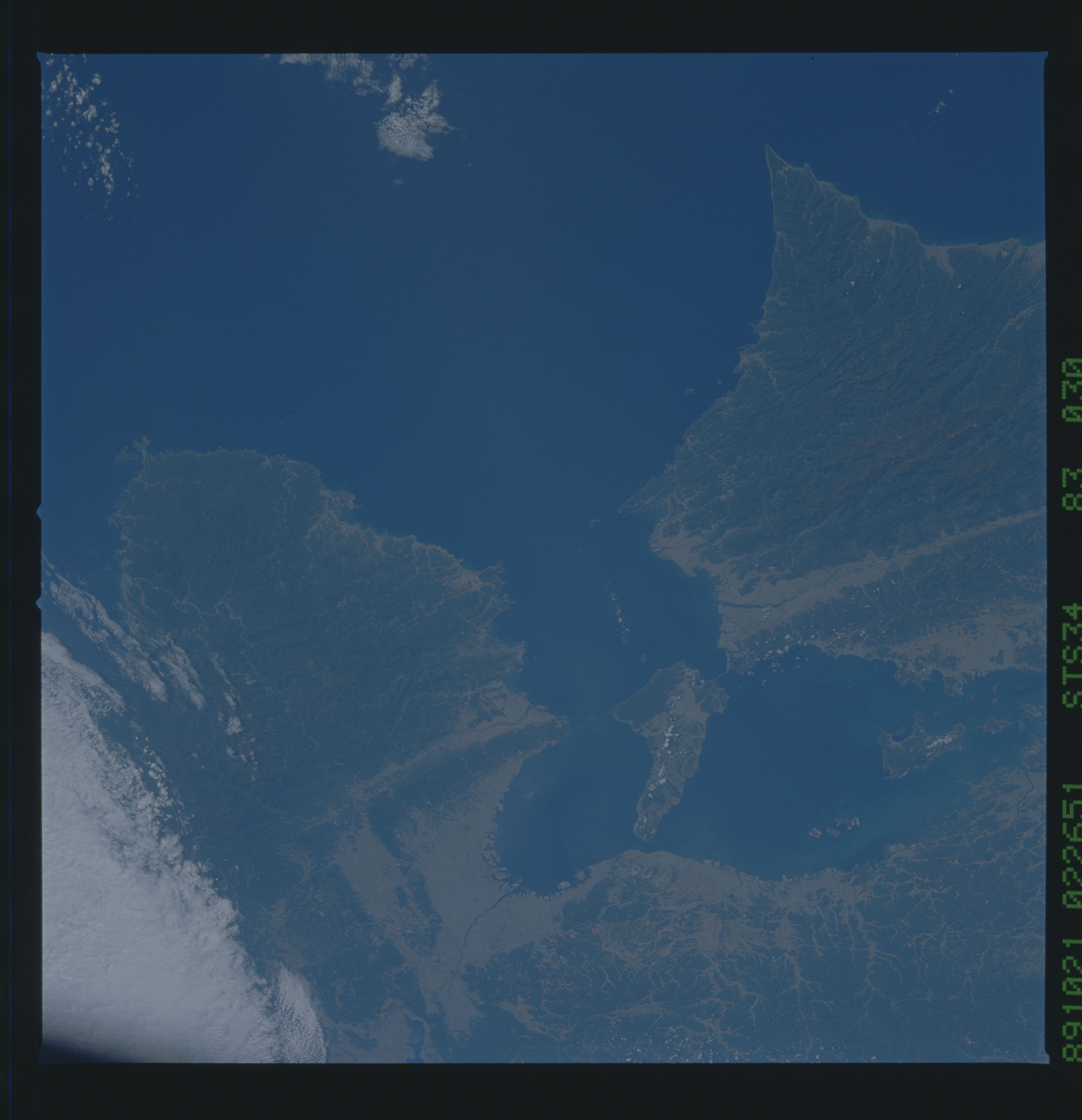
The Kii Channel seen in this north-looking view (center of the image) is the eastern entrance to the Inland Sea of Japan (located between southwest Honshu and Shikoku Island). Two extensive, heavily forested, mountainous landscapes flank the Kii Channel (Kii Peninsula is eastern peninsula). The Kii Fault can be traced diagonally (east-west orientation) across the image as a light-colored linear swath of various widths. The lighter-colored terrain throughout the entire image shows the distribution of human development either for urban settlements or, to a lesser degree, limited agricultural development. The greatest concentration of human activity is in the Kobe/Osaka Metroplex along the northeast end of Osaka Bay (northeast end of the Inland Sea). The Inland Sea is a large trough that includes a series of faulted depressions that are associated with some submergence, flooded by the sea, and dotted with many islands, which are the rims of the troughs. In terms of seismic activity, this region is located on the southeastern margin of the Eurasian Plate (where the Philippine Sea Plate is being subducted beneath the Eurasian Plate) and which is subject to numerous earthquakes. The Onaruto Bridge (linear, light-colored feature) is visible as it connects the northeastern tip of Shikoku Island with Awaji Island (large island near center of image). An area of dense clouds obscures the terrain in the eastern corner (upper right) of the image.
The Kii Channel seen in this north-looking view (center of the image) is the eastern entrance to the Inland Sea of Japan (located between southwest Honshu and Shikoku Island). Two extensive, heavily forested, mountainous landscapes flank the Kii Channel (Kii Peninsula is eastern peninsula). The Kii Fault can be traced diagonally (east-west orientation) across the image as a light-colored linear swath of various widths. The lighter-colored terrain throughout the entire image shows the distribution of human development either for urban settlements or, to a lesser degree, limited agricultural development. The greatest concentration of human activity is in the Kobe/Osaka Metroplex along the northeast end of Osaka Bay (northeast end of the Inland Sea). The Inland Sea is a large trough that includes a series of faulted depressions that are associated with some submergence, flooded by the sea, and dotted with many islands, which are the rims of the troughs. In terms of seismic activity, this region is located on the southeastern margin of the Eurasian Plate (where the Philippine Sea Plate is being subducted beneath the Eurasian Plate) and which is subject to numerous earthquakes. The Onaruto Bridge (linear, light-colored feature) is visible as it connects the northeastern tip of Shikoku Island with Awaji Island (large island near center of image). An area of dense clouds obscures the terrain in the eastern corner (upper right) of the image.
