< STS095-713-29 >
| NASA Photo ID | STS095-713-29 |
| Focal Length | 100mm |
| Date taken | 1998.11.06 |
| Time taken | 10:42:26 GMT |
Resolutions offered for this image:
5700 x 5900 pixels 483 x 500 pixels 1265 x 1254 pixels 2570 x 2553 pixels 308 x 300 pixels
5700 x 5900 pixels 483 x 500 pixels 1265 x 1254 pixels 2570 x 2553 pixels 308 x 300 pixels

Cloud masks available for this image:
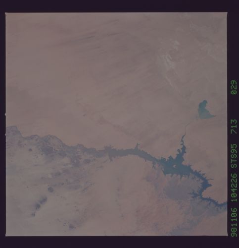
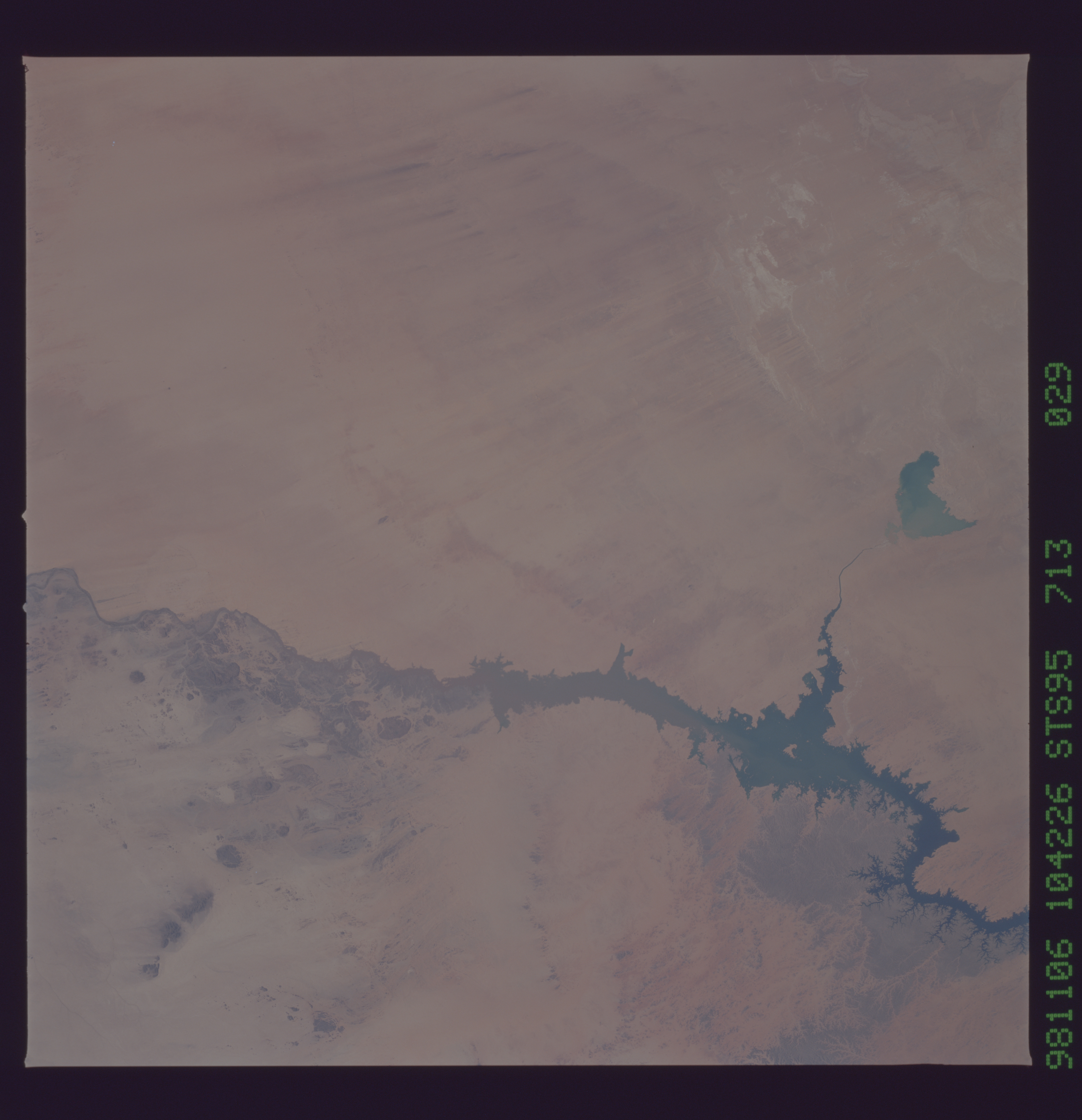
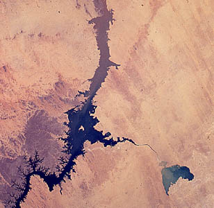
Spacecraft nadir point: 23.3° N, 30.2° E
Photo center point: 22.0° N, 31.0° E
Photo center point by machine learning:
Photo center point: 22.0° N, 31.0° E
Photo center point by machine learning:
Nadir to Photo Center: Southeast
Spacecraft Altitude: 293 nautical miles (543km)
Country or Geographic Name: | EGYPT |
Features: | LAKE NASSER |
| Features Found Using Machine Learning: | |
Cloud Cover Percentage: | 0 (no clouds present) |
Sun Elevation Angle: | 48° |
Sun Azimuth: | 202° |
Camera: | Hasselblad |
Focal Length: | 100mm |
Camera Tilt: | 17 degrees |
Format: | 5069: Kodak Elite 100S, E6 Reversal, Replaces Lumiere, Warmer in tone vs. Lumiere |
Film Exposure: | Normal |
| Additional Information | |
| Width | Height | Annotated | Cropped | Purpose | Links |
|---|---|---|---|---|---|
| 5700 pixels | 5900 pixels | No | No | Download Image Download Color Calibration Image for this Image |
|
| 483 pixels | 500 pixels | No | No | Download Image Download Color Calibration Image for this Image |
|
| 1265 pixels | 1254 pixels | Download Image | |||
| 2570 pixels | 2553 pixels | No | No | Download Image | |
| 308 pixels | 300 pixels | Download Image |
Download Packaged File
Download a Google Earth KML for this Image
View photo footprint information
No GeoTIFF is available for this photo.Image Caption: Lake Nasser, showing the newly flooded New Valley reclamation project, November 6, 1998.
